Safety Score: 3,0 of 5.0 based on data from 9 authorites. Meaning we advice caution when travelling to Germany.
Travel warnings are updated daily. Source: Travel Warning Germany. Last Update: 2024-08-13 08:21:03
Discover Schaching
The district Schaching of Deggendorf in Lower Bavaria (Bavaria) is a district in Germany about 255 mi south of Berlin, the country's capital city.
Looking for a place to stay? we compiled a list of available hotels close to the map centre further down the page.
When in this area, you might want to pay a visit to some of the following locations: Grafling, Moos, Schaufling, Niederalteich and Offenberg. To further explore this place, just scroll down and browse the available info.
Local weather forecast
Todays Local Weather Conditions & Forecast: 4°C / 39 °F
| Morning Temperature | 1°C / 34 °F |
| Evening Temperature | 4°C / 40 °F |
| Night Temperature | 4°C / 39 °F |
| Chance of rainfall | 0% |
| Air Humidity | 82% |
| Air Pressure | 1026 hPa |
| Wind Speed | Light breeze with 4 km/h (3 mph) from North-West |
| Cloud Conditions | Overcast clouds, covering 100% of sky |
| General Conditions | Light rain |
Monday, 25th of November 2024
6°C (44 °F)
2°C (35 °F)
Sky is clear, light breeze, few clouds.
Tuesday, 26th of November 2024
7°C (44 °F)
2°C (35 °F)
Moderate rain, light breeze, overcast clouds.
Wednesday, 27th of November 2024
4°C (40 °F)
2°C (35 °F)
Overcast clouds, light breeze.
Hotels and Places to Stay
Höttl
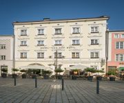
NH Deggendorf
Reblinger Hof
Donauhof
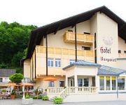
Burgwirt
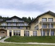
Bernrieder Hof Sport & Wellnesshotel
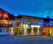
Hotel am Ohewehr
Beim Krahwirt Landgasthof
Winterl
Zur Dorfschänke
Videos from this area
These are videos related to the place based on their proximity to this place.
Bundespräsident Gauck in der Hochwasser-Region Deggendorf (2013)
Berichte: http://pnp.de/hochwasser - Spenden: http://pnp.de/fluthilfe Bundespräsident Joachim Gauck in Deggendorf über seine Eindrücke, die er in der Hochwasser-Region gesammelt hat. Video:...
Bulgarische Azubis in Bayern | Made in Germany
Bayerischer Zwiebelrostbraten - für Martin Dragolov eine echte Herausforderung. Seit einem halben Jahr macht der 20-jährige Bulgare eine Ausbildung zum Koch in Niederbayern. Seine Chefin...
ROTES KREUZ in Deggendorf sucht Ehrenamtliche für den RETTUNGSDIENST
Das Bayerische Rote Kreuz in Deggendorf ist immer auf der Suche nach interessierten Damen und Herren, die sich ehrenamtlich u.a. im Bereich Rettungsdienst aktiv einbringen wollen. Gerne stehen...
Kleines, lustiges Video vom Weihnachtsmarktstand in Deggendorf
Lustiges Video von unserem Weihnachtsmarktstand in Deggendorf :-)
Deggendorf aus der Vogelperspektive #01-2014 - Donaubrücken
Hier ein paar Eindrücke aus Deggendorf, aufgenommen mit meinem Quadrokopter - DJI Phantom II Vision+ Das ist erst der Anfang ;-) Ziel ist es, Ihnen Deggendorf aus einem Blickwinkel zu zeigen,...
Sparkassen MTB Cup Deggendorf 2012 - kategorie U11
Sestřih závodu Sparkassen MTB Cupu kategorie U11 v bavorském Deggendorfu.
Donaugartenschau 2014 in Deggendorf #01-2014 - Landesgartenschau
Hier eine kleine Zusammenfassung vom Gelände der Donaugartenschau 2014 in Deggendorf. Es folgen noch: - Die Fischergärten und der Stadthallen - Park Die Donaugartenschau in Deggendorf...
Videos provided by Youtube are under the copyright of their owners.
Attractions and noteworthy things
Distances are based on the centre of the city/town and sightseeing location. This list contains brief abstracts about monuments, holiday activities, national parcs, museums, organisations and more from the area as well as interesting facts about the region itself. Where available, you'll find the corresponding homepage. Otherwise the related wikipedia article.
Deggendorf (district)
Deggendorf is a district in Bavaria, Germany. It is bordered by (from the north and clockwise) the districts of Regen, Freyung-Grafenau, Passau, Rottal-Inn, Dingolfing-Landau and Straubing-Bogen.
Metten Abbey
Metten Abbey, or St. Michael's Abbey at Metten (in German Abtei Metten or Kloster Metten) is a house of the Benedictine Order in Metten near Deggendorf, situated between the fringes of the Bavarian Forest and the valley of the Danube, in Bavaria in Germany. The abbey was founded in 766 by Gamelbert of Michaelsbuch. For many centuries Metten was under the lordship of the Dukes and Electors of Bavaria.
Niederaltaich Abbey
Niederaltaich Abbey or Niederaltaich Monastery (Abtei or Kloster Niederaltaich) is a house of the Benedictine Order founded in 731 (or possibly 741), situated in the village of Niederalteich on the Danube in Bavaria. Note: "Niederaltaich" is the conventional spelling of the monastery, "Niederalteich" of the village).
University of Applied Sciences Deggendorf
The Deggendorf University of Applied Sciences, founded in 1994, is a business, media and technics Fachhochschule in Lower Bavaria, Germany, which places high value on practical and international experience. Apart from its undergraduate and graduate courses the UAS Deggendorf offers further education on university – level. ---Sidenote START---
Aholming transmitter
Aholming transmitter is a facility for broadcasting the program of Deutschlandfunk on 207 kHz with a power of 500 kW at day and 250 kW at night between Aholming and Ottmaring in Bavaria. Aholming transmitter, which can be received in most parts of Europe, was built between 1986 and 1988 as a replacement of Erching transmitter.
Plattling station
Plattling station is a central railway hub in eastern Lower Bavaria in southern Germany.
Breitenauriegel
Breitenauriegel is a mountain of Bavaria, Germany.
Burgstein (Dollnstein)
Burgstein (Dollnstein) is a mountain of Bavaria, Germany.
Dreitannenriegel
Dreitannenriegel is a mountain of Bavaria, Germany.
Einödriegel
Einödriegel is a mountain of Bavaria, Germany.
Geißriegel
Geißriegel is a mountain of Bavaria, Germany.
Hirschenstein
Hirschenstein is a 1,089 metre high mountain in Bavaria, Germany.
Kälberbuckel
Kälberbuckel is a mountain of Bavaria, Germany.
Klausenstein (Bavaria)
Klausenstein (Bayern) is a mountain of Bavaria, Germany.
Knogl
Knogl is a mountain of Bavaria, Germany.
Rauher Kulm (Lower Bavaria)
Rauher Kulm is a mountain of Bavaria, Germany.
Predigtstuhl (Lower Bavaria)
Predigtstuhl (Niederbayern) is a mountain of Bavaria, Germany.
Teufelstisch (Bavarian Forest)
Teufelstisch (Bayerischer Wald) is a mountain of Bavaria, Germany.
Buswartehobel
The Buswartehobel (German for Bus stop plane or literally Bus waiting plane) is a plane-shaped bus shelter in Zachenberg in the Bavarian Forest. It is located at the municipality connection road (Gemeindeverbindungsstraße) between Zachenberg and Köckersried, a short distance after the end of the village of Zachenberg. For more than twenty years, a conventional bus shelter stood at this location. As it was in a decayed and leaky condition, it needed replacement.
Schlossauer Ohe
Schlossauer Ohe is a river of Bavaria, Germany.






![Webcam: Deggendorf: Donaubrücke Deggenau, A3/E56 Suben AT-DE, Passau − Regensburg [km 565], Blickrichtung: Nürnberg capture of the webcam Deggendorf: Donaubrücke Deggenau, A3/E56 Suben AT-DE, Passau − Regensburg [km 565], Blickrichtung: Nürnberg](https://images.webcams.travel/daylight/preview/1472376409.jpg)