Safety Score: 3,0 of 5.0 based on data from 9 authorites. Meaning we advice caution when travelling to Germany.
Travel warnings are updated daily. Source: Travel Warning Germany. Last Update: 2024-08-13 08:21:03
Touring Rot
Rot in Tübingen Region (Baden-Württemberg) with it's 4,402 residents is a town located in Germany about 370 mi (or 596 km) south-west of Berlin, the country's capital place.
Time in Rot is now 02:05 AM (Tuesday). The local timezone is named Europe / Berlin with an UTC offset of one hour. We know of 9 airports nearby Rot, of which 3 are larger airports. The closest airport in Germany is Friedrichshafen Airport in a distance of 26 mi (or 41 km), South-East. Besides the airports, there are other travel options available (check left side).
There are several Unesco world heritage sites nearby. The closest heritage site in Germany is Monastic Island of Reichenau in a distance of 16 mi (or 25 km), South. We collected 1 points of interest near this location. Need some hints on where to stay? We compiled a list of available hotels close to the map centre further down the page.
Being here already, you might want to pay a visit to some of the following locations: Sauldorf, Wald, Muhlingen, Bodman-Ludwigshafen and Herdwangen-Schonach. To further explore this place, just scroll down and browse the available info.
Local weather forecast
Todays Local Weather Conditions & Forecast: 8°C / 47 °F
| Morning Temperature | 5°C / 42 °F |
| Evening Temperature | 5°C / 40 °F |
| Night Temperature | 4°C / 39 °F |
| Chance of rainfall | 1% |
| Air Humidity | 83% |
| Air Pressure | 1024 hPa |
| Wind Speed | Gentle Breeze with 6 km/h (4 mph) from North-East |
| Cloud Conditions | Overcast clouds, covering 88% of sky |
| General Conditions | Moderate rain |
Wednesday, 27th of November 2024
7°C (45 °F)
4°C (39 °F)
Broken clouds, light breeze.
Thursday, 28th of November 2024
2°C (35 °F)
-2°C (29 °F)
Rain and snow, gentle breeze, overcast clouds.
Friday, 29th of November 2024
5°C (41 °F)
-1°C (31 °F)
Few clouds, gentle breeze.
Hotels and Places to Stay
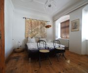
Klosterherberge
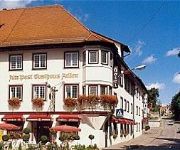
Zum Adler
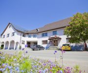
Adler Alte Post
Gasthaus zur Krone
Bären Landhotel
Videos from this area
These are videos related to the place based on their proximity to this place.
Meßkirch, der Weg zum Grillplatz!
Der Weg zum Grillplatz aus Meßkirch durch Orte Heudorf und Thalheim. Schönes Wetter.
Burg und Schlossgeschichten - Schloss Meßkirch
Das Schloss Meßkirch ,nähe Bodensee, vor der aufwändigen Renovierung. Heute ein Juwel der Region.
Klosterherberge Meßkirch Ferienwohnung
Ferienwohnung für 2+2+1 Personen. Erleben Sie 4-Sterne Komfort auf 160qm - Mitten in Messkirchs historischem Stadtzentrum nur 100 Meter vom Schloss Meßkirch Mehr Informationen: ...
CATERPILLAR 637D, D7H, 825,... Fa. Storz, Umgehungsstraße Meßkirch, Germany , 1989.
Caterpillar 637D, D7H, 825,... der Fa. Storz beim Bau der B 311 / Umgehungsstraße Meßkirch, Germany, 20.10.1989. Daten zum 637D: Traktormotor 400 PS, Heckmotor 300 PS, 49t, 23m³ ...
Störche in Meßkirch
die Ansiedlung eines 2. Storchenpaars in 2014 auf der Kirche Sankt Martin ..... mit Bildern vom Kennenlernen der Störche bis zum Erstflug der Jungstörche.
Sunshine Gugge e.V. - ZEHN
Die Sunshine-Gugge Heudorf/Rohrdorf e.V. spielt am Rosenmontag 2015 in Meßkirch den Jubiläumshit ZEHN. Viel Spaß damit! :) www.facebook.com/SunshineGugge www.sunshine-gugge.de.
Videos provided by Youtube are under the copyright of their owners.
Attractions and noteworthy things
Distances are based on the centre of the city/town and sightseeing location. This list contains brief abstracts about monuments, holiday activities, national parcs, museums, organisations and more from the area as well as interesting facts about the region itself. Where available, you'll find the corresponding homepage. Otherwise the related wikipedia article.
Ablach (Danube)
The Ablach is a right tributary of the Danube. It rises on the European Watershed, which is only a hint in this area, from the Mindersdorfer Aach in the municipality of Hohenfels in the Landkreis of Konstanz. It is about 36 kilometers long, or, when including the headwaters in the Hohenfels area, 38 km.


