Safety Score: 3,0 of 5.0 based on data from 9 authorites. Meaning we advice caution when travelling to Germany.
Travel warnings are updated daily. Source: Travel Warning Germany. Last Update: 2024-08-13 08:21:03
Touring Oberstetten
Oberstetten in Tübingen Region (Baden-Württemberg) is a town located in Germany about 341 mi (or 549 km) south-west of Berlin, the country's capital place.
Time in Oberstetten is now 02:43 PM (Friday). The local timezone is named Europe / Berlin with an UTC offset of one hour. We know of 8 airports nearby Oberstetten, of which 3 are larger airports. The closest airport in Germany is Stuttgart Airport in a distance of 25 mi (or 41 km), North. Besides the airports, there are other travel options available (check left side).
There are several Unesco world heritage sites nearby. The closest heritage site in Germany is Monastic Island of Reichenau in a distance of 45 mi (or 73 km), South. Need some hints on where to stay? We compiled a list of available hotels close to the map centre further down the page.
Being here already, you might want to pay a visit to some of the following locations: Pfronstetten, Gomadingen, Zwiefalten, Neufra and Eningen unter Achalm. To further explore this place, just scroll down and browse the available info.
Local weather forecast
Todays Local Weather Conditions & Forecast: -2°C / 29 °F
| Morning Temperature | -5°C / 22 °F |
| Evening Temperature | -3°C / 26 °F |
| Night Temperature | -2°C / 28 °F |
| Chance of rainfall | 3% |
| Air Humidity | 84% |
| Air Pressure | 1011 hPa |
| Wind Speed | Moderate breeze with 11 km/h (7 mph) from East |
| Cloud Conditions | Scattered clouds, covering 29% of sky |
| General Conditions | Snow |
Saturday, 23rd of November 2024
0°C (33 °F)
-1°C (30 °F)
Light snow, moderate breeze, overcast clouds.
Sunday, 24th of November 2024
4°C (40 °F)
2°C (35 °F)
Overcast clouds, gentle breeze.
Monday, 25th of November 2024
8°C (47 °F)
6°C (42 °F)
Light rain, gentle breeze, overcast clouds.
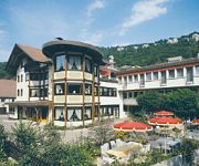
Hotels and Places to Stay
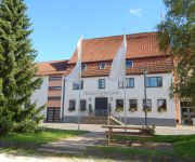
Speidels BrauManufaktur Speidel's Brauerei
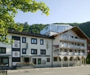
Akzent Hotel Forellenhof Rössle
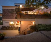
Hydepark
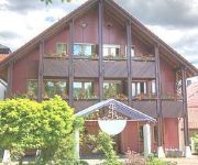
Winter Restaurant & Landhotel
Adler mit Gästehaus Herzog Ulrich
Videos from this area
These are videos related to the place based on their proximity to this place.
Motorsport | 10. Stoppelcross des Team Chaos Alb in Tigerfeld/Pfronstetten
Der Verein "Team Chaos Alb e.V." veranstaltete am zweiten September-Wochenende 2012 das 10. Stoppelcross-Rennen für Hobby- und Jedermannsfahrer. RTM Sport.de war mit der Kamera in ...
Aménagement du véhicule Lancia voyager
Loi du 11 février 2005 pour l'égalité des droits et des chances, la participation et la citoyenneté des personnes handicapées.
Mit dem Hürlimann Traktor durch Steinhilben 2011 oder Street View Oberstetter - Wilsinger Str
Mit dem Hürlimann D70 Traktor nach und durch Steinhilben.
Amazing Big Biker-Crew / Motorrad-Treffen Wilsingen 30.06.2012
Große Motorradkolonne während der gemeinsamen Ausfahrt beim Motorrad-Treffen in Wilsingen am 30.06.2012.
Umzug Pfronstetten 2014 - Regionentreffen des VAN
Regionentreffen des Verbandes Alb-Bodensee-oberschwäbische Narrenvereine Playlist Fasnet : http://www.youtube.com/playlist?list=PL51D68FC03BA07B8A Umzugsreihenfolge: 1 NZ Schäf ...
Audofeschd 2014 in Gammertingen-Harthausen
Lizenzfreie Musik von http://www.jamendo.com/de/artist/442559/xytum.
Videos provided by Youtube are under the copyright of their owners.
Attractions and noteworthy things
Distances are based on the centre of the city/town and sightseeing location. This list contains brief abstracts about monuments, holiday activities, national parcs, museums, organisations and more from the area as well as interesting facts about the region itself. Where available, you'll find the corresponding homepage. Otherwise the related wikipedia article.
Swabian Jura
The Swabian Jura, sometimes also given the name Swabian Alps in English, is a low mountain range in Baden-Württemberg, Germany, extending 220 km from southwest to northeast and 40 to 70 km (to mi) in width. It is named after the region of Swabia. The Swabian Jura occupies the region bounded by the Danube in the southeast and the upper Neckar in the northwest. In the southwest it rises to the higher mountains of the Black Forest. The highest mountain of the region is the Lemberg (1,015 m).


