Safety Score: 3,0 of 5.0 based on data from 9 authorites. Meaning we advice caution when travelling to Germany.
Travel warnings are updated daily. Source: Travel Warning Germany. Last Update: 2024-08-13 08:21:03
Explore Weiler in den Bergen
Weiler in den Bergen in Regierungsbezirk Stuttgart (Baden-Württemberg) is located in Germany about 302 mi (or 486 km) south-west of Berlin, the country's capital.
Local time in Weiler in den Bergen is now 10:00 PM (Friday). The local timezone is named Europe / Berlin with an UTC offset of one hour. We know of 11 airports in the wider vicinity of Weiler in den Bergen, of which 5 are larger airports. The closest airport in Germany is Stuttgart Airport in a distance of 30 mi (or 49 km), West. Besides the airports, there are other travel options available (check left side).
There are several Unesco world heritage sites nearby. The closest heritage site in Germany is Maulbronn Monastery Complex in a distance of 51 mi (or 82 km), West. If you need a place to sleep, we compiled a list of available hotels close to the map centre further down the page.
Depending on your travel schedule, you might want to pay a visit to some of the following locations: Waldstetten, Iggingen, Bobingen an der Rems, Leinzell and Taferrot. To further explore this place, just scroll down and browse the available info.
Local weather forecast
Todays Local Weather Conditions & Forecast: 0°C / 33 °F
| Morning Temperature | -4°C / 25 °F |
| Evening Temperature | 0°C / 32 °F |
| Night Temperature | 0°C / 33 °F |
| Chance of rainfall | 3% |
| Air Humidity | 78% |
| Air Pressure | 1009 hPa |
| Wind Speed | Fresh Breeze with 13 km/h (8 mph) from East |
| Cloud Conditions | Broken clouds, covering 66% of sky |
| General Conditions | Snow |
Saturday, 23rd of November 2024
3°C (37 °F)
-0°C (32 °F)
Light snow, moderate breeze, overcast clouds.
Sunday, 24th of November 2024
9°C (49 °F)
5°C (41 °F)
Broken clouds, light breeze.
Monday, 25th of November 2024
10°C (50 °F)
8°C (47 °F)
Scattered clouds, light breeze.
Hotels and Places to Stay
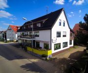
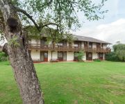
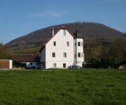
Rosengarten
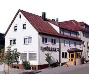
Hölzle Landgasthof
Einhorn
Pelikan
Becher Gästehaus
Becher Hotel & Restaurant
Gästehaus am Reiterhof Mutschler
Kreuz
"Heldenberg" Gasthof
Videos from this area
These are videos related to the place based on their proximity to this place.
Slalom Schwäbisch-Gmünd Sep.2012.wmv
Der etwas andere Einblick in den Slalomsport ! Mit der Go-Pro Kamera auf der Türe, Seitenwand oder Dach . Das zeigt uns Bernd Eisenmann auf seinem Opel Ascona-B 2,4L-8V. Beim Auto-Salom in...
Albmarathon 2010 - Streckenscouting Teil 4
Noch einmal geht Vexillum auf Streckenscouting für den Albmarathon 2010, und besucht zusammen mit Jogmapper ianbanks den letzten und höchsten der drei Kaiserberge, den 750 m hohen Stuifen,.
Radian Time Lapse | Schwäbische Alb | Radian Motion Control (Alpine Labs)
Hallo, heute Morgen war mir mal nach früh Aufstehen. Und die "Alb" zeigte sich von ihrer schönsten Seite......
[HD/3D] Piper PA-28-181 Archer II landing at Heubach Airport
PASSENGER WING VIEW: Piper PA-28-181 Archer II landing at Heubach EDTH, runway 07. SICHT EINES PASSAGIERS AUF DEN FLÜGEL: Piper PA-28-181 Archer II landet in Heubach EDTH auf ...
Böbingen an der Rems (Teil 1) - Impressionen im Winter
Die Gemeinde Böbingen an der Rems liegt in Baden-Württemberg im Ostalbkreis, etwa 60 km östlich der Landeshauptstadt Stuttgart. Die Bundesstraße B29 führt durch die Gemeinde. Etwa 10...
Böbingen an der Rems (Teil 2) - Impressionen im Frühjahr
Die Gemeinde Böbingen an der Rems liegt 60 km östlich der Landeshauptstadt Stuttgart im Ostalbkreis. Die direkten Nachbarstädte sind Schwäbisch Gmünd, Heubach und Aalen. Der steile Nordrand...
Videos provided by Youtube are under the copyright of their owners.


!['[HD/3D] Piper PA-28-181 Archer II landing at Heubach Airport' preview picture of video '[HD/3D] Piper PA-28-181 Archer II landing at Heubach Airport'](https://img.youtube.com/vi/Fs-1VED3OEE/mqdefault.jpg)


