Safety Score: 3,0 of 5.0 based on data from 9 authorites. Meaning we advice caution when travelling to Germany.
Travel warnings are updated daily. Source: Travel Warning Germany. Last Update: 2024-08-13 08:21:03
Discover Reinsbronn
Reinsbronn in Regierungsbezirk Stuttgart (Baden-Württemberg) is a place in Germany about 255 mi (or 411 km) south-west of Berlin, the country's capital city.
Current time in Reinsbronn is now 11:43 PM (Thursday). The local timezone is named Europe / Berlin with an UTC offset of one hour. We know of 11 airports near Reinsbronn, of which 5 are larger airports. The closest airport in Germany is Ansbach-Petersdorf Airport in a distance of 30 mi (or 48 km), East. Besides the airports, there are other travel options available (check left side).
There are several Unesco world heritage sites nearby. The closest heritage site in Germany is Würzburg Residence with the Court Gardens and Residence Square in a distance of 21 mi (or 34 km), North. We encountered 1 points of interest in the vicinity of this place. If you need a hotel, we compiled a list of available hotels close to the map centre further down the page.
While being here, you might want to pay a visit to some of the following locations: Bieberehren, Hemmersheim, Riedenheim, Simmershofen and Sonderhofen. To further explore this place, just scroll down and browse the available info.
Local weather forecast
Todays Local Weather Conditions & Forecast: 1°C / 34 °F
| Morning Temperature | -1°C / 30 °F |
| Evening Temperature | -0°C / 32 °F |
| Night Temperature | -2°C / 28 °F |
| Chance of rainfall | 0% |
| Air Humidity | 80% |
| Air Pressure | 1001 hPa |
| Wind Speed | Fresh Breeze with 13 km/h (8 mph) from East |
| Cloud Conditions | Overcast clouds, covering 100% of sky |
| General Conditions | Light snow |
Friday, 22nd of November 2024
-0°C (31 °F)
-0°C (32 °F)
Light snow, fresh breeze, broken clouds.
Saturday, 23rd of November 2024
2°C (35 °F)
1°C (34 °F)
Overcast clouds, fresh breeze.
Sunday, 24th of November 2024
8°C (46 °F)
5°C (41 °F)
Overcast clouds, gentle breeze.
Hotels and Places to Stay
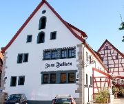
Zum Falken
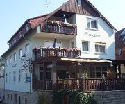
Herrgottstal Pension
Videos from this area
These are videos related to the place based on their proximity to this place.
Star Wars Jedi Academy Walktrough Teil 13 | Nar Kreeta, Rancor Part 1
Der 13. Teil meines Walktroughs. Jaden muss auf Nar Kreeta älteste und einige andere Gefangenen von einem Hutten befreien. Dabei hat sie aber nicht mit dem Rancor gerechnet.
Mondoberfläche
Die Oberfläche des zunehmenden Mondes an einem Dezemberabend in 2008. Aufgenommen mit der Canon EOS 5D Mark II durch ein 20 Zoll Cassegrain Teleskop mit 5000 mm Brennweite.
FSO-Trailer
Fallschirmspringen beim FSO Würzburg / Franken www.fallschirmspringen-franken.de skydive riedenheim oberhausen Tandemspringen.
Moonrise timelapse
Der "Supermond" vom 19. März 2011. "Nur" 356.577 Kilometer trennten uns vom Mond an diesem Abend.
Bergkirche Laudenbach
Bilder von der Bergkirche in Laudenbach, Landkreis Tauberbischofsheim, Baden Württemberg, Germany. Sowie Bilder vom Kreuzgang die auf dem Weg zur Bergkirche stehen.
ascari Classic Cars Röttingen
Level:Up! ist Ihr zuverlässiger Partner bei der Erstellung von Foto -und Videoaufnahmen aus der Vogelperspektive. Mit professionellen Flug -und Videogeräten und mittels Verwendung sogenannter...
Fußball Aktiv - 1. Mannschaft - 5. Spieltag - SGM Taubertal/Röttingen - TSV Pfedelbach 1:2 (0:0)
Tor zum 1:0 durch Marco Rehklau.
Rottingen, Romantiche Strasse (D).
Le meridiane di Rottingen Germania, sono meridiane molto diverse da quelle che siamo abituati a vedere qui in Italia affrescate sulle case, comunque molto interessanti e belle.
Videos provided by Youtube are under the copyright of their owners.
Attractions and noteworthy things
Distances are based on the centre of the city/town and sightseeing location. This list contains brief abstracts about monuments, holiday activities, national parcs, museums, organisations and more from the area as well as interesting facts about the region itself. Where available, you'll find the corresponding homepage. Otherwise the related wikipedia article.
Herrgottsbach
Herrgottsbach is a river of Baden-Württemberg, Germany.
Gollach
Gollach is a river of Bavaria, Germany.


