Bad Rippoldsau
District of Klösterle
in Karlsruhe Region of Baden-Württemberg, Germany

Noteable things around
Location Summary
Decimal Coordinates (Latitude, Longitude):
48.428 and 8.328 (Lat./Lng.)
Coordinates by Time:
N 48° 25' 42" and E 8° 19' 41"
Currency and Currency Code:
Euro - EUR
Spoken languages:
German
Local electricity:
Mobile phone / cellular frequencies (MHz):
Local Time: 02:49 AM (Saturday)
Timezone: Europe/Berlin
UTC/GMT offset: 1 hours
Sunrise and Sunset:
7:47 am and 4:39 pm
Antipode Coordinates:
-44.033 and -176.367 (Lat./Lng.)
Closest place to antipode coordinates:
Ouwenga
References
This place on Geonames.org
Current travel safety evaluation for Germany in Western Europe

Safety Score: 3,0 of 5.0 based on data from 9 authorites. Meaning we advice caution when travelling to Germany.

Travel warnings are updated daily. Source: Travel Warning Germany. Last Update: 2024-08-13 08:21:03

Delve into Bad Rippoldsau

The district Bad Rippoldsau of Klösterle in Karlsruhe Region (Baden-Württemberg) is a district located in Germany about 360 mi south-west of Berlin, the country's capital town.

In need of a room? We compiled a list of available hotels close to the map centre further down the page.

Since you are here already, you might want to pay a visit to some of the following locations: Bad Rippoldsau-Schapbach, Baiersbronn, Bad Peterstal-Griesbach, Freudenstadt and Schenkenzell. To further explore this place, just scroll down and browse the available info.

Local weather forecast

Todays Local Weather Conditions & Forecast: 0°C / 32 °F

Morning Temperature -6°C / 22 °F
Evening Temperature -3°C / 27 °F
Night Temperature -2°C / 28 °F
Chance of rainfall 0%
Air Humidity 90%
Air Pressure 1024 hPa
Wind Speed Gentle Breeze with 8 km/h (5 mph) from East
Cloud Conditions Overcast clouds, covering 94% of sky
General Conditions Snow

Sunday, 24th of November 2024

8°C (47 °F)
3°C (37 °F)
Overcast clouds, gentle breeze.

Monday, 25th of November 2024

9°C (48 °F)
6°C (44 °F)
Moderate rain, gentle breeze, broken clouds.

Tuesday, 26th of November 2024

7°C (44 °F)
3°C (38 °F)
Moderate rain, light breeze, scattered clouds.

Hotels and Places to Stay

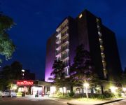
DORMERO Hotel Freudenstadt

Address
4,7 mi
Karl von Hahn Str. 129
72250 Freudenstadt
Germany

Time Information

Checkout: 12:00 - Checkin: 15:00
Reception
Weekday: 0:00 - 24:00
Weekend: 0:00 - 24:00


Langenwaldsee

Address
3,3 mi
Strassburger Str. 99
72250 Freudenstadt
Germany

Time Information

Checkout: 11:30 - Checkin: 13:30
Reception
Weekday: 8:00 - 21:30
Weekend: closed


Flair Adlerbad

Address
4,4 mi
Kniebisstr. 55
77740 Bad Peterstal-Griesbach
Germany

Time Information

Checkout: 11:00 - Checkin: 14:30
Reception
Weekday: 8:00 - 21:00
Weekend: 8:00 - 21:00


Lamm

Address
6,3 mi
Ellbachstr. 4
72270 Baiersbronn
Germany

Time Information

Checkout: 11:00 - Checkin: 14:00
Reception
Weekday: 6:30 - 22:00
Weekend: closed


Waldblick Kniebis

Address
3,4 mi
Eichelbachstrasse 47
72250 Freudenstadt
Germany

Time Information

Checkout: 11:00 - Checkin: 15:00
Reception
Weekday: 7:30 - 22:30
Weekend: 7:30 - 22:30


Cafe Günter Kniebis

Address
3,0 mi
Baiersbronner Str. 26
72250 Freudenstadt
Germany

Time Information

Checkout: 12:00 - Checkin: 11:00
Reception
Weekday: 7:00 - 21:00
Weekend: 7:00 - 21:00


Am Kurgarten Erlebnishotel

Address
5,6 mi
Forststr. 12
72270 Baiersbronn
Germany

Time Information

Checkout: 10:00 - Checkin: 14:00
Reception
Weekday: 8:00 - 17:00
Weekend: 8:00 - 14:00


Rundblick

Address
5,7 mi
Oberdorfstr. 37
72270 Baiersbronn
Germany

Time Information

Checkout: 12:00 - Checkin: 09:00
Reception
Weekday: 6:00 - 18:30
Weekend: 7:00 - 18:30


Pappel

Address
5,7 mi
Oberdorfstr. 1
72270 Baiersbronn
Germany

Time Information

Checkout: 11:00 - Checkin: 14:00
Reception
Weekday: 8:00 - 20:00 (lunchbreak: 18:00 - 8:00)
Weekend: 8:00 - 20:00


Rose

Address
5,8 mi
Bildstöckleweg 2
72270 Baiersbronn
Germany

Time Information

Checkout: 11:00 - Checkin: 15:00
Reception
Weekday: 8:00 - 18:00
Weekend: 8:00 - 18:00


Videos from this area

These are videos related to the place based on their proximity to this place.

Alternativer Wolf und Bärenpark Schwarzwald: Kaja

Published: May 16, 2014
Length: 51:22 min
Rating: 5 of 5
Author: Hildegard Pannen


Alternativer Wolf und Bärenpark Schwarzwald: Kaja badet

Published: May 03, 2013
Length: 05:27 min
Rating: 5 of 5
Author: Hildegard Pannen


Alternativer Wolf und Bärenpark Schwarzwald: Bea und Biggi

Published: April 27, 2013
Length: 36:13 min
Rating: 5 of 5
Author: Hildegard Pannen


Alternativer Wolf und Bärenpark Schwarzwald - Schapi und Poldi

Published: September 15, 2012
Length: 12:19 min
Rating: 5 of 5
Author: Hildegard Pannen

Schapi und Poldi sind noch im alten Gehege! Heute leben sie gegenüber in der neuen "Seniorenresidenz" mit eigenem Bach!


Alternativer Wolf und Bärenpark Schwarzwald: Poldi unterwegs

Published: April 19, 2013
Length: 53:17 min
Rating: 5 of 5
Author: Hildegard Pannen


Alternativer Wolf und Bärenpark Schwarzwald: Schapi badet

Published: April 18, 2013
Length: 04:33 min
Rating: 0 of 5
Author: Hildegard Pannen

Schapi genießt sein Bad im Fegersbächle!


Alternativer Wolf und Bärenpark Schwarzwald: Ben

Published: October 13, 2013
Length: 17:36 min
Rating: 5 of 5
Author: Hildegard Pannen

Ben im September 2013.


Alternativer Wolf und Bärenpark Schwarzwald: Schapi

Published: April 27, 2013
Length: 35:43 min
Rating: 0 of 5
Author: Hildegard Pannen

Schapi lebt mit Poldi zusammen in der "Seniorenresidenz". Er ist blind!!


Alternativer Wolf und Bärenpark Schwarzwald: Biggi genießt den Bach

Published: April 28, 2013
Length: 10:54 min
Rating: 0 of 5
Author: Hildegard Pannen


Alternativer Wolf und Bärenpark Schwarzwald: Schapi

Published: April 27, 2013
Length: 16:18 min
Rating: 0 of 5
Author: Hildegard Pannen

Schapi ist blind!


Videos provided by Youtube are under the copyright of their owners.

Attractions and noteworthy things

Distances are based on the centre of the city/town and sightseeing location. This list contains brief abstracts about monuments, holiday activities, national parcs, museums, organisations and more from the area as well as interesting facts about the region itself. Where available, you'll find the corresponding homepage. Otherwise the related wikipedia article.

Black Forest

The Black Forest is a wooded mountain range in Baden-Württemberg, southwestern Germany. It is bordered by the Rhine valley to the west and south. The highest peak is the Feldberg with an elevation of 1,493 metres (4,898 ft). The region is almost rectangular with a length of 160 km and breadth of up to 60 km .

Located at 48.3, 8.15 (Lat. / Lng.), about 12 miles away.
Wikipedia Article
Black Forest, Forests and woodlands of Germany, Geography of Baden-Württemberg, Mountain ranges of Germany

Freudenstadt (district)

Freudenstadt is a district (Kreis) in the middle of Baden-Württemberg, Germany. Neighboring districts are (from north clockwise) Rastatt, Calw, Tübingen, Zollernalbkreis, Rottweil and the Ortenaukreis.

Located at 48.5, 8.42 (Lat. / Lng.), about 6 miles away.
Wikipedia Article, Homepage
Karlsruhe (region), Districts of Baden-Württemberg, Freudenstadt (district)

Mathematical Research Institute of Oberwolfach

The Mathematical Research Institute of Oberwolfach (German: Mathematisches Forschungsinstitut Oberwolfach) in Oberwolfach, Germany, was founded by mathematician Wilhelm Süss in 1944. It organizes weekly workshops on diverse topics where mathematicians and scientists from all over the world come to do collaborative research. The iconic model of the Boy surface was installed in front of the Institute as a gift from Mercedes-Benz on January 28, 1991.

Located at 48.3456, 8.23528 (Lat. / Lng.), about 7 miles away.
Wikipedia Article
Leibniz-Gemeinschaft, Research institutes in Germany, Mathematical institutes, International research institutes, Baden-Württemberg

Black Forest Observatory

Black Forest Observatory (BFO) or Observatorium Schiltach is a geophysical observatory owned and operated by Karlsruhe University and Stuttgart University. It is located near Schiltach in the Black Forest region of Baden-Württemberg, in southwest Germany. The observatory is in the Anton mine, which was abandoned and then converted in 1972.

Located at 48.33, 8.33 (Lat. / Lng.), about 7 miles away.
Wikipedia Article
Buildings and structures in Baden-Württemberg

Alpirsbach Abbey

Alpirsbach Abbey (in German Kloster Alpirsbach) was a house of the Benedictine Order located at Alpirsbach in Baden-Württemberg in Germany. It was founded in 1095 by Count Adalbert of Zollern, Alwik of Sulz and Ruodman of Hausen, and settled by monks from Sankt Blasien in the Schwarzwald. The Vögte (lords protectors) were successively the Counts of Zollern, the Dukes of Teck and the Counts of Württemberg.

Located at 48.3461, 8.40417 (Lat. / Lng.), about 7 miles away.
Wikipedia Article
Benedictine monasteries in Germany, Monasteries in Baden-Württemberg, 1095 establishments in Germany, 1535 disestablishments in Germany, Christian monasteries established in the 11th century

Reichenbach Priory (Baden-Württemberg)

Reichenbach Monastery or Priory was a house of the Benedictine Order, located at Klosterreichenbach, now part of Baiersbronn in Baden-Württemberg in Germany. The monastery was founded, against the background of the Investiture Controversy and the Hirsau Reforms, as a priory of Hirsau Abbey, from where it was settled, in 1082; in 1085 the church was dedicated to Saint Gregory the Great by Bishop Gebhard of Konstanz.

Located at 48.5256, 8.40139 (Lat. / Lng.), about 8 miles away.
Wikipedia Article
Monasteries in Baden-Württemberg, Benedictine monasteries in Germany, 1082 establishments, Christian monasteries established in the 11th century

All Saints' Abbey (Baden-Württemberg)

All Saints' Abbey (Kloster Allerheiligen) was a Premonstratensian monastery near Oppenau in the Black Forest in Baden-Württemberg, Germany.

Located at 48.5372, 8.19417 (Lat. / Lng.), about 10 miles away.
Wikipedia Article
Premonstratensian monasteries in Germany, Monasteries in Baden-Württemberg, Religious organizations established in the 1190s, Christian monasteries established in the 12th century, 1192 establishments in Germany, 1802 disestablishments in Germany

Betzweiler-Wälde

Betzweiler-Wälde is a town in the district of Freudenstadt in Baden-Württemberg in Germany.

Located at 48.3608, 8.48194 (Lat. / Lng.), about 8 miles away.
Wikipedia Article
Towns in Baden-Württemberg, Freudenstadt (district)

Mummelsee

The Mummelsee is a 17-metre-deep lake at the western mountainside of the Hornisgrinde in the northern Black Forest of Germany. It is very popular with tourists travelling along the Schwarzwaldhochstraße. According to legends, the lake is inhabited by a Nix and the King of the Mummelsee.

Located at 48.5981, 8.20083 (Lat. / Lng.), about 13 miles away.
Wikipedia Article
Lakes of Baden-Württemberg

Black Forest Open Air Museum

The Black Forest Open Air Museum (German: Schwarzwälder Freilichtmuseum Vogtsbauernhof) is an open air museum in the Black Forest, Germany, located between Hausach and Gutach. The museum is centred on the Vogtsbauernhof farmhouse dating from 1612, which was built on this site. Other buildings from the Black Forest have been dismantled, transported to the museum and reassembled.

Located at 48.2714, 8.19806 (Lat. / Lng.), about 12 miles away.
Wikipedia Article
Black Forest, Open air museums in Germany, Farm museums, Museums in Baden-Württemberg

Brandenkopf

Brandenkopf is a mountain of Baden-Württemberg, Germany.

Located at 48.3333, 8.15 (Lat. / Lng.), about 10 miles away.
Wikipedia Article
Mountains of Baden-Württemberg

Kniebis

Kniebis is a mountain of Baden-Württemberg, Germany.

Located at 48.4764, 8.29389 (Lat. / Lng.), about 4 miles away.
Wikipedia Article
Mountains of Baden-Württemberg

Schliffkopf

Schliffkopf is a mountain of Baden-Württemberg, Germany.

Located at 48.5333, 8.2 (Lat. / Lng.), about 9 miles away.
Wikipedia Article
Mountains of Baden-Württemberg

Seekopf (Seebach)

Seekopf (Seebach) is a mountain of Baden-Württemberg, Germany.

Located at 48.5708, 8.23417 (Lat. / Lng.), about 11 miles away.
Wikipedia Article
Mountains of Baden-Württemberg

Acher Valley Railway

|} The Acher Valley Railway is a 10.4 km long branch line from Achern to Ottenhöfen im Schwarzwald in the Black Forest in Germany that branches off the Rhine Valley Railway.

Located at 48.5667, 8.14997 (Lat. / Lng.), about 13 miles away.
Wikipedia Article
Railway lines in Baden-Württemberg, Heritage railways in Germany, Ortenaukreis

Freudenstadt Central Station

Freudenstadt Central Station (Freudenstadt Hauptbahnhof) is the main station in the town of Freudenstadt in the German state of Baden-Württemberg and is an important railway junction in the northern Black Forest.

Located at 48.4605, 8.4286 (Lat. / Lng.), about 5 miles away.
Wikipedia Article, Homepage
Railway stations in Baden-Württemberg, Hauptbahnhof in Germany

Nagold (river)

The Nagold is a river in Baden-Württemberg, southwestern Germany. A tributary of the Enz, it gave its name to the town of Nagold. It is 90.4 kilometres in length and has its source in Urnagold in the municipality of Seewald in the Northern Black Forest and flows in an easterly direction past Nagold, Calw and Liebenzell and joins the Enz in Pforzheim, near what is now the Parkhotel Pforzheim.

Located at 48.605, 8.43667 (Lat. / Lng.), about 13 miles away.
Wikipedia Article
Rivers of Baden-Württemberg

Schiltach (river)

Schiltach is a river of Baden-Württemberg, Germany.

Located at 48.2906, 8.34222 (Lat. / Lng.), about 10 miles away.
Wikipedia Article
Rivers of Baden-Württemberg

Wolf (river)

Wolf is a river of Baden-Württemberg, Germany.

Located at 48.2992, 8.22 (Lat. / Lng.), about 10 miles away.
Wikipedia Article
Rivers of Baden-Württemberg

Kleine Kinzig

Kleine Kinzig is a river of Baden-Württemberg, Germany.
Located at 48.45, 8.4 (Lat. / Lng.), about 4 miles away.
Wikipedia Article
Rivers of Baden-Württemberg

Stockerbach

Stockerbach is a river of Baden-Württemberg, Germany.
Located at 48.4833, 8.46667 (Lat. / Lng.), about 7 miles away.
Wikipedia Article
Rivers of Baden-Württemberg

capture of the webcam Kniebis: Nachtloipe − WebCam

Kniebis: Nachtloipe − WebCam, Kniebis (source)

capture of the webcam Kniebis: Dorf

Kniebis: Dorf, Kniebis (source)

capture of the webcam Kniebis: Nachtloipe − WebCam

Kniebis: Nachtloipe − WebCam, Kniebis (source)

capture of the webcam Kniebis (Östliche Höhe) › North-West: Kniebis − Skihütte und Nachtloipe

Kniebis (Östliche Höhe) › North-West: Kniebis − Skihütte und Nachtloipe, Kniebis (Östliche Höhe) (source)

capture of the webcam Kniebis › South-West: Kniebis-Hütte − Skilift Kniebis

Kniebis › South-West: Kniebis-Hütte − Skilift Kniebis, Kniebis (source)

capture of the webcam Kniebis › West: Waldblick

Kniebis › West: Waldblick, Kniebis (source)

Webcams provided by webcam.travel are under the copyright of their owners.