Safety Score: 3,0 of 5.0 based on data from 9 authorites. Meaning we advice caution when travelling to Germany.
Travel warnings are updated daily. Source: Travel Warning Germany. Last Update: 2024-08-13 08:21:03
Delve into Biberach
Biberach in Karlsruhe Region (Baden-Württemberg) with it's 3,257 habitants is located in Germany about 352 mi (or 566 km) south-west of Berlin, the country's capital town.
Current time in Biberach is now 07:53 AM (Sunday). The local timezone is named Europe / Berlin with an UTC offset of one hour. We know of 9 airports close to Biberach, of which 3 are larger airports. The closest airport in Germany is Karlsruhe Baden-Baden Airport in a distance of 15 mi (or 24 km), North-West. Besides the airports, there are other travel options available (check left side).
There are several Unesco world heritage sites nearby. The closest heritage site is Strasbourg – Grande île in France at a distance of 25 mi (or 40 km). The closest in Germany is Maulbronn Monastery Complex in a distance of 36 mi (or 40 km), West. We encountered 2 points of interest near this location. If you need a hotel, we compiled a list of available hotels close to the map centre further down the page.
While being here, you might want to pay a visit to some of the following locations: Forbach, Seebach, Buhlertal, Ottenhofen im Schwarzwald and Weisenbach. To further explore this place, just scroll down and browse the available info.
Local weather forecast
Todays Local Weather Conditions & Forecast: 9°C / 48 °F
| Morning Temperature | 4°C / 40 °F |
| Evening Temperature | 5°C / 41 °F |
| Night Temperature | 6°C / 43 °F |
| Chance of rainfall | 0% |
| Air Humidity | 79% |
| Air Pressure | 1019 hPa |
| Wind Speed | Gentle Breeze with 6 km/h (4 mph) from North |
| Cloud Conditions | Overcast clouds, covering 100% of sky |
| General Conditions | Light rain |
Monday, 25th of November 2024
10°C (50 °F)
5°C (41 °F)
Moderate rain, moderate breeze, clear sky.
Tuesday, 26th of November 2024
5°C (41 °F)
1°C (34 °F)
Moderate rain, gentle breeze, scattered clouds.
Wednesday, 27th of November 2024
6°C (42 °F)
5°C (41 °F)
Light rain, gentle breeze, overcast clouds.
Hotels and Places to Stay
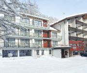
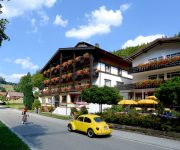
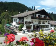
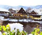
Traube Tonbach
Nationalpark Schliffkopf
Sonnenhof Flair Hotel
Klumpp
Schwanen Resort
Landhaus Eickler
Das Waldhaus
EOS Tagungszentrum Allerheiligen
Adieu Alltag: Pension Oesterle im Schwarzwald
TRAUBE TONBACH
Videos from this area
These are videos related to the place based on their proximity to this place.
11.02.2012 Skilanglauf im Eisschrank Nordschwarzwald (bitte HD 720 auswählen)
Minus 12 bis minus 16, Sonne, knallharte Spur, Wahnsinns-Grip am Berg Traumhafte Spur - vom Langlaufcenter Herrenwies gepflegt.
Am Mummelsee am 09.06.2014
Am Mummelsee am 09.06.2014 Zum Mummelsee kommt man von Baden-Baden aus, wenn man mit dem Auto auf der B500, Schwarzwaldhochstraße, über das Schloßhotel Bühlerhöhe und Kurhaus ...
Winterpanorama der Hornisgrinde vom Dreifürstenstein bis zum SWR-Sendeturm
Der Standort ist auf der "Obergrind", die östlich der Hornisgrinde liegt. Gut einen Kilometer misst die Luftlinie vom Standort bis zum SWR-Sendeturm. Das Video entstand an einem sonnigen Wintertag...
Hornisgrinde (Nordschwarzwald) im Dezember 2012
Auf dem Weg zur Hornisgrinde bzw. auf der Hornisgrinde entstanden die Fotos diesser Diashow. Zu sehen sind der Sender Hornisgrinde, der kleine Windpark, der Bismarckturm und Fotos zeigen auch.
Mummelsee 2D
Acompáñanos en esta nueva escapada al lago Mummelsee y sus alrededores en la Selva Negra alemana.
Schwarzwald Hornisgrinde, höchster Berg in Nordschwarzwald, im Herbst am 20.11.2012
Schwarzwald Hornisgrinde, höchster Berg in Nordschwarzwald (1164 m), im Herbst am 20.11.2012. Mit Blick in die nebelgefüllte, oberrheinische Tiefebene, aus der auf der gegenüberliegenden...
Mummelseeloipe Richtung Unterstmatt am 31. Dezember 2010
An Silvester 2010/2011 war eine sehr schöne Inversionswetterlage im Nordschwarzwald. Auf dem Video ist der Anfang der Mummelseeloipe vom Mummelsee nach Unterstmatt zu sehen, von dem man ...
Hornisgrinde - Berg und Sendeturm
Die Hornisgrinde ist mit 1163 m ü. NHN[1] der höchste Berg des Nordschwarzwaldes. Sie ist ein langgestreckter Bergrücken mit einer Länge von rund zwei Kilometern und liegt ungefähr in...
Videos provided by Youtube are under the copyright of their owners.
Attractions and noteworthy things
Distances are based on the centre of the city/town and sightseeing location. This list contains brief abstracts about monuments, holiday activities, national parcs, museums, organisations and more from the area as well as interesting facts about the region itself. Where available, you'll find the corresponding homepage. Otherwise the related wikipedia article.
Seekopf (Seebach)
Seekopf (Seebach) is a mountain of Baden-Württemberg, Germany.


