Safety Score: 3,0 of 5.0 based on data from 9 authorites. Meaning we advice caution when travelling to Germany.
Travel warnings are updated daily. Source: Travel Warning Germany. Last Update: 2024-08-13 08:21:03
Delve into Efringen
The district Efringen of Wintersweiler in Freiburg Region (Baden-Württemberg) is a subburb in Germany about 424 mi south-west of Berlin, the country's capital town.
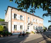
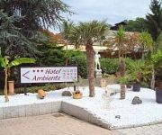
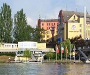
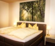
If you need a hotel, we compiled a list of available hotels close to the map centre further down the page.
While being here, you might want to pay a visit to some of the following locations: Efringen-Kirchen, Fischingen, Eimeldingen, Binzen and Bad Bellingen. To further explore this place, just scroll down and browse the available info.
Local weather forecast
Todays Local Weather Conditions & Forecast: 11°C / 51 °F
| Morning Temperature | 8°C / 46 °F |
| Evening Temperature | 7°C / 45 °F |
| Night Temperature | 7°C / 45 °F |
| Chance of rainfall | 5% |
| Air Humidity | 75% |
| Air Pressure | 1023 hPa |
| Wind Speed | Gentle Breeze with 8 km/h (5 mph) from North-East |
| Cloud Conditions | Broken clouds, covering 75% of sky |
| General Conditions | Moderate rain |
Wednesday, 27th of November 2024
10°C (49 °F)
9°C (48 °F)
Broken clouds, light breeze.
Thursday, 28th of November 2024
6°C (42 °F)
3°C (37 °F)
Moderate rain, gentle breeze, overcast clouds.
Friday, 29th of November 2024
6°C (43 °F)
1°C (34 °F)
Sky is clear, light breeze, clear sky.
Hotels and Places to Stay
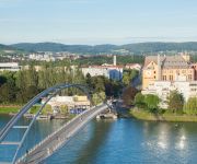
Dreiländerbrücke
Schlafstadt
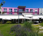
carathotel Basel
Mühle
Walsers Landhotel
Ambiente
Maximilian
Fritz
Ganita
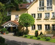
Rebstock Landgasthof
Videos from this area
These are videos related to the place based on their proximity to this place.
Weil am Rhein; Hafenbahn; MaK G 1206 [4K - Real 3D]
Weil am Rhein; Hafenbahn; MaK G 1206 ----------------------------------------------- Bitte höchste Auflösung und Vollbild einstellen (3D). Um die Aufnahmen in 3D zu sehen, benötigen Sie...
Weil am Rhein; Hafenbahn; MaK G 1206
Weil am Rhein; Hafenbahn; MaK G 1206 Eine circa 4.600 m lange Gleisanlage verbindet die verschiedenen Hafenbereiche miteinander, so können Waren vom Hafen Süd bis zum Hafen Nord ...
RECHERCHE DE FUITE SUR TOITURE Village-Neuf (68)
RECHERCHE DE FUITE SUR TOITURE Village-Neuf (68) EXPERT EN RECHERCHE DE FUITE D'EAU EN ALSACE .7 id Intervenant depuis plus de 10 ans , Tel 03 88 52 29 52 le réseau des agences ...
7ID EXPERT EN DÉTECTION DE FUITE SANS CASSE Village-Neuf (68)
7ID EXPERT EN DÉTECTION DE FUITE SANS CASSE Village-Neuf (68) EXPERT EN RECHERCHE DE FUITE D'EAU MULHOUSE .7 id Intervenant depuis plus de 10 ans , Tel 03 88 52 29 52 le ...
Efringen-Kirchen; Züge/Trains; 18. Jan. 2012
Züge am Bahnhof Efringen-Kirchen. Kursbuchstrecke (DB) 702; km 258,4 -------------------------------------------- Trains on station Efringen-Kirchen. Route number 702; km 258.4 0:00 "RE...
Info-Center Katzenbergtunnel
In Efringen-Kirchen, ganz in der Nähe des Südportals des Katzenbergtunnels, hat die DB ProjektBau ein Info-Center eingerichtet. Rund 40 Informationstafeln sowie zahlreiche Modelle und Exponate...
023 058-1; Führerstandsmitfahrt [1/2]
Fahrt im Führerstand der Dampflokomotive 23 058 (Tender voraus) von Weil am Rhein bis Freiburg im Breisgau. Dieses Video zeigt den Streckenabschnitt der Rheintalbahn zwischen Weil am Rhein...
Videos provided by Youtube are under the copyright of their owners.
Attractions and noteworthy things
Distances are based on the centre of the city/town and sightseeing location. This list contains brief abstracts about monuments, holiday activities, national parcs, museums, organisations and more from the area as well as interesting facts about the region itself. Where available, you'll find the corresponding homepage. Otherwise the related wikipedia article.
EuroAirport Basel-Mulhouse-Freiburg
EuroAirport Basel-Mulhouse-Freiburg is an international airport 6 km northwest of Basel, 22 km southeast of Mulhouse, and 70 km south of Freiburg. It is located in France, on the administrative territory of the commune of Saint-Louis near the Swiss and German borders.
Weil am Rhein
Weil am Rhein is a German town and commune which is a suburb of the city of Basel in Switzerland. It is on the east bank of the River Rhine, and close to the point at which the Swiss, French and German borders meet. It is the most southwesterly town in Germany.
Battle of Friedlingen
The Battle of Friedlingen was fought in 1702 between France and the Holy Roman Empire. The Imperial forces were led by Louis William, Margrave of Baden-Baden, while the French were led by Claude Louis Hector de Villars. The French were victorious.
Silo Tower Basel
The Silo Tower of Basel is located in the Swiss city of Basel, in the Rhine harbour of Kleinhueningen, near the Dreilaenderecks. The silo tower was built in 1923 by a Swiss shipping company. Its viewing platform stands at a height of 52 metres (about 160 feet), which offers a view of the Rhine, the Rhine harbour, the city of Basel, and the Sundgauer hill country. In the distance, one may appreciate details in Germany and France.
Gate of Saint John
The Gate of Saint John (in German St. Johanns-Tor or Sankt-Johanns-Tor) is a former city gate in the ancient city walls of Basel, Switzerland. It is one of the three remaining gateways and a heritage site of national significance.
Thomas Tower
The Thomas Tower is a former watchtower in the ancient city walls of Basel, Switzerland, just across the Gate of Saint John. It is named after Thomas Becket, Archbishop of Canterbury.
Vitra Design Museum
The Vitra Design Museum is an internationally renowned, privately owned museum for design in Weil am Rhein, Germany. Vitra CEO Rolf Fehlbaum founded the museum in 1989 as an independent private foundation. The Vitra corporation provides it with a financial subsidy, the use of Vitra architecture, and organizational cooperation.
Wiese
The Wiese is a river in Baden-Württemberg, Germany, and Basel-City, Switzerland, a right tributary of the Rhine. It rises in the Black Forest, on the Feldberg. The Wiese flows through Todtnau, Schönau im Schwarzwald, Schopfheim and Lörrach. After crossing the border with Switzerland, the Wiese flows through the quarters of Basel on the right side of the Rhine, and joins the Rhine opposite the French town Saint-Louis. Its length is 55 km.
Black Forest Academy
Black Forest Academy (BFA) is a private, coeducational boarding school in southwestern Germany. It was founded in 1956 by TeachBeyond, formerly Janz Team Ministries, in Kandern, Baden-Württemberg and provides an English language education with a Christian worldview for both elementary and secondary students. Admission is conditional upon agreement with the school's educational philosophy.
Birs
The BIRS Index is a share index of the 12 largest companies listed on the Banja Luka Stock Exchange, established on 1 May 2004. BIRS stands for Berzanski indeks Republike Srpske, which is Serbian for The Stock Exchange Index of Republika Srpska, an entity in Bosnia and Herzegovina. The constituents of the index are determined semi-annually, on 15 May and 15 November. Component companies must meet a number of requirements set out by the BLSE.
Rötteln Castle
Rötteln Castle, located above the Lörrach suburb of Haagen, lies in the extreme southwest corner of the German state of Baden-Württemberg. The fortification was one of the most powerful in the southwest, and today is the third largest castle ruin in Baden. The ruins of the castle are situated on a widely visible forested hill 422 metres above sea level. The keep lies on a spur projecting from the steep sided east side of the lower Wiese valley.
Museums in Basel
The Basel museums encompass a series of museums in the city of Basel, Switzerland, and the neighboring region. They represent a broad spectrum of collections with a marked concentration in the fine arts and house numerous holdings of international significance. With at least three dozen institutions, not including the local history collections in the surrounding communities, the region offers an extraordinarily high density of museums compared to other metropolitan areas of similar size.
Kurpark Bad Bellingen
The Kurpark Bad Bellingen (24.3 hectares) is a nature park and botanical garden located on the Badstraße, Bad Bellingen, Baden-Württemberg, Germany. Its natural area covers 11.3 hectares; the park and garden covers 10.8 hectares, and includes green spaces as well as yearly plantings of tens of thousands of spring and summer flowers.
Battle of Schliengen
At the Battle of Schliengen (26 October 1796), both the French Republican Army commanded by Jean-Victor Moreau and the Austrian army under the command of Archduke Charles of Austria claimed victories. The village of Schliengen lies close to the border of present-day Baden-Württemberg and Switzerland, in the Kreis Lörrach. In the French Revolutionary Wars, Schliengen was a strategically important location for both armies.
Kembs-Niffer Branch Canal
The Kembs-Niffer Branch Canal is a French canal connecting the Grand Canal d'Alsace at Kembs to the Canal du Rhône au Rhin.
Canal de Huningue
The Canal de Huningue is a canal in eastern France connecting the Rhine at Huningue to Niffer. The locks are no longer operational, but the canal is navigable from Niffer until Kembs. The canal was enlarged in 1961 between Grand Canal d'Alsace and Mulhouse. At the same time, the canal between Mulhouse and Friesenheim was closed to traffic as it had been duplciated by the Grand Canal d'Alsace. Parts of the abandoned line are being restored.
Schule für Gestaltung Basel
Switzerland's Schule für Gestaltung Basel (Basel School of Design) at the Allgemeine Gewerbeschule and its students have influenced the international graphic design community since it opened in 1968. Its tradition was shaped by influential personalities such as Armin Hofmann, Emil Ruder, Kurt Hauert, and Wolfgang Weingart. The name of the school represents an educational approach which perpetuates their ideas: to lay a strong and broad foundation for the major design disciplines.
Gare de Saint-Louis
La Gare de Saint-Louis is the main railway station in the border town of Saint-Louis, Alsace, France.
Basel St. Johann railway station
Basel St. Johann (referred to as Bahnhof Basel St. Johann in German and Gare de Bâle-Saint-Jean in French) is a railway station in inner-city Basel, Switzerland.
Gare de Saint-Louis-la-Chaussée
La Gare de Saint-Louis-la-Chaussée is a railway station serving the community of Saint-Louis-la-Chaussée (Neuweg) in the north of the commune of Saint-Louis, Alsace, France.
Gare de Bartenheim
La Gare de Bartenheim is a railway station serving the commuter town of Bartenheim, Alsace, France.
Rötteln
Rötteln is a village beneath the ruins of the Rötteln Castle in Southern Baden, which today is part of the district of Haagen in the city of Lörrach, Baden-Württemberg.
Three Countries Bridge
The Three Countries Bridge is an arch bridge which crosses the Rhine between the commune of Huningue and Weil am Rhein. It is the world's longest single-span bridge dedicated exclusively to carrying pedestrians and cyclists. Its overall length is 248 metres and its main span is 229.4 metres . Its name comes from the bridge's location between France, Germany and Switzerland (the latter being located approximately 200 metres away).
Entenstein Castle
Entenstein Castle is a medieval castle surrounded by a moat situated in the center of the town of Schliengen. Schliengen is located in the district of Lörrach, Baden-Würtemberg, in the very south-west of Germany in the proximity of the Black Forrest. The origins of the castle can not be clearly dated. The first use of a building at this location can be tracked to Walter of Schliengen in 821. By 1000 a residential tower might have been in use.
SIS Swiss International School
The SIS Swiss International Schools are a group of 14 private day schools in Switzerland, Germany and Brazil offering continuous education from kindergarten through to college. As of 2013, 1,760 students are enrolled at SIS. SIS has been operating schools in Switzerland since 1999, in Germany since 2008, and in Brazil since 2011. It is a joint venture of Kalaidos Education Group (Switzerland) and Klett Group (Germany).




!['Weil am Rhein; Hafenbahn; MaK G 1206 [4K - Real 3D]' preview picture of video 'Weil am Rhein; Hafenbahn; MaK G 1206 [4K - Real 3D]'](https://img.youtube.com/vi/v3U9eQSL5mQ/mqdefault.jpg)


!['023 058-1; Führerstandsmitfahrt [1/2]' preview picture of video '023 058-1; Führerstandsmitfahrt [1/2]'](https://img.youtube.com/vi/y3pnyYB6d_c/mqdefault.jpg)

