Safety Score: 3,0 of 5.0 based on data from 9 authorites. Meaning we advice caution when travelling to Germany.
Travel warnings are updated daily. Source: Travel Warning Germany. Last Update: 2024-08-13 08:21:03
Explore Worblingen
The district Worblingen of Rielasingen-Worblingen in Freiburg Region (Baden-Württemberg) is located in Germany about 388 mi south-west of Berlin, the country's capital.
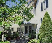
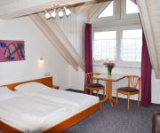
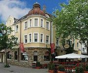
If you need a place to sleep, we compiled a list of available hotels close to the map centre further down the page.
Depending on your travel schedule, you might want to pay a visit to some of the following locations: Ohningen, Moos, Gottmadingen, Volkertshausen and Hilzingen. To further explore this place, just scroll down and browse the available info.
Local weather forecast
Todays Local Weather Conditions & Forecast: 8°C / 46 °F
| Morning Temperature | 0°C / 32 °F |
| Evening Temperature | 3°C / 38 °F |
| Night Temperature | 1°C / 34 °F |
| Chance of rainfall | 0% |
| Air Humidity | 59% |
| Air Pressure | 1023 hPa |
| Wind Speed | Calm with 2 km/h (1 mph) from North-East |
| Cloud Conditions | Overcast clouds, covering 99% of sky |
| General Conditions | Overcast clouds |
Monday, 25th of November 2024
8°C (46 °F)
4°C (40 °F)
Sky is clear, calm, clear sky.
Tuesday, 26th of November 2024
7°C (45 °F)
2°C (36 °F)
Moderate rain, light breeze, overcast clouds.
Wednesday, 27th of November 2024
7°C (44 °F)
6°C (43 °F)
Overcast clouds, light breeze.
Hotels and Places to Stay
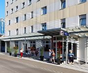
Best Western Hotel Lamm
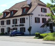
Alte Mühle
Zapa
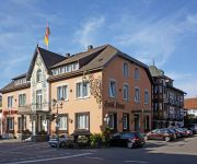
Krone
Hotel Trezor
Löwen
Krone
Relax
Hegau Tower
Victoria
Videos from this area
These are videos related to the place based on their proximity to this place.
GERMANY: The Hegau - volcanic landscape [HD]
The Hegau is a formerly volcanic landscape in southern Germany extending around the industrial city of Singen, between Lake Constance in the east, the Rhine River in the south, the Danube River...
Singen, Best Western Hotel - 14.04.2014 10:30
More Cams: http://livespotting.tv ▷ Musik: http://www.robertobronco.com Livespotting.tv ist ein innovatives Streaming-System zur Online-Präsentation und Vermarktung Ihres Standorts....
Singen, Best Western Hotel - 15.04.2014 20:45
More Cams: http://livespotting.tv ▷ Musik: http://www.robertobronco.com Livespotting.tv ist ein innovatives Streaming-System zur Online-Präsentation und Vermarktung Ihres Standorts....
Hegau-Echo: Deutschland trifft auf Griechenland bei der EM und in Singen
Singen, 21. Juni: Das SÜDKURIER Hegau-Echo war in Singen unterwegs, um die Stimmung vor dem EM-Viertelfinale einzufangen. Griechen, Portugiesen und Deutsche drücken ihren Spielern die ...
Singen, Best Western Hotel - 12.04.2014 20:45
More Cams: http://livespotting.tv ▷ Musik: http://www.robertobronco.com Livespotting.tv ist ein innovatives Streaming-System zur Online-Präsentation und Vermarktung Ihres Standorts....
Singen - 23.03.2014 12:00
More Cams: http://livespotting.tv ▷ Musik: http://www.robertobronco.com Livespotting.tv ist ein innovatives Streaming-System zur Online-Präsentation und Vermarktung Ihres Standorts....
Singen, Best Western Hotel - 08.04.2014 06:00
More Cams: http://livespotting.tv ▷ Musik: http://www.robertobronco.com Livespotting.tv ist ein innovatives Streaming-System zur Online-Präsentation und Vermarktung Ihres Standorts....
Singen, Best Western Hotel - 15.04.2014 06:00
More Cams: http://livespotting.tv ▷ Musik: http://www.robertobronco.com Livespotting.tv ist ein innovatives Streaming-System zur Online-Präsentation und Vermarktung Ihres Standorts....
Singen - 27.03.2014 10:30
More Cams: http://livespotting.tv ▷ Musik: http://www.robertobronco.com Livespotting.tv ist ein innovatives Streaming-System zur Online-Präsentation und Vermarktung Ihres Standorts....
Singen, Best Western Hotel - 09.04.2014 10:30
More Cams: http://livespotting.tv ▷ Musik: http://www.robertobronco.com Livespotting.tv ist ein innovatives Streaming-System zur Online-Präsentation und Vermarktung Ihres Standorts....
Videos provided by Youtube are under the copyright of their owners.
Attractions and noteworthy things
Distances are based on the centre of the city/town and sightseeing location. This list contains brief abstracts about monuments, holiday activities, national parcs, museums, organisations and more from the area as well as interesting facts about the region itself. Where available, you'll find the corresponding homepage. Otherwise the related wikipedia article.
Konstanz (district)
Konstanz (or Constance) is a district (Kreis) in the south of Baden-Württemberg on the German-Swiss border, stiuated along the shores of Lake Constance. Neighboring districts are (from west clockwise) Schwarzwald-Baar, Tuttlingen, Sigmaringen and Bodenseekreis. To the south it borders the Swiss canton Thurgau and Schaffhausen. The municipality of Büsingen is an exclave located inside the Kanton Schaffhausen.
Aachtopf
The Aachtopf is Germany's biggest natural spring, producing an average of 8,500 litres per second. Production varies seasonally and in response to the weather, but the spring never runs dry. The Aachtopf is a karst spring which is located south of the western end of the Swabian Jura, near the town Aach. The name Aachtopf is compounded from Aach (meaning water in Old High German); the name of the river created by the spring is in full the Radolfzeller Aach.
Diessenhofen District
Diessenhofen District is a former district of the canton of Thurgau in Switzerland. It had a population of 6,621 (as of 2009). Its capital was the town of Diessenhofen. The former district contained the following municipalities:
Hüttwilersee
Hüttwilersee is a lake in the Canton of Thurgau, Switzerland. It is located near two other lakes, Nussbaumersee and Hasensee, on the border of the municipalities of Hüttwilen und Uesslingen-Buch.
St. George's Abbey, Stein am Rhein
St. George's Abbey, Stein am Rhein (Kloster Sankt Georgen, Stein am Rhein) was a Benedictine monastery in Stein am Rhein, Switzerland.
Hasensee
Hasensee is a lake in the canton of Thurgau, Switzerland. It is located in the same valley as Nussbaumersee and Hüttwilersee. Its surface area is 0.11 km² and the surface elevation is 434.16 m, after being lowered by 1.5 m in World War II. Hasensee is or was also known as Buchemer See or oberer See (upper lake).
Nussbaumersee
Nussbaumersee is a small lake between Nussbaumen and Uerschhausen, both in the municipality of Hüttwilen in the Canton of Thurgau, Switzerland. Its surface area is 0.252 km². Hüttwilersee and Hasensee are located in the same valley. Nussbaumer See is or was also known as Werdsee or Wertsee, Uerschhauser See or unterer See (lower lake). Together with Hasensee they formed the Helfenberger Seen or Ittinger Seen.
Basadingen
Basadingen is a village and former municipality in the canton of Thurgau, Switzerland. In 1999 the municipality was merged with the neighboring municipality Schlattingen to form a new and larger municipality Basadingen-Schlattingen.
Schlattingen
Schlattingen is a village and former municipality in the canton of Thurgau, Switzerland. In 1999 the municipality was merged with the neighboring municipality Basadingen to form a new and larger municipality Basadingen-Schlattingen.
Buch bei Frauenfeld
Buch bei Frauenfeld is a village and former municipality in the canton of Thurgau, Switzerland. It was first recorded in year 1260 as Buoch. The municipality also contained the villages Trüttlikon, Hueb, Vorderhorben and Hinterhorben. It had 380 inhabitants in 1850, which increased to 305 in 1900, 331 in 1950 and 333 in 1990. In 1995 the municipality was merged with the neighboring municipality Uesslingen to form a new and larger municipality Uesslingen-Buch.
Hohenkrähen
Hohenkrähen is a mountain of Baden-Württemberg, Germany.
Mägdeberg
Mägdeberg is a mountain of Baden-Württemberg, Germany.
Rosenegg (mountain)
Rosenegg is a mountain of Baden-Württemberg, Germany.
Schiener Berg
Schiener Berg is a mountain of Baden-Württemberg, Germany.
Alemannenring
The Alemannenring was an auto racing circuit in Southern Germany. The circuit was located on public roads around in the industrial area of Singen in Baden-Württemberg. It hosted its final motor race in 1995.
Radolfzeller Aach
The Radolfzeller Aach (also known as Hegauer Aach) is a right or north tributary of the Rhine in the south of Baden-Württemberg. It is approximately 32 km long.
Werd (Lake Constance)
Werd Island is the main island of the small island group Werd Islands in the westernmost part of the Lower Lake of Lake Constance just before the High Rhine leaves the part of the lake known as Rheinsee. It is located on Swiss territory between Stein am Rhein and Eschenz.
Biber (Rhine)
The Biber is a small river on the border between Germany and Switzerland. The source is located at Watterdingen in the municipality Tengen, district of Constance in Baden-Wuerttemberg. After about 24 km the Biber river flows into the Rhine at the Biber Mill west of Hemishofen in the Canton of Schaffhausen. The Biber is the largest tributary of the High Rhine on the stretch between Stein am Rhein and Schaffhausen.
Unterhof Castle
Unterhof Castle is a castle in the municipality of Diessenhofen of the Canton of Thurgau in Switzerland. It is a Swiss heritage site of national significance.
Freudenfels Castle
Freudenfels Castle is a castle in the municipality of Eschenz of the Canton of Thurgau in Switzerland. It is a Swiss heritage site of national significance.
Liebenfels Castle
Liebenfels Castle is a castle in the municipality of Herdern of the Canton of Thurgau in Switzerland. It is a Swiss heritage site of national significance.
Mammern Castle
Mammern Castle is a castle in the municipality of Mammern of the Canton of Thurgau in Switzerland. It is a Swiss heritage site of national significance.
Hohenklingen Castle
Hohenklingen Castle is a castle in the municipality of Stein am Rhein of the Canton of Schaffhausen in Switzerland. It is a Swiss heritage site of national significance.
Stammheim railway station
Stammheim is a railway station in the Swiss canton of Zurich and municipality of Unterstammheim. The station is located on the Winterthur to Etzwilen line and is served by Zurich S-Bahn line S29, which links Winterthur and Stein am Rhein.
Etzwilen railway station
Etzwilen is a railway station in the Swiss canton of Thurgau and municipality of Wagenhausen. It takes its name from the nearby settlement of Etzwilen. The station is located on the Seelinie railway line, which links Schaffhausen with Konstanz, at its junction with the Winterthur to Etzwilen line and the Etzwilen to Singen freight line.






!['GERMANY: The Hegau - volcanic landscape [HD]' preview picture of video 'GERMANY: The Hegau - volcanic landscape [HD]'](https://img.youtube.com/vi/jEk8GYbhUvQ/mqdefault.jpg)


