Safety Score: 3,0 of 5.0 based on data from 9 authorites. Meaning we advice caution when travelling to Germany.
Travel warnings are updated daily. Source: Travel Warning Germany. Last Update: 2024-08-13 08:21:03
Touring Memprechtshofen
The district Memprechtshofen of in Freiburg Region (Baden-Württemberg) is a subburb located in Germany about 356 mi south-west of Berlin, the country's capital place.
Need some hints on where to stay? We compiled a list of available hotels close to the map centre further down the page.
Being here already, you might want to pay a visit to some of the following locations: Rheinmuenster, Sasbach, Ottersweier, Appenweier and Lauf. To further explore this place, just scroll down and browse the available info.
Local weather forecast
Todays Local Weather Conditions & Forecast: 4°C / 40 °F
| Morning Temperature | 2°C / 36 °F |
| Evening Temperature | 2°C / 36 °F |
| Night Temperature | 3°C / 37 °F |
| Chance of rainfall | 0% |
| Air Humidity | 80% |
| Air Pressure | 1023 hPa |
| Wind Speed | Gentle Breeze with 8 km/h (5 mph) from North |
| Cloud Conditions | Overcast clouds, covering 86% of sky |
| General Conditions | Light snow |
Sunday, 24th of November 2024
12°C (54 °F)
9°C (49 °F)
Overcast clouds, gentle breeze.
Monday, 25th of November 2024
12°C (54 °F)
8°C (47 °F)
Moderate rain, gentle breeze, broken clouds.
Tuesday, 26th of November 2024
10°C (50 °F)
8°C (46 °F)
Light rain, gentle breeze, scattered clouds.
Hotels and Places to Stay
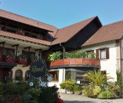
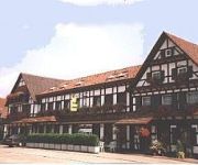
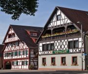
Ratz Landgasthof
Zum Rössel
Blume Landgasthof
Engel Hotel-Restaurant
Videos from this area
These are videos related to the place based on their proximity to this place.
A5 Achern bis Bühl vor dem Ausbau
Fahrt auf der A5 von Achern nach Bühl am 11.07.2009 mit Brücke der Anschlußstelle Achern.
Historischer Feldtag - Getreide-Ernte u. Dreschen
Historischer Feldtag im badischen Achern vom 22. Juli 2008 Getreideernte von der Sichel bis zum Mähbinder. Abholen der Garben und anschließendes dreschen beim "Tag des offenen Dorfes" in ...
AUS MOZARTS REICH FANTASIE Ernst Urbach 1. Teil Marek Weber und Orchester
Aufgenommen auf altem Grammophon von Schellack Platte mit Motiven aus Mozarts Zauberflöte AUS Mozarts Reich FANTASIE (Ernst Urbach) 1. Teil Marek Weber und sein Orchester Aufgenommen ...
Vor meinem Vaterhaus Lied im Volkston (Bruno Hardt-Warden) Willy Schneider
Vor meinem Vaterhaus Lied im Volkston (Bruno Hardt-Warden) Willy Schneider (Bariton) mit Orchesterbegleitung Aufgenommen von einer alten Schellack Schallplatte und etwas restauriert zur ...
Test: Gopro 4 Silver Nightlapse Straßburg Footage&Tutorial || KNIPSBUDE IN ACTION
SOCIAL MEDIA FACEBOOK https://www.facebook.com/knibu.de INSTAGRAM http://instagram.com/lanix_ninety ▻EQUIPMENT Folgendes Equipment verwende ich um für euch Youtube Videos zu ...
Don Juan Szenen a.d. Pantominischen Ballet Musik von Gluck HANS VON BENDA
Szenen a.d. Pantominischen Ballet "Don Juan" Musik von Gluck HANS VON BENDA mit seinem Kammerorchester aufgenommen auf altem Grammophon mit Schellackplatte Rückseite Backside of ...
Funky B & The Kings Of Shuffle am 10 Januar 2015 im Crazy Lion mit dem Titel Lovely shakedown
Temperamentvoll und mit viel Power ging es beim ersten Konzert 2015 im Liveclub Crazy Lion in Achern zu. Die 3 Musiker ( Markus Lauer an der Orgel, Carsten Egger an den Saiten und Jörg Mattern...
Dynamite Daze am 27 Dez 2014 live im Crazy Lion
One of the best Drum-Solo with a genial light-effect from Colin Jamieson ( Drums, Percussion )
Videos provided by Youtube are under the copyright of their owners.
Attractions and noteworthy things
Distances are based on the centre of the city/town and sightseeing location. This list contains brief abstracts about monuments, holiday activities, national parcs, museums, organisations and more from the area as well as interesting facts about the region itself. Where available, you'll find the corresponding homepage. Otherwise the related wikipedia article.
Battle of Diersheim (1797)
The Battle of Diersheim (20–21 April 1797) saw a First French Republic army led by Jean Victor Marie Moreau clash with a Habsburg Austrian army commanded by Anton Count Sztáray de Nagy-Mihaly. Though both sides suffered about 3,000 casualties in the bitter fighting, the Austrians finally retreated with the loss of 13 artillery pieces. Austrian General Wilhelm von Immens was killed and Sztáray badly wounded.
Ill (France)
The Ill is a river in Alsace, in north-eastern France. It is a "left-side", or western tributary of the Rhine. It starts down from its source near the village of Winkel, in the Jura mountains, with a resurgence near Ligsdorf, turns around Ferrette on its east side, and then runs northward through Alsace, flowing parallel to the Rhine.
Baden Airpark
Baden Airpark, or officially Flughafen Karlsruhe/Baden-Baden, is an international airport located in Rheinmünster in the state of Baden-Württemberg in Germany, 40 km south of Karlsruhe, 12 km west of Baden-Baden and 25 km north of Strasbourg, France. In 2010, it was the second-largest airport in Baden-Württemberg, and the 18th-largest in Germany with 1,192,894 passengers per year.
Gymnasium Achern
Gymnasium Achern is a Gymnasium in Achern, Baden-Württemberg, Germany, founded in 1877. It has some 1500 students and 120 teachers. It emphasizes science, foreign languages, and art. It was one of the first gymnasiums in Baden-Württemberg to graduate its students after eight years instead of the usual nine years, before this was made compulsory for all gymnasiums in the state. Though many names have been proposed, Gymnasium Achern was never named after a person.
CFB Baden-Soellingen
Canadian Forces Base Baden-Soellingen or CFB Baden-Soellingen was a Canadian Forces base located near the farming community of Söllingen, part of the municipality of Rheinmünster in the West German state of Baden-Württemberg. It is now a commercial area called Baden Airpark, which also includes the regional airport Flughafen Karlsruhe/Baden-Baden.
Acher
The Acher is a river in the district of Ortenau, Baden-Württemberg, Germany and a right tributary of the Rhine River. It flows in an eastwesterly direction from the Black Forest toward the Rhine, between the Rench River to the South and the Oos River to the North. Its source is located near the top of Schliffkopf Mountain (Black Forest) at an elevation of 1,054 metres above sea level, above Ottenhöfen.
Rench
The Rench is a river in the district of Ortenau, Baden-Württemberg, Germany and a right-side tributary of the Rhine River. Its source is near Kniebis Mountain not far from Bad Griesbach in the Black Forest. It runs for 59 km before it discharges into the Rhine River near Rheinau/Lichtenau. The Rench runs along the Rench Valley through Bad Peterstal, Oppenau, Lautenbach, Oberkirch and Renchen. In Oppenau the Lierbach discharges into the Rench.
Kinzig (Rhine)
The Kinzig is a river in southwestern Germany, a right tributary of the Rhine. It runs for 95 km from the Black Forest through the Upper Rhine River Plains. The Kinzig valley and secondary valleys constitute the largest system of valleys in the Black Forest. Depending on the definition, the Kinzig is either the border between the Northern and Middle Black Forest or part of the Middle Black Forest.
Casemate de Rountzenheim Sud
See Fortified Sector of Haguenau for a broader discussion of the Haguenau sector of the Maginot Line. The Casemate de Rountzenheim Sud is an interval infantry casemate of the Maginot Line. The casemate is in the town of Rœschwoog in France, behind the campsite, to the south of the railway.
Iffezheim Lock
The Iffezheim Lock is a river lock on the Rhine near Iffezheim in Baden-Württemberg, Germany. The two passages of the lock serve to allow ships and barges to bypass the hydropower station on the French side of the river. It is one of the heaviest-used locks in Germany, with a daily average of 107 commercial vessels passing through in 2003 and 30 million shipping tonnes per year. The chambers of the double lock have usable areas of 24 x 270 m.
Forest of Hagenau
Forest of Hagenau (French: Forêt de Haguenau) lies to the north of the town of Hagenau and is the largest undivided forest in France.
Siege of Kehl (1733)
The Siege of Kehl (14–28 October 1733) was one of the opening moves of the French Rhineland campaign in the War of the Polish Succession, at the fortress town of Kehl in the upper Rhine River valley. A large French army under the command of the Duke of Berwick besieged and captured the fortress, which was lightly garrisoned and in poor condition.
Musée de la Laub
Musée de la Laub is a museum in Bischwiller in the Bas-Rhin department of France. Built in 1665 under Duke Christian II de Birkenfeld Bischwiller, it was the centre of village life until the 20th century. It became the town hall in 1912 and housed the village fire service until 1986. Address: Place de la Mairie, 67240 Bischwiller, France Telephone: 03 88 53 99 29
Haguenau Airport
Haguenau Airport is an airport in France, located about 2 miles southeast of Haguenau (Département du Bas-Rhin,Alsace); 15 miles north of Strasburg and 250 miles east of Paris. The airport supports general aviation, with no commercial airline service available. It is primarily a business and jet charter airport.
Acher Valley Railway
|} The Acher Valley Railway is a 10.4 km long branch line from Achern to Ottenhöfen im Schwarzwald in the Black Forest in Germany that branches off the Rhine Valley Railway.
Institut national des études territoriales
The Institut national des études territoriales (INET, National Institute of Territorial Studies) is a French Public administration school. INET offers initial and continuing training to managerial staff of large local and regional authorities. Most of the students from the INET become directors or head of department (finance, budget, human resources) in towns of more than 80 000 inhabitants, departments or regions.
Stollhofen
Stollhofen is a place near Rheinmünster, Rastatt district, Baden-Württemberg, Germany. It lies on the river Sulzbach, and was first mentioned in documents in 1154 and given city status in the 13th century. It gives its name to the Lines of Stollhofen, a 10 mile defensive line between Stollhofen and Bühl constructed in 1703 during the War of the Spanish Succession. The town was captured in 1707 and its fortifications demolished.


