Safety Score: 2,8 of 5.0 based on data from 9 authorites. Meaning we advice caution when travelling to Gambia.
Travel warnings are updated daily. Source: Travel Warning Gambia. Last Update: 2024-08-13 08:21:03
Discover Ibo Town
The district Ibo Town of Serekunda in City of Banjul is a district in Gambia a little west of Banjul, the country's capital city.
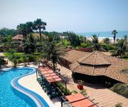
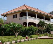
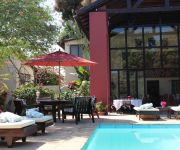
Looking for a place to stay? we compiled a list of available hotels close to the map centre further down the page.
When in this area, you might want to pay a visit to some of the following locations: Banjul, Brikama, Kerewan, Kaolack and Fatick. To further explore this place, just scroll down and browse the available info.
Local weather forecast
Todays Local Weather Conditions & Forecast: 27°C / 80 °F
| Morning Temperature | 26°C / 79 °F |
| Evening Temperature | 27°C / 80 °F |
| Night Temperature | 27°C / 81 °F |
| Chance of rainfall | 0% |
| Air Humidity | 38% |
| Air Pressure | 1013 hPa |
| Wind Speed | Moderate breeze with 12 km/h (7 mph) from South-East |
| Cloud Conditions | Clear sky, covering 1% of sky |
| General Conditions | Sky is clear |
Monday, 25th of November 2024
28°C (82 °F)
27°C (81 °F)
Sky is clear, moderate breeze, clear sky.
Tuesday, 26th of November 2024
27°C (80 °F)
26°C (79 °F)
Sky is clear, moderate breeze, clear sky.
Wednesday, 27th of November 2024
26°C (79 °F)
26°C (79 °F)
Sky is clear, gentle breeze, clear sky.
Hotels and Places to Stay
Kololi Beach Club
Seafront Residence
Sand Beach Hotel
Roc Heights Lodge
Oasis Relax Lodge
Lemon Creek Hotel Resort
Hibiscus House
Holiday Beach Club Hotel
OCEAN BAY HOTEL AND RESORT-BAKAU
GOLDEN BEACH HOTEL
Videos from this area
These are videos related to the place based on their proximity to this place.
have a break: one-day trip to the Senegal in march 2009
on our trip by jeep to the Senegal, we had a drinking break on the so called smugglers-road between the Senegal and the Gambia. It was a very narrow, sandy road on which you could only drive...
Tanjeh Tye n Dye
This is one of three parts of a video made for the Tanjeh villiage museum as a classroom teaching aid aimed at keeping local skills and traditions alive. The Village museum is run by Abdoulie...
London Corner School, Serrekunda, The Gambia
An impression of the London Corner School in Serrekunda, The Gambia. Children of this school are sponsored by the Yamah Youth Foundation: www.yamahyouth.com.
Nathaniel Fatty Miracle Video NEEM CREAM (director's cut)
Peace Corps: The Gambia brings you informative and entertaining Do-It-Yourself training videos for various Agriculture/Forestry and Environmental Education subjects. We hope this will better...
DISCOVERING TRUTH - Vision-Killing Attitudes - 1
a weekly down-to-earth, practical biblical teaching on Gambian National Television, by Pastor Forbes of ABIDING WORD MINISTRIES, popularly known as "the nation's pastor". DISCOVERING TRUTH.
Volunteer Remarks @ Swearing In 4 Sept 09
After new Education Peace Corps Volunteers were sworn in at the U.S. Ambassador's residence in Fajara, new volunteers Katie Hofstetter & Stephen St. John delivered an address in Mandinka, ...
Videos provided by Youtube are under the copyright of their owners.
Attractions and noteworthy things
Distances are based on the centre of the city/town and sightseeing location. This list contains brief abstracts about monuments, holiday activities, national parcs, museums, organisations and more from the area as well as interesting facts about the region itself. Where available, you'll find the corresponding homepage. Otherwise the related wikipedia article.
Serekunda
Serrekunda is the largest city in the Gambia, lying southwest of Banjul. Its population as of 2006, was 335,733 people. Although Banjul is the Gambian capital, it is on an island, making further growth difficult and channeling much of the growth to Serekunda. Serrekunda is known for its market, its silk cotton tree and its wrestling arena. The town's suburbs include Kanifing, Latrikunda, Sukuta and London Corner, and the town flows into the seaside resorts of Bakau, Fajara and Kotu.
Bakau
Bakau is a town on the Atlantic Ocean coast of the Gambia, lying west of Banjul. It is known for its botanical gardens, its crocodile pool Bakau Kachikally and for the beaches at Cape Point. It is the first major suburb outside Banjul and the most developed town in the Gambia. Close to Bakau and Banjul is Serrekunda
Kanifing District
Kanifing is a city in the Banjul Division of the Gambia. It is located near Serrekunda, the largest city in the country. Kanifing is the larger of the two districts in Banjul Division.
Kololi
Kololi is a resort town on the shore of the Atlantic Ocean in Gambia. It is surrounded by the Bijilo Forest. The primary hotels are located on "The Strip" which is a short road leading to the beach and the hotels of Senegambia and the Kairaba. The Strip is lined with restaurants and entrance is monitored by the Gambian tourist police. A favorite with tourists, particularly from the UK, Belgium, Germany and The Netherlands.
Yundum
Yundum is a small town in Gambia, east of the capital, Banjul. It is situated adjacent to the country's international airport.
Banjul International Airport
Banjul International Airport also known as Yundum International is the international airport of Banjul, capital of the Gambia. In 2004, the airport served 967,719 passengers. The airport has a number of amenities, including bars serving primarily snacks and drinks, as well as small shops selling local souvenirs and stalls representing local cell phone providers, all of which are before security.
National Assembly of the Gambia
The National Assembly is the legislative branch of government in the Gambia.
Kanifing LGA
Kanifing is one of eight Local Government Areas in the Gambia.
Brufut
Brufut is a town located in the Western Division of the Gambia. The town of Brufut is situated a couple of kilometres inland from the costal road, but the name Brufut is applied to an area extending from around the town, out to the coast. It has a main street with a market, and some government offices. It is a fast developing location because of its highly developed infra structure.
Sukuta
Sukuta is a town located in the Western Division of the Gambia. It had a population of 16,667 as of the 1993 census.
Nema Kunku
Nema Kunku is a village in Foni Jarrol district in the Western Division of the Gambia. Nema kunku is a surrounding village of Gambia's largest town Serekunda. The population of the village is 99% local (Gambian) people.
Lamin, Western Division, Gambia
Lamin is the largest village in Kombo NorthWestern Division of the Gambia. A village with two large clans, Bojang, and Manneh, as the founders, and all the rest are considered "lountan" meaning "strangers" in Manidinko. There is a village leader, "AlKalo" who is from the lineage of the Bojang. Until recently the village was divided into zones marked by tribes, the Mandinkos in Sateba, the Jolas in Sanchaba, the Manjako in Wayoto and all the other tribes in Temasu.
Kombo North/Saint Mary
Kombo North/Saint Mary is one of the nine districts of the Gambia's Western Division, which is located to the south of the Gambia River in the southwest of the country. Kombo North/Saint Mary is in the northwest of the division, between Kombo South and Banjul Division. It is the only district in the Western Division with coasts on both the Atlantic Ocean and the Gambia River.
Independence Stadium (Bakau)
Independence Stadium is a multi-purpose stadium in Bakau, Gambia. It is currently used mostly for football matches, although it is also used for music concerts, political events, trade fairs and national celebrations. The stadium holds 20,000 people.
The Daily Observer
The Daily Observer is a newspaper published in Bakau in Banjul, the Gambia. The paper, Gambia's first daily newspaper, was founded by Kenneth Best in 1990. Best had previously managed another paper called the Daily Observer in Liberia, until the First Liberian Civil War caused him to relocate with his family to the Gambia. In October 1994, following Yahya Jammeh's military coup, Best was expelled from Gambia, although the newspaper was allowed to continue.
The Gambia–United States relations
Gambian–American relations are bilateral relations between the Gambia and the United States.
Arch 22
Arch 22 is a commemorative arch on the road into Banjul in the Gambia. It was built in 1996 to mark the military coup d'etat which over threw the democratically elected government, and saw the rise to power on 22 July 1994 of President Yahya Jammeh and his Armed Forces Provisional Ruling Council. The arch stands on the Banjul-Serrekunda Highway near to the traffic island which intersects with Box Bar Road, Independence Drive and Marina Parade.
Kachikally Museum and Crocodile Pool
The Kachikally crocodile pool is located in the heart of Bakau about 10 miles (16 km) from the capital Banjul. It is one of three sacred crocodile pools used as sites for fertility rituals. The others are Folonko in Kombo South and Berending on the north bank.
Abuko Nature Reserve
Abuko National Park is a nature reserve in the Gambia lying south of the town of Abuko. It is a popular tourist attraction and was the country's first designated wildlife reserve.
Bijilo Forest Park
Bijilo Forest Park is a forest park in the Gambia.
Tanbi Wetland Complex
Tanbi Wetland Complex is a wetland reserve in the Gambia outside of Banjul. Established in 2001 it covers an area of 4500 hectares. This area covers a wide area and can be seen from a spectacular view at Lamin's, Lamin lodge. Its very common for monkeys to be spotted in the overgrowth
Banjulunding
Banjulunding is a town in western Gambia. It is located in Kombo North/Saint Mary District in the Western Division. As of 2008, it has an estimated population of 8,029.
Salagi Forest Park
Salagi Forest Park is a forest park in the Gambia. Established on January 1, 1954, it covers 262 hectares.
University of the Gambia
The University of the Gambia (UTG) is an institution of higher education located in Sere Kunda, the largest city in the Gambia.
Royal Victoria Teaching Hospital
The Royal Victoria Teaching Hospital (RVTH) is the central hospital in Banjul, the capital of the West African nation of the Gambia. The governmental hospital is located at Independence Drive in Banjul and is with over 540 beds as the biggest state-of-the-art hospital. It was originally built under British colonisation of Africa in 1853. The operation of Royal Victoria Hospital (RVH) was improved with the help of the Sisters of St. Joseph of Cluny in 1903.


