Safety Score: 3,0 of 5.0 based on data from 9 authorites. Meaning we advice caution when travelling to France.
Travel warnings are updated daily. Source: Travel Warning France. Last Update: 2024-08-13 08:21:03
Delve into Bramousse
Bramousse in Hautes-Alpes (Provence-Alpes-Côte d'Azur Region) is located in France about 354 mi (or 569 km) south-east of Paris, the country's capital town.
Current time in Bramousse is now 02:53 AM (Saturday). The local timezone is named Europe / Paris with an UTC offset of one hour. We know of 12 airports close to Bramousse, of which 5 are larger airports. The closest airport in France is Mont-Dauphin - St-Crépin Airport in a distance of 7 mi (or 12 km), West. Besides the airports, there are other travel options available (check left side).
There are two Unesco world heritage sites nearby. The closest heritage site is Residences of the Royal House of Savoy in Italy at a distance of 52 mi (or 84 km). If you need a hotel, we compiled a list of available hotels close to the map centre further down the page.
While being here, you might want to pay a visit to some of the following locations: Briancon, Claviere, Cesana Torinese, Sauze di Cesana and Sestriere. To further explore this place, just scroll down and browse the available info.
Local weather forecast
Todays Local Weather Conditions & Forecast: 4°C / 39 °F
| Morning Temperature | -10°C / 14 °F |
| Evening Temperature | -3°C / 27 °F |
| Night Temperature | -4°C / 24 °F |
| Chance of rainfall | 0% |
| Air Humidity | 58% |
| Air Pressure | 1026 hPa |
| Wind Speed | Light breeze with 5 km/h (3 mph) from West |
| Cloud Conditions | Scattered clouds, covering 44% of sky |
| General Conditions | Scattered clouds |
Sunday, 24th of November 2024
7°C (45 °F)
3°C (37 °F)
Overcast clouds, light breeze.
Monday, 25th of November 2024
8°C (46 °F)
7°C (45 °F)
Moderate rain, light breeze, broken clouds.
Tuesday, 26th of November 2024
7°C (45 °F)
4°C (39 °F)
Moderate rain, light breeze, overcast clouds.
Hotels and Places to Stay
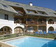
Ferme de l'Izoard Logis
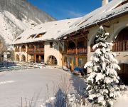
La Ferme de l'Izoard
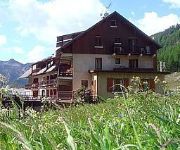
La Cascade Logis
Videos from this area
These are videos related to the place based on their proximity to this place.
Queyras Eté 2012 - Furfande
Une jolie boucle à faire au dessus d'Arvieux (Queyras - Hautes-Alpes). Les alpages, les chalets et le refuge de Furfande valent vraiment les efforts pour y accéder. All videos are there...
Le Queyras en VTT, août 2012, jour 1
Résumé en images de notre rando en VTT dans le Queyras. Sur cette première journée, le départ se fait d'Arvieux, à destination du col de Furfande.
Queyras, Les chalets de Clapeyto à raquette
Sortie journée à raquette dans la vallée d'Arvieux avec Destinations Queyras.
TUKC - French Alps - Triple Step
This is Nick Wright running Triple Step on the Middle Guil in the French Alps, with Josh Cartwright coming after him Camera: GoPro Hero 3 Black Edition Resolution: 1080p Frame Rate: 60fps...
Vue panoramique EXCEPTIONNELLE des crêtes du col de Furfande (Queyras)
Vue panoramique exceptionnelle sur les crêtes du col de Furfande (Queyras)
Videos provided by Youtube are under the copyright of their owners.
Attractions and noteworthy things
Distances are based on the centre of the city/town and sightseeing location. This list contains brief abstracts about monuments, holiday activities, national parcs, museums, organisations and more from the area as well as interesting facts about the region itself. Where available, you'll find the corresponding homepage. Otherwise the related wikipedia article.
Queyras
The Queyras is a valley located in the French Hautes-Alpes, of which the geographical extent is the basin of the river Guil, a tributary of the Durance. The Queyras is one of the oldest mountain ranges of the Alps, and it was one of the last ones to be opened to public tourism towards the end of the 20th century, thus being relatively untouched by environmental destruction.


