Safety Score: 3,0 of 5.0 based on data from 9 authorites. Meaning we advice caution when travelling to France.
Travel warnings are updated daily. Source: Travel Warning France. Last Update: 2024-08-13 08:21:03
Delve into Les Traverses
Les Traverses in Alpes-Maritimes (Provence-Alpes-Côte d'Azur Region) is located in France about 398 mi (or 641 km) south-east of Paris, the country's capital town.
Current time in Les Traverses is now 03:35 PM (Friday). The local timezone is named Europe / Paris with an UTC offset of one hour. We know of 12 airports close to Les Traverses, of which 5 are larger airports. The closest airport in France is Barcelonnette - Saint-Pons Airport in a distance of 30 mi (or 48 km), North-West. Besides the airports, there are other travel options available (check left side).
There are two Unesco world heritage sites nearby. The closest heritage site is Vineyard Landscape of Piedmont: Langhe-Roero and Monferrato in Italy at a distance of 62 mi (or 99 km). If you need a hotel, we compiled a list of available hotels close to the map centre further down the page.
While being here, you might want to pay a visit to some of the following locations: Pietraporzio, Sambuco, Vinadio, Bersezio and Aisone. To further explore this place, just scroll down and browse the available info.
Local weather forecast
Todays Local Weather Conditions & Forecast: 13°C / 55 °F
| Morning Temperature | 6°C / 43 °F |
| Evening Temperature | 9°C / 48 °F |
| Night Temperature | 8°C / 46 °F |
| Chance of rainfall | 0% |
| Air Humidity | 48% |
| Air Pressure | 1023 hPa |
| Wind Speed | Light breeze with 5 km/h (3 mph) from South |
| Cloud Conditions | Clear sky, covering 1% of sky |
| General Conditions | Sky is clear |
Saturday, 16th of November 2024
12°C (54 °F)
8°C (46 °F)
Sky is clear, gentle breeze, clear sky.
Sunday, 17th of November 2024
13°C (56 °F)
10°C (50 °F)
Overcast clouds, light breeze.
Monday, 18th of November 2024
15°C (60 °F)
8°C (46 °F)
Overcast clouds, gentle breeze.
Hotels and Places to Stay
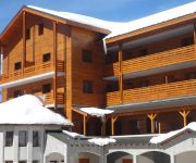
Adonis Valberg Residence de Tourisme
Videos from this area
These are videos related to the place based on their proximity to this place.
Roubion La Transhumance 2010
HD - sans dialogue - Après être descendu des Alpages de Vignols, le troupeau traverse le village de Roubion pour monter jusqu'à la station de ski de Roubion les Buisses et terminer l'automne...
Riding's my life épisode 1: roubion et ses conneries
"Riding's my life" Rider : ce bouffon d'anglais et son acolyte de français Team: Lapierre Original Caméraman: y en a pas, on a la chance d'avoir des « hero » qui savent filmer seul Lieu...
Descente de Valberg en Direction de Nice (route D30)
Plein de neige sur la route en descendant de Valberg (Route D30)
Transhumance ...
Pour Babeth et Nadine - Le Rupicapra Dimanche 05 octobre 2014, Fête de la transhumance, ROUBION http://www.rupicapra-tinee.com/
DH Roubion - 2014
Vidéo des reco du samedi matin sur la descente de la Coupe régionale PACA Musique : Grimm - Electrify (feat. Father Dude)
marcher avec les moutons arrivée aux Buisses.MP4
Parties de Roubion, les brebis arrivent à la station des Buisses.
Videos provided by Youtube are under the copyright of their owners.
Attractions and noteworthy things
Distances are based on the centre of the city/town and sightseeing location. This list contains brief abstracts about monuments, holiday activities, national parcs, museums, organisations and more from the area as well as interesting facts about the region itself. Where available, you'll find the corresponding homepage. Otherwise the related wikipedia article.
Raton (river)
The Raton is a short mountain river that flows through the Alpes-Maritimes department of southeastern France. It flows into the Cians north of Rigaud. It flows from west to east along the following communes: north side: Guillaumes, Beuil south side: Auvare, Puget-Rostang, Rigaud


