Safety Score: 3,0 of 5.0 based on data from 9 authorites. Meaning we advice caution when travelling to France.
Travel warnings are updated daily. Source: Travel Warning France. Last Update: 2024-08-13 08:21:03
Discover La Beaumette
La Beaumette in Alpes-Maritimes (Provence-Alpes-Côte d'Azur Region) is a town in France about 390 mi (or 628 km) south-east of Paris, the country's capital city.
Current time in La Beaumette is now 11:28 AM (Friday). The local timezone is named Europe / Paris with an UTC offset of one hour. We know of 12 airports near La Beaumette, of which 5 are larger airports. The closest airport in France is Barcelonnette - Saint-Pons Airport in a distance of 22 mi (or 35 km), North-West. Besides the airports, there are other travel options available (check left side).
There are two Unesco world heritage sites nearby. The closest heritage site is Vineyard Landscape of Piedmont: Langhe-Roero and Monferrato in Italy at a distance of 61 mi (or 99 km). Looking for a place to stay? we compiled a list of available hotels close to the map centre further down the page.
When in this area, you might want to pay a visit to some of the following locations: Pietraporzio, Bersezio, Sambuco, Vinadio and Acceglio. To further explore this place, just scroll down and browse the available info.
Local weather forecast
Todays Local Weather Conditions & Forecast: 12°C / 53 °F
| Morning Temperature | 6°C / 43 °F |
| Evening Temperature | 7°C / 45 °F |
| Night Temperature | 8°C / 46 °F |
| Chance of rainfall | 0% |
| Air Humidity | 35% |
| Air Pressure | 1021 hPa |
| Wind Speed | Light breeze with 3 km/h (2 mph) from East |
| Cloud Conditions | Clear sky, covering 2% of sky |
| General Conditions | Sky is clear |
Saturday, 16th of November 2024
13°C (56 °F)
7°C (44 °F)
Sky is clear, light breeze, clear sky.
Sunday, 17th of November 2024
11°C (53 °F)
8°C (46 °F)
Overcast clouds, light breeze.
Monday, 18th of November 2024
6°C (43 °F)
3°C (37 °F)
Light rain, gentle breeze, broken clouds.
Hotels and Places to Stay
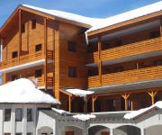
Adonis Valberg Residence de Tourisme
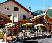
Hotel Le Chastellares
L Ecureuil Logis
Videos from this area
These are videos related to the place based on their proximity to this place.
Guillaumes, Alpes-Maritimes, Provence-Alpes-Côte d'Azur, France [HD] (videoturysta)
After the Var Valley and Gorges de Daluis we visit the Guillaumes village. This charming village is located at the end of Gorges de Daluis and is a gateway to the Mercantour National Park....
Raft'Ubaye - Rafting Gorges de Daluis - filmé en GoPro Hero 3 HD
Raft'Ubaye c'est du rafting sur l'Ubaye bien sûr, mais c'est aussi des descentes de rafting en itinérance sur les plus beaux parcours Alpins navigables au printemps... Cette fois-ci, c'est...
Une Nissan GTR ouvre la route des Alpes à une Z3, suivie d'une Z06 (Episode 2)
Une Nissan GTR ouvre la route des Alpes à une Z3, suivie d'une Z06 (Episode 2)
Rando Enduro Mercantour sept 2013
Randonnée à VTT dans le Mercantour sur 2 jours septembre 2013. Arrivée à Guillaume.
Cycling in France - May in the South of France 2011 - Route des Grandes Alpes - Part 11
Cycling in the Alpes - May in the South of France 2011 - Route des Grandes Alpes.
acropelle heliportage roya minipelle
mise en place d'une minipelle par heliportage dans le parc du mercantour 06.
Videos provided by Youtube are under the copyright of their owners.
Attractions and noteworthy things
Distances are based on the centre of the city/town and sightseeing location. This list contains brief abstracts about monuments, holiday activities, national parcs, museums, organisations and more from the area as well as interesting facts about the region itself. Where available, you'll find the corresponding homepage. Otherwise the related wikipedia article.
Aigue Blanche
The Aigue Blanche is a short mountain river that flows through the Provence-Alpes-Côte d'Azur region of southeastern France. It lies completely within the department of Alpes-Maritimes and crosses three communes: Guillaumes, Beuil, and Péone. Its source is in the Maritime Alps, and it flows into the river Tuébi in the village Péone.


!['Guillaumes, Alpes-Maritimes, Provence-Alpes-Côte d'Azur, France [HD] (videoturysta)' preview picture of video 'Guillaumes, Alpes-Maritimes, Provence-Alpes-Côte d'Azur, France [HD] (videoturysta)'](https://img.youtube.com/vi/ycZfeAts1Fs/mqdefault.jpg)


