Safety Score: 3,0 of 5.0 based on data from 9 authorites. Meaning we advice caution when travelling to France.
Travel warnings are updated daily. Source: Travel Warning France. Last Update: 2024-08-13 08:21:03
Delve into Rocles
Rocles in Lozère (Occitanie) with it's 206 habitants is a town located in France about 294 mi (or 473 km) south of Paris, the country's capital town.
Time in Rocles is now 05:38 PM (Friday). The local timezone is named Europe / Paris with an UTC offset of one hour. We know of 12 airports closer to Rocles, of which 4 are larger airports. The closest airport in France is Mende-Brenoux Airport in a distance of 19 mi (or 31 km), South-West. Besides the airports, there are other travel options available (check left side).
There are several Unesco world heritage sites nearby. The closest heritage site in France is The Causses and the Cévennes, Mediterranean agro-pastoral Cultural Landscape in a distance of 37 mi (or 60 km), South-West. In need of a room? We compiled a list of available hotels close to the map centre further down the page.
Since you are here already, you might want to pay a visit to some of the following locations: Mende, Le Puy-en-Velay, Florac, Le Chambon and Yssingeaux. To further explore this place, just scroll down and browse the available info.
Local weather forecast
Todays Local Weather Conditions & Forecast: 10°C / 50 °F
| Morning Temperature | 3°C / 37 °F |
| Evening Temperature | 3°C / 38 °F |
| Night Temperature | 2°C / 36 °F |
| Chance of rainfall | 0% |
| Air Humidity | 57% |
| Air Pressure | 1024 hPa |
| Wind Speed | Light breeze with 3 km/h (2 mph) from North |
| Cloud Conditions | Broken clouds, covering 54% of sky |
| General Conditions | Broken clouds |
Saturday, 16th of November 2024
14°C (57 °F)
5°C (40 °F)
Sky is clear, light breeze, clear sky.
Sunday, 17th of November 2024
13°C (55 °F)
7°C (44 °F)
Broken clouds, light breeze.
Monday, 18th of November 2024
7°C (44 °F)
2°C (35 °F)
Light rain, light breeze, broken clouds.
Hotels and Places to Stay
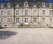
Domaine De Barres
Videos from this area
These are videos related to the place based on their proximity to this place.
TESTUD FRANCK SARL : Plomberie Sanitaire chauffage à Langogne 48
www.testud48.fr Bonjour et bienvenue. Vous recherchez un spécialiste en plomberie, sanitaire, chauffage, ne cliquez plus, vous êtes sur la bonne page ! A votre service en Lozère Franck Testud...
Train intercités Cévenol : De Chamborigaud aux Gorges de l'Allier
Voyage à bord du train corail intercités Cévenol Nimes / Clermont-Ferrand sncf , entre Chamborigaud et les Gorges de l'Allier (Prades). Un parcours unique entre Languedoc Roussillon et Auvergne...
Vol au dessus du massif central
Prises de vue aériennes autours du lac de naussac, du mont gerbier de jonc et des massifs environnants, filmé avec un Canon EOS 60D.
Isis à la balade en main
Isis, jument alezane à la balade en main après un galop à partir du lac de Naussac. Lieu : relais de Palhères.
Pipistrel Virus ND Neiges + Langogne
Notre Dame des Neiges take off/decollage Langogne landing/atterrissage Virus 912 Pipistrel.
Projet Parc Naturel Régional des sources et gorges de l'Allier (19/20 F3 Auvergne 4/11/2013)
4 novembre 2013 : Une rencontre entre les Présidents des Régions Auvergne et Languedoc Roussillon , à Naussac (48-Lozère) , pour le projet de PNR Parc Naturel Régional des sources et gorges...
Complainte du Gévaudan
Clip vidéo d'un slam sur la Bête du Gévaudan, réalisé avec Kwal (le slameur) lors de mon séjour à Langogne en septembre 2012.
Videos provided by Youtube are under the copyright of their owners.
Attractions and noteworthy things
Distances are based on the centre of the city/town and sightseeing location. This list contains brief abstracts about monuments, holiday activities, national parcs, museums, organisations and more from the area as well as interesting facts about the region itself. Where available, you'll find the corresponding homepage. Otherwise the related wikipedia article.
Lac de Naussac
Lac de Naussac is a lake in Lozère, France. At an elevation of 945 m, its surface area is 10.8 km².


