Safety Score: 3,0 of 5.0 based on data from 9 authorites. Meaning we advice caution when travelling to France.
Travel warnings are updated daily. Source: Travel Warning France. Last Update: 2024-08-13 08:21:03
Delve into Argeliers
Argeliers in Aude (Occitanie) with it's 1,321 habitants is a city located in France about 384 mi (or 618 km) south of Paris, the country's capital town.
Current time in Argeliers is now 07:40 AM (Saturday). The local timezone is named Europe / Paris with an UTC offset of one hour. We know of 12 airports closer to Argeliers, of which 4 are larger airports. The closest airport in France is Béziers-Vias Airport in a distance of 22 mi (or 36 km), East. Besides the airports, there are other travel options available (check left side).
There are several Unesco world heritage sites nearby. The closest heritage site in France is Historic Fortified City of Carcassonne in a distance of 29 mi (or 46 km), West. In need of a room? We compiled a list of available hotels close to the map centre further down the page.
Since you are here already, you might want to pay a visit to some of the following locations: Narbonne, Beziers, Carcassonne, Lodeve and Perpignan. To further explore this place, just scroll down and browse the available info.
Local weather forecast
Todays Local Weather Conditions & Forecast: 13°C / 55 °F
| Morning Temperature | 10°C / 50 °F |
| Evening Temperature | 11°C / 51 °F |
| Night Temperature | 10°C / 50 °F |
| Chance of rainfall | 0% |
| Air Humidity | 67% |
| Air Pressure | 1023 hPa |
| Wind Speed | Gentle Breeze with 6 km/h (3 mph) from West |
| Cloud Conditions | Overcast clouds, covering 94% of sky |
| General Conditions | Overcast clouds |
Sunday, 17th of November 2024
19°C (66 °F)
14°C (56 °F)
Few clouds, moderate breeze.
Monday, 18th of November 2024
16°C (60 °F)
9°C (49 °F)
Broken clouds, moderate breeze.
Tuesday, 19th of November 2024
15°C (59 °F)
13°C (55 °F)
Broken clouds, moderate breeze.
Hotels and Places to Stay
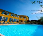
La Bastide Cabezac Symboles de France
Videos from this area
These are videos related to the place based on their proximity to this place.
Trail Bize-Minervois 2014
Le 26 janvier 2014, par une belle journée a démarré le 1er TBM, une réussite, beau parcours et bonne organisation, ça mérite une suite. Plus de batterie pour filmer entièrement la dernière...
Circuit Vtt du Roc Minervois
Un circuit Vtt magnifique au départ de Bize Minervois, le tracé se trouve sur Plani Cycles... merci à ceux qui ont travaillé pour nous faire découvrir ces sentiers !
Le Logis Colbert
For English translation, go to the end of this description) Gite de charme à Bize-Minervois dans l'Aude (Languedoc-Roussillon dans le sud de la France) Visitez notre site: http://www.logiscolbe...
Videos provided by Youtube are under the copyright of their owners.
Attractions and noteworthy things
Distances are based on the centre of the city/town and sightseeing location. This list contains brief abstracts about monuments, holiday activities, national parcs, museums, organisations and more from the area as well as interesting facts about the region itself. Where available, you'll find the corresponding homepage. Otherwise the related wikipedia article.
Cesse Aqueduct
Cesse Aqueduct (French: Pont-Canal de la Cesse) is one of several aqueducts, or water bridge, created for the Canal du Midi. Originally, the canal crossed the Cesse on the level. Pierre-Paul Riquet, the original architect of the canal, had placed a curved dam 205 metres long and 9.10 metres high across the Cesse in order to collect water to make the crossing possible; the aqueduct replaced this dam.
Port de la Robine
Port de la Robine is located at PK168 on the Canal du Midi immediately adjacent to the Truilhas Bridge. The turn for the La Nouvelle branch is .5 km north east and the Cesse aqueduct .5 km south west. There is room for 80 boats. Facilities include parking, sanitation, fuel, and security. Map
Épanchoir des Patiasses
The Épanchoir des Patiasses is a siphon for water release from the Canal du Midi immediately to the west of the Cesse Aqueduct and southeast of the village of Mirepeisset. {{#invoke:Coordinates|coord}}{{#coordinates:43.27973|N|2.91489|E|scale:1000|||| |primary |name=Patiasses Siphon }}


