Safety Score: 3,0 of 5.0 based on data from 9 authorites. Meaning we advice caution when travelling to France.
Travel warnings are updated daily. Source: Travel Warning France. Last Update: 2024-08-13 08:21:03
Delve into Las Boygeas
Las Boygeas in Dordogne (Nouvelle-Aquitaine) is located in France about 244 mi (or 393 km) south of Paris, the country's capital town.
Current time in Las Boygeas is now 08:30 AM (Friday). The local timezone is named Europe / Paris with an UTC offset of one hour. We know of 11 airports close to Las Boygeas, of which 4 are larger airports. The closest airport in France is Périgueux-Bassillac Airport in a distance of 21 mi (or 34 km), South-West. Besides the airports, there are other travel options available (check left side).
There are several Unesco world heritage sites nearby. The closest heritage site in France is Prehistoric Sites and Decorated Caves of the Vézère Valley in a distance of 25 mi (or 40 km), South. If you need a hotel, we compiled a list of available hotels close to the map centre further down the page.
While being here, you might want to pay a visit to some of the following locations: Glandon, Limoges, Perigueux, Nontron and Boulazac. To further explore this place, just scroll down and browse the available info.
Local weather forecast
Todays Local Weather Conditions & Forecast: 11°C / 52 °F
| Morning Temperature | 3°C / 38 °F |
| Evening Temperature | 6°C / 43 °F |
| Night Temperature | 4°C / 39 °F |
| Chance of rainfall | 0% |
| Air Humidity | 59% |
| Air Pressure | 1024 hPa |
| Wind Speed | Light breeze with 3 km/h (2 mph) from South-West |
| Cloud Conditions | Clear sky, covering 0% of sky |
| General Conditions | Sky is clear |
Saturday, 16th of November 2024
12°C (53 °F)
5°C (41 °F)
Few clouds, calm.
Sunday, 17th of November 2024
11°C (51 °F)
4°C (39 °F)
Broken clouds, light breeze.
Monday, 18th of November 2024
11°C (52 °F)
5°C (41 °F)
Overcast clouds, calm.
Hotels and Places to Stay
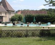
La Ferme de Laupilière
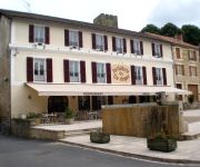
Hostellerie du Fin Chapon Logis
Videos from this area
These are videos related to the place based on their proximity to this place.
Trail riding in the Dordogne, France 8-11 June 2011
3 days riding with http://www.dordognemotorcycleholidays.com/ in the Dordogne, France.
01 EQUESTRE 87500 SAINT-YRIEIX Patrick Marquebielle
Au Centre équestre de saint-Yrieix La Perche (87500) Il y a régulièrement d'importantes manifestations hippique.
03 FRELONS D'ASIE NID 2009
Construction d'un nid par des frelons d'Asie. Nouvelle version 2009. Les frelons construisent leur nid avec leurs mandibules. Il y aura certainement, comme l'année dernière, beaucoup de...
05 EQUESTRE Patrick Marquebielle
A 87500 SAINT-YRIEIX La PERCHE, UN MAGNIFIQUE CENTRE EQUESTRE , ou se déroulent de nombreuses et importantes manifestation hippique.
08 CENTRE EQUESTRE le BARRAGE (diapo)
Compétitions équestre à 87500 Saint-Yrieix la perche. Concours de sauts. LE BARRAGE.
02 Patrick Marquebielle
Au Centre équestre de saint-Yrieix La Perche (87500) Il y a régulièrement d'importantes manifestations hippique.
03 RALLYE 2009 L'épingle
RALLYE coefficient 5 RALLYE de Saint-Yrieix-La-Perche. 87500 FRANCE Vidéo sur un passage en épingle.
04 EQUESTRE Patrick Marquebielle
A 87500 SAINT-YRIEIX La PERCHE, UN MAGNIFIQUE CENTRE EQUESTRE , ou se déroulent de nombreuses et importantes manifestation hippique.
04 RALLYE 2009 Départ
RALLYE AUTO de Saint-Yrieix-La-Perche. 87500 FRANCE Vidéo sur le départ d'un Rallye Auto.
Videos provided by Youtube are under the copyright of their owners.
Attractions and noteworthy things
Distances are based on the centre of the city/town and sightseeing location. This list contains brief abstracts about monuments, holiday activities, national parcs, museums, organisations and more from the area as well as interesting facts about the region itself. Where available, you'll find the corresponding homepage. Otherwise the related wikipedia article.
Canton of Lanouaille
The Canton of Lanouaille is a canton of the Dordogne département, in France. The lowest point of the canton is in Nanthiat at 135 m, the highest point is in Saint-Cyr-les-Champagnes at 435 m, the average elevation is 375 m. The least populated commune is Nanthiat with 291 inhabitants and the most populated commune is Payzac with 1,041. The second most populated commune is the canton seat Lanouaille.


