Safety Score: 3,0 of 5.0 based on data from 9 authorites. Meaning we advice caution when travelling to France.
Travel warnings are updated daily. Source: Travel Warning France. Last Update: 2024-08-13 08:21:03
Delve into Vitreville
Vitreville in Seine-Maritime (Normandy) is a city located in France about 111 mi (or 179 km) north-west of Paris, the country's capital town.
Current time in Vitreville is now 07:19 PM (Friday). The local timezone is named Europe / Paris with an UTC offset of one hour. We know of 13 airports closer to Vitreville, of which 5 are larger airports. The closest airport in France is Le Havre Octeville Airport in a distance of 9 mi (or 14 km), South-West. Besides the airports, there are other travel options available (check left side).
There are several Unesco world heritage sites nearby. The closest heritage site in France is Le Havre, the City Rebuilt by Auguste Perret in a distance of 11 mi (or 18 km), South. In need of a room? We compiled a list of available hotels close to the map centre further down the page.
Since you are here already, you might want to pay a visit to some of the following locations: Le Havre, Bertheauville, Lisieux, Bernay and Notre-Dame-de-Fresnay. To further explore this place, just scroll down and browse the available info.
Local weather forecast
Todays Local Weather Conditions & Forecast: 10°C / 50 °F
| Morning Temperature | 7°C / 44 °F |
| Evening Temperature | 10°C / 50 °F |
| Night Temperature | 7°C / 45 °F |
| Chance of rainfall | 0% |
| Air Humidity | 70% |
| Air Pressure | 1028 hPa |
| Wind Speed | Gentle Breeze with 7 km/h (4 mph) from West |
| Cloud Conditions | Scattered clouds, covering 40% of sky |
| General Conditions | Scattered clouds |
Saturday, 16th of November 2024
8°C (47 °F)
11°C (52 °F)
Sky is clear, gentle breeze, clear sky.
Sunday, 17th of November 2024
11°C (52 °F)
10°C (50 °F)
Moderate rain, moderate breeze, overcast clouds.
Monday, 18th of November 2024
11°C (51 °F)
11°C (52 °F)
Moderate rain, strong breeze, overcast clouds.
Hotels and Places to Stay
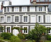
Jardin Gorbeau Etretat Guesthouse
Hotel Le Rayon Vert
Hôtel Ambassadeur
Domaine St Clair - Le Donjon
Hôtel des Falaises
Videos from this area
These are videos related to the place based on their proximity to this place.
Les falaises d'Etretat en Normandie HD 1080p
Les falaises d'Etretat en Normandie (promenade à Etretat) - Etretat novembre 2012 - Film en HD 1080p. Découvrez le vidéo des magnifiques falaises d'Etretat en Normandie. Natural cliffs...
02 Francie 2013 - Étretat, Honfleur a Beuvron en Auge
Étretat je francouzské městečko, ležící na pobřeží Lamanšského průlivu severně od Le Havru. Po stranách oblázkové "chrastící" pláže nádherné bílé útesy s přirozeně...
VTT Etretat janvier 2014
sortie Bolbec VTT Aventure au Tilleul. 35 km dans le froid et le vent, physiques mais sympas!
Géologie du Massif d'Aval à Etretat
Stratigraphie événementielle sur un site touristique célèbre. Vidéo commentée. Pour plus de précision sur les niveaux, consulter le site : craies.crihan.fr. Event stratigraphy on the...
Maison F4 à louer, Turretot , 940€/mois
http://www.fnaim.fr/annonces-immobilier/fiche-20468-7617.html CENTRE BOURG - Pavillon neuf, séjour ouvert sur cuisine USA 40m². 3 belles chambres, lingerie. Garage + parkings. Jardin 320m²...
cliff collapse in Saint-Jouin-Bruneval, France
a cliff naturally collapsed this monday, it's more than 30.000 tons of rocks that felt onto the beach. Hopefully people on the beach were evacuated before.
destruction bloc beton antidebarquement Saint jouin bruneval
destruction de blocs betons antidebarquement contenant tellermine et obus a saint jouin bruneval en mars 2007 (3 reportages de france3)
Videos provided by Youtube are under the copyright of their owners.
Attractions and noteworthy things
Distances are based on the centre of the city/town and sightseeing location. This list contains brief abstracts about monuments, holiday activities, national parcs, museums, organisations and more from the area as well as interesting facts about the region itself. Where available, you'll find the corresponding homepage. Otherwise the related wikipedia article.
Operation Biting
Operation Biting, also known as the Bruneval Raid, was the codename given to a British Combined Operations raid on a German radar installation in Bruneval, northern France, that occurred between 27–28 February 1942 during World War II. A number of these installations had been identified from Royal Air Force aerial reconnaissance during 1941, but their exact purpose and the nature of the equipment that they possessed was not known.


