Safety Score: 3,0 of 5.0 based on data from 9 authorites. Meaning we advice caution when travelling to France.
Travel warnings are updated daily. Source: Travel Warning France. Last Update: 2024-08-13 08:21:03
Discover Le Val
Le Val in Seine-Maritime (Normandy) is a town in France about 105 mi (or 169 km) north-west of Paris, the country's capital city.
Current time in Le Val is now 06:48 AM (Friday). The local timezone is named Europe / Paris with an UTC offset of one hour. We know of 13 airports near Le Val, of which 5 are larger airports. The closest airport in France is St Aubin Airport in a distance of 24 mi (or 38 km), East. Besides the airports, there are other travel options available (check left side).
There are several Unesco world heritage sites nearby. The closest heritage site in France is Le Havre, the City Rebuilt by Auguste Perret in a distance of 31 mi (or 50 km), South-West. Looking for a place to stay? we compiled a list of available hotels close to the map centre further down the page.
When in this area, you might want to pay a visit to some of the following locations: Bertheauville, Dieppe, Le Havre, Rouen and Bernay. To further explore this place, just scroll down and browse the available info.
Local weather forecast
Todays Local Weather Conditions & Forecast: 10°C / 51 °F
| Morning Temperature | 7°C / 44 °F |
| Evening Temperature | 8°C / 47 °F |
| Night Temperature | 6°C / 44 °F |
| Chance of rainfall | 0% |
| Air Humidity | 74% |
| Air Pressure | 1028 hPa |
| Wind Speed | Gentle Breeze with 6 km/h (4 mph) from West |
| Cloud Conditions | Overcast clouds, covering 92% of sky |
| General Conditions | Overcast clouds |
Saturday, 16th of November 2024
9°C (49 °F)
11°C (51 °F)
Broken clouds, moderate breeze.
Sunday, 17th of November 2024
11°C (52 °F)
9°C (48 °F)
Heavy intensity rain, strong breeze, overcast clouds.
Monday, 18th of November 2024
8°C (47 °F)
7°C (44 °F)
Light rain, fresh breeze, broken clouds.
Hotels and Places to Stay
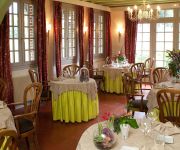
Le Relais des Dalles
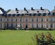
Chateau de Sissi Chateaux & Hotels Collection
Les Rives du Lac
Videos from this area
These are videos related to the place based on their proximity to this place.
tuto minecraft pour faire un phare sans fil de redstone
Salut à tous c'est mat7620 c'est ma premiere vidéo désolé de na pas pouvoir faire de vrai vidéo grace à Fraps mais mon ordi n'est pas assez puissant. :)
union musicale cany barville
defilé du mois de juillet et mois d'août 2014 de l'harmonie fanfare avec leurs nouvelles tenues vous pourrez bientôt nous retrouver sur un nouveau site internet.
VENTE LONGERE NORMANDE CANY BARVILLE PROCHE DE LA MER
TRES BELLE LONGERE NORMANDE CANY BARVILLE PROCHE DE LA MER : http://www.cotelittoral.fr/vente-longere-normande-cany-barville-proche-de-la-mer-62750.html - Localisation : CANY ...
2015-03-21 Les Randonneurs Verts Cauchois : Randonnée du Printemps 2015
21/03/2015 Les Randonneurs Verts Cauchois : Quad, Randonnée du Printemps 2015 Sortie Quad entre Cany Barville et Veulettes Sur Mer - Seine-Maritime - Normandie. Chemins roulants, avec ...
2014-05-08 Les Randonneurs Verts Cauchois : Randonné de la Victoire - Quad -
08/05/2014 Les Randonneurs Verts Cauchois : Quad, Randonnée de la Victoire 2014 Sortie Quad dans les environs de Cany Barville - Seine-Maritime - Normandie. Chemins roulants, humides, avec...
AR-Drone 1st Flight
1st flight with the Parrot AR.Drone captured by my security camera and the onboard recorder of the drone. You can see part of the onboard recorder in a PIP. You'll also see the crash towards the end.
Videos provided by Youtube are under the copyright of their owners.
Attractions and noteworthy things
Distances are based on the centre of the city/town and sightseeing location. This list contains brief abstracts about monuments, holiday activities, national parcs, museums, organisations and more from the area as well as interesting facts about the region itself. Where available, you'll find the corresponding homepage. Otherwise the related wikipedia article.
Durdent (river)
The river Durdent is one of the many small coastal rivers that flow from the plateau of the Pays de Caux into the English Channel.


