Safety Score: 3,0 of 5.0 based on data from 9 authorites. Meaning we advice caution when travelling to France.
Travel warnings are updated daily. Source: Travel Warning France. Last Update: 2024-08-13 08:21:03
Discover Le Maupas
Le Maupas in Seine-Maritime (Normandy) is a place in France about 80 mi (or 129 km) north-west of Paris, the country's capital city.
Current time in Le Maupas is now 06:53 AM (Friday). The local timezone is named Europe / Paris with an UTC offset of one hour. We know of 13 airports near Le Maupas, of which 5 are larger airports. The closest airport in France is Rouen Airport in a distance of 16 mi (or 25 km), South-East. Besides the airports, there are other travel options available (check left side).
There are several Unesco world heritage sites nearby. The closest heritage site in France is Le Havre, the City Rebuilt by Auguste Perret in a distance of 34 mi (or 55 km), West. If you need a hotel, we compiled a list of available hotels close to the map centre further down the page.
While being here, you might want to pay a visit to some of the following locations: Rouen, Bertheauville, Bernay, Dieppe and Evreux. To further explore this place, just scroll down and browse the available info.
Local weather forecast
Todays Local Weather Conditions & Forecast: 10°C / 49 °F
| Morning Temperature | 5°C / 41 °F |
| Evening Temperature | 7°C / 44 °F |
| Night Temperature | 5°C / 41 °F |
| Chance of rainfall | 0% |
| Air Humidity | 73% |
| Air Pressure | 1028 hPa |
| Wind Speed | Light breeze with 4 km/h (3 mph) from South-West |
| Cloud Conditions | Broken clouds, covering 62% of sky |
| General Conditions | Broken clouds |
Saturday, 16th of November 2024
8°C (47 °F)
8°C (46 °F)
Scattered clouds, light breeze.
Sunday, 17th of November 2024
10°C (51 °F)
8°C (47 °F)
Moderate rain, moderate breeze, overcast clouds.
Monday, 18th of November 2024
9°C (48 °F)
11°C (52 °F)
Light rain, fresh breeze, overcast clouds.
Hotels and Places to Stay
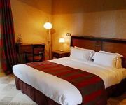
Le Clos des Fontaines
Videos from this area
These are videos related to the place based on their proximity to this place.
épisode-#02- pokémon version blanche Ponchiot mon ami !
Salut a tous et on se retrouve pour la suite du let's play de pokemon version blanche.
démonstration de Taekwondo - club de Villers Ecalles 22 03 2014
petite démonstration de Taekwondo au Club de Villers Ecalles .
Jumièges 3D
L'abbaye de Jumièges est un remarquable témoignage de l'architecture religieuse médiévale normande. Un témoin exceptionnel des premières grandes réalisations de l'art roman en Normandie...
Visite virtuelle abbaye de Jumièges
Une visite 360° réalisée par François Gobert, photographe panoramiste 360° de l'agence Média Sphérique à ROUEN. 06.61.63.06.23 www.media-spherique.com mediaspherique@gmail.com.
L'ABBAZIA DI JUMIEGE.mpg
L'Abbazia di Jumièges (Senna Marittima) deve la sua origine ad una chiesa fondata da San Colombano e poi ingrandita in abbazia sempre di Regola colombaniana fondata da san Filiberto, figlio...
Tendance floue : Nous n'irons plus aux paradis
Le collectif tendance floue composé de 13 photographes a capturé, de 1990 à 2005, des événements marquants de notre époque. Toutes ces images qui nous questionnent sur le monde sont ...
Paquebot sur la Seine
Le AZAMARA JOURNEY en descente de la Seine au niveau de yainville le 27 mai 2012.
Macro-déchets : Les rivages de la Seine Normande 70km avant la Mer, en aval de ROUEN...
En Europe comme ailleurs, les macro-déchets polluent les milieux aquatiques. Partout dans le Monde, la pollution de l'eau par nos déchets est visible. In Europe as somewhere else, the...
Videos provided by Youtube are under the copyright of their owners.
Attractions and noteworthy things
Distances are based on the centre of the city/town and sightseeing location. This list contains brief abstracts about monuments, holiday activities, national parcs, museums, organisations and more from the area as well as interesting facts about the region itself. Where available, you'll find the corresponding homepage. Otherwise the related wikipedia article.
Austreberthe
The Austreberthe is a 18-km river in the Seine-Maritime. Its source is the village of Sainte-Austreberthe. It meets the Seine at Duclair. The Austreberthe is crossed by the Barentin Viaduct, a noteworthy 30 metre high brick railway bridge built in 1846, about 19-km from Rouen.


