Safety Score: 3,0 of 5.0 based on data from 9 authorites. Meaning we advice caution when travelling to France.
Travel warnings are updated daily. Source: Travel Warning France. Last Update: 2024-08-13 08:21:03
Delve into Saint-Philbert-sur-Orne
Saint-Philbert-sur-Orne in Orne (Normandy) with it's 128 habitants is a city located in France about 124 mi (or 200 km) west of Paris, the country's capital town.
Current time in Saint-Philbert-sur-Orne is now 08:13 PM (Friday). The local timezone is named Europe / Paris with an UTC offset of one hour. We know of 13 airports closer to Saint-Philbert-sur-Orne, of which 5 are larger airports. The closest airport in France is Caen-Carpiquet Airport in a distance of 23 mi (or 37 km), North. Besides the airports, there are other travel options available (check left side).
There are several Unesco world heritage sites nearby. The closest heritage site in France is Mont-Saint-Michel and its Bay in a distance of 15 mi (or 24 km), South. In need of a room? We compiled a list of available hotels close to the map centre further down the page.
Since you are here already, you might want to pay a visit to some of the following locations: Caen, Argentan, Notre-Dame-de-Fresnay, Vire and Bayeux. To further explore this place, just scroll down and browse the available info.
Local weather forecast
Todays Local Weather Conditions & Forecast: 9°C / 48 °F
| Morning Temperature | 8°C / 47 °F |
| Evening Temperature | 8°C / 46 °F |
| Night Temperature | 4°C / 39 °F |
| Chance of rainfall | 0% |
| Air Humidity | 79% |
| Air Pressure | 1027 hPa |
| Wind Speed | Light breeze with 3 km/h (2 mph) from South-West |
| Cloud Conditions | Broken clouds, covering 82% of sky |
| General Conditions | Broken clouds |
Saturday, 16th of November 2024
9°C (48 °F)
4°C (40 °F)
Broken clouds, light breeze.
Sunday, 17th of November 2024
10°C (51 °F)
6°C (43 °F)
Light rain, gentle breeze, overcast clouds.
Monday, 18th of November 2024
9°C (49 °F)
10°C (50 °F)
Light rain, moderate breeze, overcast clouds.
Hotels and Places to Stay
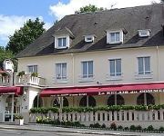
Du Commerce Logis
Videos from this area
These are videos related to the place based on their proximity to this place.
Vue depuis les Crêtes à St Omer (14)
Vue sur le Mont Pinçon au Plessis Grimoult et Clecy depuis le haut des Crêtes à St-Omer.
Suisse Normande Le Raid Sportif 2013
Vidéo du Raid "Sportif" du Raid Suisse Normande du 5 Mai 2013. Equipe "CCPB Raid Team", notre 1er Raid qui se finit plutôt pas mal au classement... www.trailrunner.fr.
BattlePaint Clécy - Enterrement vie garçon
Enterrement vie de garçon - 28/06/14 BattlePaint - Paintball à Clécy, Calvados http://www.battlepaint.fr Réalisation/Filming/Editing : Jonathan Morel http://www.inat-events.com https://www.fac...
location canoe kayak pont d'ouilly, clecy, thury harcourt en suisse normande.wmv
infos pratiques location canoe kayak pour des descentes de rivière entre pont d'ouilly et thury harcourt au coeur de la suisse normande. Description des activités nautiques, canoe kayak,...
Parapente - Vol en stage Initiation - Clecy - Saint Omer - Plaine Altitude
Montage vidéo de mon cinquieme vol réalisé pendant mon stage initiation en parapente à Clécy - Saint-Omer en Basse Normandie avec l'école plaine-altitude. Site internet: http://www.faridbouze...
motocross clecy 2011
site du caméraman (assembleur pc) : http://dannydu13.wix.com/site-infodu14 motocross de clecy (14) . résumé de la plupart des meilleur sauts et tours filmé en HD 720p en attente de commentair...
Videos provided by Youtube are under the copyright of their owners.
Attractions and noteworthy things
Distances are based on the centre of the city/town and sightseeing location. This list contains brief abstracts about monuments, holiday activities, national parcs, museums, organisations and more from the area as well as interesting facts about the region itself. Where available, you'll find the corresponding homepage. Otherwise the related wikipedia article.
Rouvre
The Rouvre is a river in Lower Normandy, in the Orne département, a tributary of the Orne. The river's source is in the commune of Beauvain, a few kilometres to the east of La Ferté-Macé. After crossing the Pays d'Houlme, it turns in a north-westerly direction to re-enter the Swiss Normandy, and then in its last 15 kilometres passes around Bréel. The Rouvre then flows into the Orne between the dam at Saint-Philbert-sur-Orne and Pont-d'Ouilly, and joins the Orne at Rouvrou (elevation 63 metres).


