Safety Score: 3,0 of 5.0 based on data from 9 authorites. Meaning we advice caution when travelling to France.
Travel warnings are updated daily. Source: Travel Warning France. Last Update: 2024-08-13 08:21:03
Delve into Tierceville
Tierceville in Calvados (Normandy) with it's 146 habitants is a town located in France about 134 mi (or 215 km) west of Paris, the country's capital town.
Time in Tierceville is now 02:27 AM (Saturday). The local timezone is named Europe / Paris with an UTC offset of one hour. We know of 13 airports closer to Tierceville, of which 5 are larger airports. The closest airport in France is Caen-Carpiquet Airport in a distance of 9 mi (or 15 km), South-East. Besides the airports, there are other travel options available (check left side).
There are several Unesco world heritage sites nearby. The closest heritage site in France is Le Havre, the City Rebuilt by Auguste Perret in a distance of 32 mi (or 51 km), North-East. In need of a room? We compiled a list of available hotels close to the map centre further down the page.
Since you are here already, you might want to pay a visit to some of the following locations: Bayeux, Caen, Vire, Saint-Lo and Notre-Dame-de-Fresnay. To further explore this place, just scroll down and browse the available info.
Local weather forecast
Todays Local Weather Conditions & Forecast: 9°C / 49 °F
| Morning Temperature | 3°C / 37 °F |
| Evening Temperature | 8°C / 46 °F |
| Night Temperature | 8°C / 46 °F |
| Chance of rainfall | 0% |
| Air Humidity | 69% |
| Air Pressure | 1022 hPa |
| Wind Speed | Light breeze with 5 km/h (3 mph) from North-East |
| Cloud Conditions | Few clouds, covering 19% of sky |
| General Conditions | Few clouds |
Sunday, 17th of November 2024
11°C (52 °F)
8°C (46 °F)
Light rain, moderate breeze, overcast clouds.
Monday, 18th of November 2024
10°C (51 °F)
11°C (51 °F)
Light rain, fresh breeze, overcast clouds.
Tuesday, 19th of November 2024
8°C (46 °F)
4°C (40 °F)
Light rain, fresh breeze, overcast clouds.
Hotels and Places to Stay
Gold Beach Hôtel
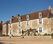
Ferme de la Rançonnière ou Manoir de Mathan
Hostellerie St-Martin Logis
La Pecherie Logis
Hôtel de Paris
Videos from this area
These are videos related to the place based on their proximity to this place.
Vols à Vers sur mer pour changer
Vols en pleine nature au dessus des plages mythiques du Débarquement en Normandie.entre Vers sur mer et Asnelles En fond, les vestiges des pontos du port artificiel d'Arromanche. dommage...
Meeting Creully 2014 - Les avions du 6 juin 44
Creully, le 6 juin 2014, the D-Day... Le jour le plus long... Les 07 et 08 juin 2014, "Le Stade d'Aéromodélisme Régional de Creully" célébrait sur sa plateforme la 8ème édition du meeting...
Meeting Creully 2014 - Les planeurs du 6 juin 2014
Creully, le 6 juin 2014, the D-Day... Le jour le plus long... Les 07 et 08 juin 2014, "Le Stade d'Aéromodélisme Régional de Creully" célébrait sur sa plateforme la 8ème édition du meeting...
Meeting Creully 2014 - Les avions du 6 juin 2014
Creully, le 6 juin 2014, the D-Day... Le jour le plus long... Les 07 et 08 juin 2014, "Le Stade d'Aéromodélisme Régional de Creully" célébrait sur sa plateforme la 8ème édition du meeting...
Creully vol du matin en Monsun 40% + Valach VM120B2-4T...
Comment commencer mieux la journée qu'avec un petit vol du matin, au soleil levant... Et sur un beau terrain, c'est encore mieux... Réveil en douceur au son du Valach 120... Et si le Valach...
creully premier vol ka6cr de Sylvain
Les estivalles de Creully 2013: Premier vol du Ka6cr échelle 1/2 (kit Bill Hempel) du copain Sylvain. Un vrai vélo, mais en grand... Bravo !
Country au Forum des Associations de Creully - 7 Septembre 2013 (La Pose pour la Presse)
Démonstration de danse country au forum des associations de Creully. L'équipe pose pour les photographes de la presse locale.
Le Groupe de Country CatDance au Téléthon de Creully - 9 Décembre 2012
Participation dans le froid au Téléthon 2012 organisé à Creully (Bessin) du groupe de danse Country de Patricia. Début de cette prestation du 9 décembre 2012 par La Bomba.
Country au Forum des Associations de Creully - 7 Septembre 2013 (La Présentation par Sylvie)
Sylvie présente les démonstrations de country à venir du club Pat Dance. Cela s'est déroulé lors du forum des associations de septembre à Creully.
Videos provided by Youtube are under the copyright of their owners.
Attractions and noteworthy things
Distances are based on the centre of the city/town and sightseeing location. This list contains brief abstracts about monuments, holiday activities, national parcs, museums, organisations and more from the area as well as interesting facts about the region itself. Where available, you'll find the corresponding homepage. Otherwise the related wikipedia article.
Invasion of Normandy
The Invasion of Normandy was the invasion and establishment of Allied forces in Normandy, France, during Operation Overlord in 1944 during World War II. It was the largest amphibious operation ever to take place. Allied land forces that saw combat in Normandy on 6 June came from Canada, the Free French Forces, the United Kingdom, and the United States.
Normandy landings
The Normandy landings, codenamed Operation Neptune, were the landing operations of the Allied invasion of Normandy, in Operation Overlord, during World War II. The landings commenced on Tuesday, 6 June 1944 (D-Day), beginning at 6:30 am British Double Summer Time (GMT+2). In planning, as for most Allied operations, the term D-Day was used for the day of the actual landing, which was dependent on final approval.
Ferme de la Rançonnière
The Ferme de la Rançonniere is a farm located in the Calvados region, Normandy, France. The first buildings were constructed in the 13th century, when the residence was called La Ferme de Biéville. At that time, Normandy was suffering from the tensions between the English crown and the kingdom of France, which eventually evolved into the Hundred Years War.
Manoir de Mathan
The Manoir de Mathan is a manor house located in the town of Crépon in the Calvados region of France. The original structure was built in 1605, when it included a coach entry, which has since been removed. At that time, the manor belonged to the Hue de Mathan family after whom it was named. As well as the main house, there was a cellar, kitchen garden, and a bread oven in a separate outbuilding. A pond fed by a stream that flowed through the grounds completed the ensemble.
Bazenville Airfield
Bazenville Airfield is a former World War II airfield, located 1.8 km east of Bazenville in the Basse-Normandie region, France. The airfield was located only 5 kilometers southwest from the Normandy Gold landing beach, and when it opened the frontline was only 9 kilometers away.
Sainte-Croix-sur-Mer Airfield
Sainte-Croix-sur-Mer Airfield is a former World War II airfield, located 1 km northwest of Sainte-Croix-sur-Mer in the Basse-Normandie region, France. The airfield was located only 3.5 kilometers from the Normandy Gold landing beach,, and when it opened the frontline was not much further away. Over the first month of its existence the frontline only moved to 19 kilometers (11 miles) away.


