Safety Score: 3,0 of 5.0 based on data from 9 authorites. Meaning we advice caution when travelling to France.
Travel warnings are updated daily. Source: Travel Warning France. Last Update: 2024-08-13 08:21:03
Discover Longvillers
Longvillers in Calvados (Normandy) with it's 341 citizens is a town in France about 136 mi (or 219 km) west of Paris, the country's capital city.
Current time in Longvillers is now 09:29 PM (Friday). The local timezone is named Europe / Paris with an UTC offset of one hour. We know of 13 airports near Longvillers, of which 5 are larger airports. The closest airport in France is Caen-Carpiquet Airport in a distance of 12 mi (or 19 km), North-East. Besides the airports, there are other travel options available (check left side).
There are several Unesco world heritage sites nearby. The closest heritage site in France is Mont-Saint-Michel and its Bay in a distance of 29 mi (or 47 km), South. Looking for a place to stay? we compiled a list of available hotels close to the map centre further down the page.
When in this area, you might want to pay a visit to some of the following locations: Bayeux, Caen, Vire, Saint-Lo and Notre-Dame-de-Fresnay. To further explore this place, just scroll down and browse the available info.
Local weather forecast
Todays Local Weather Conditions & Forecast: 10°C / 50 °F
| Morning Temperature | 5°C / 42 °F |
| Evening Temperature | 8°C / 46 °F |
| Night Temperature | 4°C / 40 °F |
| Chance of rainfall | 0% |
| Air Humidity | 73% |
| Air Pressure | 1027 hPa |
| Wind Speed | Light breeze with 4 km/h (3 mph) from West |
| Cloud Conditions | Broken clouds, covering 65% of sky |
| General Conditions | Broken clouds |
Saturday, 16th of November 2024
9°C (49 °F)
8°C (46 °F)
Few clouds, light breeze.
Sunday, 17th of November 2024
11°C (52 °F)
8°C (46 °F)
Light rain, moderate breeze, overcast clouds.
Monday, 18th of November 2024
10°C (51 °F)
11°C (51 °F)
Light rain, fresh breeze, overcast clouds.
Hotels and Places to Stay
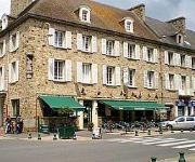
De la Place Logis
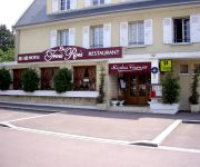
Les Trois Rois Logis
Videos from this area
These are videos related to the place based on their proximity to this place.
The Battle at Villers Bocage .wmv
The battle of 13th. june 1944 was the template for this Sce. A modern warfare artwork :with the new Steelbeasts update 2.538 Tiger 1 = Leopard 2A5 Cromwell´s = Leopard 1A5 APC = M113...
Villers-Bocage: The Drive to Tilly Junction
Villers-Bocage: tracking the drive from Michael Wittmann's starting point to the Tilly Junction on the morning of 13th June 1944.
Villers-Bocage Maison Jardin Garage Terrain verger, cour Ca
France Achat / Vente Maison Villers-Bocage Cave Jardin Garage Terrain verger, cour Maison Chambres 3 - proche saint martin des besaces - DPE 357 - Emissions de GES 28 150 000,00 € Maison...
Festival Les Veillées d'été
Festival de rue en Normandie. 7 soirées pique-nique spectacles au coeur du Bocage Normand! - http://veilleesdete.canalblog.com.
Nos Retrouvailles du 25 octobre 2014 a Tilly sur Seulles
Hesite pas a rejoindre le groupe si un jour tu es passè par Tilly sur seulles te rappelles tu quand tu habitais tilly sur seulles.
Championnat de France Junior de Motocross, Tilly sur Seulles
Bagarre pour les points pour Morgan Fiquenel 533.
La Rando du Téléthon par Les Accro' Bike
Randonnée VTT organisée par Les Joyeux Cyclo d'Audrieu pour le téléthon 2014 à Tilly sur Seulles.
Terrain à vendre, Lingevres (14)
http://www.visiteonline.fr/annonce-immobiliere/Vente-Terrain-LINGEVRES,2000002974530.htm?r=smartvisite PROCHE TILLY SUR SEULLES, belle parcelle de terrain à bâtir d'une superficie d'environ ...
Videos provided by Youtube are under the copyright of their owners.
Attractions and noteworthy things
Distances are based on the centre of the city/town and sightseeing location. This list contains brief abstracts about monuments, holiday activities, national parcs, museums, organisations and more from the area as well as interesting facts about the region itself. Where available, you'll find the corresponding homepage. Otherwise the related wikipedia article.
Battle of Villers-Bocage
The Battle of Villers-Bocage took place during the Second World War on 13 June 1944, one week after the Allies landed in Normandy to begin the liberation of German-occupied France. The battle was the result of a British attempt to improve their position by exploiting a temporary vulnerability in the German defences to the west of the city of Caen.
Operation Perch
Operation Perch was a British offensive of the Second World War which took place between 7 and 14 June 1944, during the Battle of Normandy. The operation was intended to encircle and seize the German occupied city of Caen, which was a major Allied objective in the early stages of the invasion of northwest Europe. A combination of fierce German resistance and failures at the British command level foiled the operation before its objectives were achieved.


