Safety Score: 3,0 of 5.0 based on data from 9 authorites. Meaning we advice caution when travelling to France.
Travel warnings are updated daily. Source: Travel Warning France. Last Update: 2024-08-13 08:21:03
Delve into Formigny
Formigny in Calvados (Normandy) with it's 254 habitants is located in France about 151 mi (or 242 km) west of Paris, the country's capital town.
Current time in Formigny is now 08:42 PM (Friday). The local timezone is named Europe / Paris with an UTC offset of one hour. We know of 13 airports close to Formigny, of which 5 are larger airports. The closest airport in France is Caen-Carpiquet Airport in a distance of 23 mi (or 37 km), South-East. Besides the airports, there are other travel options available (check left side).
There are several Unesco world heritage sites nearby. The closest heritage site in France is Le Havre, the City Rebuilt by Auguste Perret in a distance of 46 mi (or 75 km), East. If you need a hotel, we compiled a list of available hotels close to the map centre further down the page.
While being here, you might want to pay a visit to some of the following locations: Bayeux, Saint-Lo, Vire, Caen and Coutances. To further explore this place, just scroll down and browse the available info.
Local weather forecast
Todays Local Weather Conditions & Forecast: 10°C / 50 °F
| Morning Temperature | 7°C / 44 °F |
| Evening Temperature | 7°C / 45 °F |
| Night Temperature | 5°C / 42 °F |
| Chance of rainfall | 0% |
| Air Humidity | 74% |
| Air Pressure | 1028 hPa |
| Wind Speed | Light breeze with 5 km/h (3 mph) from West |
| Cloud Conditions | Few clouds, covering 22% of sky |
| General Conditions | Few clouds |
Saturday, 16th of November 2024
9°C (48 °F)
9°C (48 °F)
Scattered clouds, gentle breeze.
Sunday, 17th of November 2024
11°C (52 °F)
9°C (48 °F)
Light rain, moderate breeze, overcast clouds.
Monday, 18th of November 2024
9°C (47 °F)
11°C (52 °F)
Light rain, fresh breeze, overcast clouds.
Hotels and Places to Stay
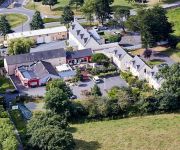
Domaine de l'Hostréière
Domaine de l'Hostréière
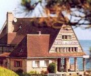
Du Casino Logis
Club Belambra Omaha Beach Résidence de Tourisme
Videos from this area
These are videos related to the place based on their proximity to this place.
Vierville-sur-Mer, Omaha Beach
The American landing at Omaha Beach on 6th June 1944 was the bloodiest of the daay. This video shows views around the Vierville-sur-Mer draw (exit) called D-1, views from a pillbox overlooking...
Omaha Beach Memorial / Gedenkstätte Normandie
Gedenkstätte für die gefallenen Soldaten bei der Landung in Europa am D-Day; aufgenommen Mai 2011 in Vierville-sur-Mer, Frankreich.
Omaha Beach, US Memorial, Arromanches, France Dancejill's photos around Saint-Laurent-sur-Mer
Preview of Dancejill's blog at TravelPod. Read the full blog here: http://www.travelpod.com/travel-blog-entries/dancejill/1/1246647157/tpod.html This blog preview was made by TravelPod using...
Maison F6 à vendre, St Laurent Sur Mer (14), 223500€
http://www.visiteonline.fr/annonce-immobiliere/Vente-Maison-ST-LAURENT-SUR-MER,2000007508647.htm?r=smartvisite BOURG COTIER, maison de 6 pièces principales d...
Francia 2014 - Omaha e i luoghi del D Day
Il 6 giugno 1944 ebbe inizio l'operazione Overlord, il più grande sbarco della storia militare, attuato dagli anglo-americani sulle coste della Normandia, nella Francia settentrionale. Vi...
Views on Omaha Beach, Normandy
This is a small sample of the video clip files showing views of the Omaha Beach sector of Normandy in France taken from the Video History Today database. Please take a look at Video History...
Videos provided by Youtube are under the copyright of their owners.
Attractions and noteworthy things
Distances are based on the centre of the city/town and sightseeing location. This list contains brief abstracts about monuments, holiday activities, national parcs, museums, organisations and more from the area as well as interesting facts about the region itself. Where available, you'll find the corresponding homepage. Otherwise the related wikipedia article.
Omaha Beach
Omaha Beach is the code name for one of the five sectors of the Allied invasion of German-occupied France in the Normandy landings on 6 June 1944, during World War II. The beach is located on the coast of Normandy, France, facing the English Channel, and is 5 miles (8 km) long, from east of Sainte-Honorine-des-Pertes to west of Vierville-sur-Mer on the right bank of the Douve River estuary.
Normandy American Cemetery and Memorial
The Normandy American Cemetery and Memorial is a World War II cemetery and memorial in Colleville-sur-Mer, Normandy, France, that honors American soldiers who died in Europe during World War II.
Battle of Formigny
The Battle of Formigny (15 April 1450) was a battle of the Hundred Years' War fought between England and France. It was a decisive victory for the French.
SS Pennsylvanian
SS Pennsylvanian was a cargo ship built in 1913 for the American-Hawaiian Steamship Company. During World War I she was requisitioned by the United States Navy and commissioned as USS Pennsylvanian (ID-3511) in September 1918, but renamed two months later to USS Scranton. After her Navy service, her original name of Pennsylvanian was restored.
A-21 Saint-Laurent-sur-Mer
Saint-Laurent-sur-Mer is an abandoned World War II military airfield, which is located near the commune of Saint-Laurent-sur-Mer in the Basse-Normandie region of northern France.


