Safety Score: 3,0 of 5.0 based on data from 9 authorites. Meaning we advice caution when travelling to France.
Travel warnings are updated daily. Source: Travel Warning France. Last Update: 2024-08-13 08:21:03
Delve into Arrancy
Arrancy in Aisne (Hauts-de-France) with it's 50 habitants is a city located in France about 77 mi (or 124 km) north-east of Paris, the country's capital town.
Current time in Arrancy is now 11:24 PM (Friday). The local timezone is named Europe / Paris with an UTC offset of one hour. We know of 13 airports closer to Arrancy, of which 5 are larger airports. The closest airport in France is Laon - Chambry Airport in a distance of 9 mi (or 15 km), North-West. Besides the airports, there are other travel options available (check left side).
There are several Unesco world heritage sites nearby. The closest heritage site in France is Cathedral of Notre-Dame, Former Abbey of Saint-Rémi and Palace of Tau, Reims in a distance of 21 mi (or 33 km), South-East. In need of a room? We compiled a list of available hotels close to the map centre further down the page.
Since you are here already, you might want to pay a visit to some of the following locations: Laon, Reims, Vervins, Soissons and Epernay. To further explore this place, just scroll down and browse the available info.
Local weather forecast
Todays Local Weather Conditions & Forecast: 11°C / 51 °F
| Morning Temperature | 5°C / 42 °F |
| Evening Temperature | 7°C / 44 °F |
| Night Temperature | 5°C / 41 °F |
| Chance of rainfall | 0% |
| Air Humidity | 63% |
| Air Pressure | 1027 hPa |
| Wind Speed | Light breeze with 4 km/h (2 mph) from South-West |
| Cloud Conditions | Scattered clouds, covering 46% of sky |
| General Conditions | Scattered clouds |
Saturday, 16th of November 2024
8°C (47 °F)
4°C (39 °F)
Overcast clouds, light breeze.
Sunday, 17th of November 2024
10°C (49 °F)
4°C (38 °F)
Moderate rain, moderate breeze, overcast clouds.
Monday, 18th of November 2024
6°C (44 °F)
8°C (46 °F)
Light rain, fresh breeze, broken clouds.
Hotels and Places to Stay
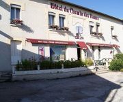
du Chemin des Dames Logis
L'Auberge De Vauclair Logis
Videos from this area
These are videos related to the place based on their proximity to this place.
France, Laon centre on a Harley 883R
A short ride round Laon old town centre while on the road the south, its a lovely old town set up on a ridge over the Picardy plain, 50 miles north east of Paris. Theres a cable car to take...
Funiculaires Laon ( Cablecar )
modern cablecar system between the railway station and the medieval town of Laon / Aisne.
Harlem Shake Liesse-Marais
Harlem Shake du Football Club Liesse-Marais Participants : Charlix, Remi, Kenian, Tarmouze, La Mouche, Cedric, Vivien, Dam's, Hadrien, Arthur, Christian, Benoît, Doudouce, Romain, Romu, Florian....
Les Zapéro contes. Soirée du 15 avril 2011
Extraits de la séance des Zapéro contes organisée par l'asbl Racontance, le 15 avril 2011, à l'Estaminet " La Fleur en Papier Doré" 55 rue des Alexiens, à Bruxelles. Une soirée " haut...
Rando Coucy les Eppes - Le Mont Pigeon
tour du mont Pigon sur les hauteurs de Bruyères et Montbérault dans le sens inverse des aiguilles d'une montre.
Videos provided by Youtube are under the copyright of their owners.
Attractions and noteworthy things
Distances are based on the centre of the city/town and sightseeing location. This list contains brief abstracts about monuments, holiday activities, national parcs, museums, organisations and more from the area as well as interesting facts about the region itself. Where available, you'll find the corresponding homepage. Otherwise the related wikipedia article.
Ailette (river)
The Ailette is a 59.5 km long river in the Aisne département, eastern France. Its source is at Sainte-Croix. It flows generally west-northwest. It is a left tributary of the Oise into which it flows between Manicamp and Quierzy, 30 km northeast of Compiègne. On most of its course, it shares its valley with the Canal de l'Oise à l'Aisne.
Vauclair Abbey
Vauclair or Vauclerc Abbey was a Cistercian abbey founded in 1134 by saint Bernard of Clairvaux at the request of Barthélemy de Jur, bishop of Laon.


