Safety Score: 3,0 of 5.0 based on data from 9 authorites. Meaning we advice caution when travelling to France.
Travel warnings are updated daily. Source: Travel Warning France. Last Update: 2024-08-13 08:21:03
Discover Lucelle
Lucelle in Haut-Rhin (Grand-Est) is a town in France about 246 mi (or 397 km) south-east of Paris, the country's capital city.
Current time in Lucelle is now 09:44 PM (Friday). The local timezone is named Europe / Paris with an UTC offset of one hour. We know of 13 airports near Lucelle, of which 5 are larger airports. The closest airport in France is EuroAirport Basel-Mulhouse-Freiburg Airport in a distance of 18 mi (or 28 km), North-East. Besides the airports, there are other travel options available (check left side).
There are several Unesco world heritage sites nearby. The closest heritage site is La Chaux-de-Fonds / Le Locle, Watchmaking Town Planning in Switzerland at a distance of 29 mi (or 47 km). The closest in France is From the Great Saltworks of Salins-les-Bains to the Royal Saltworks of Arc-et-Senans, the Production of Open-pan Salt in a distance of 73 mi (or 47 km), South-West. We discovered 5 points of interest in the vicinity of this place. Looking for a place to stay? we compiled a list of available hotels close to the map centre further down the page.
When in this area, you might want to pay a visit to some of the following locations: Delemont, Porrentruy, Altkirch, Laufen and Biel/Bienne. To further explore this place, just scroll down and browse the available info.
Local weather forecast
Todays Local Weather Conditions & Forecast: 8°C / 46 °F
| Morning Temperature | 2°C / 35 °F |
| Evening Temperature | 5°C / 41 °F |
| Night Temperature | 2°C / 36 °F |
| Chance of rainfall | 0% |
| Air Humidity | 73% |
| Air Pressure | 1026 hPa |
| Wind Speed | Light breeze with 4 km/h (2 mph) from West |
| Cloud Conditions | Few clouds, covering 13% of sky |
| General Conditions | Few clouds |
Saturday, 16th of November 2024
11°C (52 °F)
5°C (41 °F)
Sky is clear, light breeze, clear sky.
Sunday, 17th of November 2024
9°C (49 °F)
6°C (42 °F)
Light rain, gentle breeze, overcast clouds.
Monday, 18th of November 2024
7°C (45 °F)
5°C (41 °F)
Light rain, light breeze, overcast clouds.
Hotels and Places to Stay
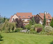
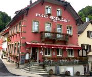
Le Petit Kohlberg
Hôtel Collin
Videos from this area
These are videos related to the place based on their proximity to this place.
Philipp Tanner #6 on Suzuki LTR 450 @ SAM ATV MX Ederswiler 2012
1st Stefan Schreiber 2nd Philipp Tanner 2rd Blacky Betschart.
1914-1918 WW1 : Sapes, abris et blockhaus sur le front de la Largue
Vestiges encore visibles de nos jours dans le Sundgau de la première guerre mondiale qui dura de 1914 à 1918. ATTENTION ! Il est très dangereux de s'aventurer dans les galeries soutérraines,...
1914-1918 WW1 : Abri-PC du village de Moernach
Vestiges des positions allemandes encore visibles de nos jours dans le Sundgau de la première guerre mondiale qui dura de 1914 à 1918. Cette série de vidéos a été tourné de 2007 à 2011...
1914-1918 WW1 : Vestiges sur le terrain de Durlinsdorf à Winkel
Vestiges encore visibles de nos jours dans le Sundgau de la première guerre mondiale qui dura de 1914 à 1918. Cette vidéo a été tourné en 2008 uniquement dans le but de laisser une petite...
1914-1918 WW1 : Positions sur le Kastelberg à Koestlach
Vestiges encore visibles de nos jours dans le Sundgau de la première guerre mondiale qui dura de 1914 à 1918. Cette série de vidéos a été tourné de 2007 à 2011 uniquement dans le but...
Randonnée VTT de Wittersdorf le 1 septembre 2013
Randonné VTT de Wittersdorf du 01/09/13. Petit extrait du parcours de 63 km dans les forêts au dessus de Ferrette.
L'expo de patchwork, c'est pour bientôt !
Du 1er au 12 mai, Ferrette va vivre au rythme du patchwork. Les travaux seront présentés de haut en bas de la rue du Château.
L'école de basket fête carnaval
Entraînement haut en couleurs, pour les jeunes basketteurs du BC Vieux-Ferrette !
Chantier au Château : c'est parti !
Comme tous les ans, des jeunes consacrent une partie de leurs vacances à la restauration du Château de Ferrette.
Tournoi de Ferrette 2012, le best of.mpg
Le tournoi de Ferrette 2012 a rendu son verdict, avec la victoire de Durlinsdorf. Revivez en images et en musique les plus beaux buts de la soirée.
Videos provided by Youtube are under the copyright of their owners.
Attractions and noteworthy things
Distances are based on the centre of the city/town and sightseeing location. This list contains brief abstracts about monuments, holiday activities, national parcs, museums, organisations and more from the area as well as interesting facts about the region itself. Where available, you'll find the corresponding homepage. Otherwise the related wikipedia article.
Château de Morimont
The Château de Morimont is a ruined castle in the Alsace region of France, situated in the commune of Oberlarg in the Haut-Rhin département. It is 40 km south-west of Mulhouse and 45 km west of the Swiss city Basel.
Lucelle Abbey
Lucelle Abbey or Lützel Abbey was a Cistercian monastery in the present village of Lucelle, in the Haut-Rhin department in Alsace, France, but located right on the Swiss border. The name of the original foundation was Lucis cella, the "cell of light". Lucelle was founded in 1124 as a daughter house of Bellevaux Abbey, which in its turn was a daughter house of Morimond Abbey. It was dissolved in 1792 during the French Revolution.
Lucelle
Lucelle is a village situated on the Franco-Swiss border. It is divided between the two countries, the northern half (47 inhabitants in 1999) being part of the commune of Lucelle, Haut-Rhin, in the Haut-Rhin département, the southern half being part of Pleigne, in the Swiss Canton of Jura. An important Cistercian monastery, Lucelle Abbey, was located here from the early 12th to the late 18th century.
Col des Rangiers
Col des Rangiers (el. 856 m. ) is a mountain pass in the canton of Jura in Switzerland. It connects Courgenay and Develier.
Asuel Castle
Asuel Castle is a ruined castle in the municipality of La Baroche of the Canton of Jura in Switzerland. It is a Swiss heritage site of national significance.


