Safety Score: 3,0 of 5.0 based on data from 9 authorites. Meaning we advice caution when travelling to France.
Travel warnings are updated daily. Source: Travel Warning France. Last Update: 2024-08-13 08:21:03
Discover Sainte-Odile
Sainte-Odile in Bas-Rhin (Grand-Est) is a town in France about 233 mi (or 374 km) east of Paris, the country's capital city.
Current time in Sainte-Odile is now 03:49 AM (Saturday). The local timezone is named Europe / Paris with an UTC offset of one hour. We know of 10 airports near Sainte-Odile, of which 3 are larger airports. The closest airport in France is Strasbourg Airport in a distance of 12 mi (or 20 km), North-East. Besides the airports, there are other travel options available (check left side).
There are several Unesco world heritage sites nearby. The closest heritage site in France is Strasbourg – Grande île in a distance of 18 mi (or 29 km), North-East. We discovered 2 points of interest in the vicinity of this place. Looking for a place to stay? we compiled a list of available hotels close to the map centre further down the page.
When in this area, you might want to pay a visit to some of the following locations: Molsheim, Selestat, Ribeauville, Saverne and Colmar. To further explore this place, just scroll down and browse the available info.
Local weather forecast
Todays Local Weather Conditions & Forecast: 9°C / 48 °F
| Morning Temperature | 3°C / 37 °F |
| Evening Temperature | 6°C / 42 °F |
| Night Temperature | 4°C / 39 °F |
| Chance of rainfall | 0% |
| Air Humidity | 60% |
| Air Pressure | 1022 hPa |
| Wind Speed | Light breeze with 3 km/h (2 mph) from North-West |
| Cloud Conditions | Clear sky, covering 3% of sky |
| General Conditions | Sky is clear |
Sunday, 17th of November 2024
9°C (48 °F)
6°C (44 °F)
Light rain, light breeze, overcast clouds.
Monday, 18th of November 2024
8°C (46 °F)
6°C (42 °F)
Light rain, light breeze, overcast clouds.
Tuesday, 19th of November 2024
10°C (50 °F)
5°C (41 °F)
Moderate rain, moderate breeze, overcast clouds.
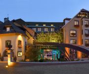
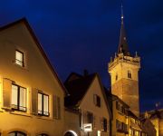
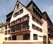
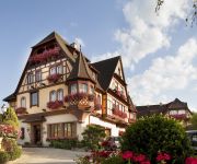
Hotels and Places to Stay
Hostellerie des Chateaux & Spa
Le Clos des Délices
Le Pavillon 7
Le Colombier
5 Terres Hôtel & Spa - MGallery by Sofitel
A la cour d Alsace
Le Parc Hotel Restaurants et Spa
Résidence des Châteaux
La Diligence
La Petite Auberge Logis
Videos from this area
These are videos related to the place based on their proximity to this place.
28 ème edition course de côte de Barr
Essais course de côte de Barr 28 ème édition 05/05/2012 dans l'après midi. Plusieurs catégorie de moto telle que les 600, 1300, promotions, classique, championnat suisse ... y sont représent...
Yannick DIETRICH, HONDA RS250, Barr 2010 caméra embarquée
Yannick DIETRICH, HONDA RS250, Championnat de France de la Montagne à Barr en 2010. www.drt.fr.fm.
vtt descente Barr 2010
ein paar aufnahmen (4min. clip) vom ersten lauf in barr 2010. zu mehr hat es dieses jahr bei mir nicht gereicht ;-)
Course de Cote de Barr 2008
Petite vidéo sur le Team 100% d'adrénaline lors de la course de cote de Barr 2008.
Ariel Atoms in Ottrott and nearby forest roads
Edited highlights of the first good day of AAOC Alpine Tour 08. We (eventually) leave the very pretty village of Ottrott, pass through the equally pretty village of Saint-Nabor and onto...
montage 3: run en ktm 520 exc supermotard a saint nabor.avi
Petit run en ktm 520 exc de 2002 monté en 17 pouces filmé avec une gopro en 720p musique nightcal (filme driver)
La gare d'Ottrott, un réseau en 0 de Jean-Michel Marx
http://www.aiguillages.eu Les liens : Abonnement sur Youtube : http://www.youtube.com/subscription_center?add_user=aiguillages Page Facebook : https://www.facebook.com/aiguillages.eu Site...
Videos provided by Youtube are under the copyright of their owners.
Attractions and noteworthy things
Distances are based on the centre of the city/town and sightseeing location. This list contains brief abstracts about monuments, holiday activities, national parcs, museums, organisations and more from the area as well as interesting facts about the region itself. Where available, you'll find the corresponding homepage. Otherwise the related wikipedia article.
Mont Sainte-Odile
Mont Sainte-Odile (German: Odilienberg or Ottilienberg; called Allitona in the 8th century) is a 760 m peak of the Vosges Mountains in Alsace in France, immediately west of Barr. The mountain is named for Saint Odile. It has a monastery/convent at its top called the Hohenburg Abbey, and is notable also for its stone fortifications called "the Pagan Wall. " In 1992, it was the site of an Airbus crash.
Mont Sainte-Odile Abbey
Mont Sainte-Odile Abbey, also known as Hohenburg Abbey, is a nunnery, situated on the Mont Sainte-Odile, the most famous of the Vosges mountain range in the French region of Alsace.
Château du Birkenfels
The Château du Birkenfels is a ruined castle in the commune of Ottrott in the French département of Bas-Rhin. It is surrounded by the Obernai Forest.
Air Inter Flight 148
Air Inter Flight 148 was a scheduled airline flight on 20 January 1992 that crashed in the Vosges Mountains, near Mont Sainte-Odile, while circling to land at Strasbourg Airport. Of 96 people on board, 9 survived.
Château de Lutzelbourg
The Château de Lutzelbourg is a ruined medieval castle, above the town of Ottrott, in the Bas-Rhin department of eastern France.
Château de Dreistein
The Château de Dreistein is a ruined castle in the commune of Ottrott in the Bas-Rhin département of France. It is, in fact, three separate castles built on rocky promontories, hence the name drei Stein, "three stones" in medieval German.
Château du Hagelschloss
The Château du Hagelschloss (also known as Château de Waldsberg) is a ruined castle in the commune of Ottrott in the Bas-Rhin département of France. It was constructed in the 13th century. Hagelschloss is probably named because of its position dominating the Hagelthal valley. In the 19th century, it was known as Waldberg and is mentioned as such in certain historic documents.
Château du Landsberg
The Château du Landsberg is a castle in the commune of Heiligenstein in the Bas-Rhin département in Alsace, France. Construction dates from the 12th, 13th and 15th centuries. The land belonged to the Abbey of Niedersmunster. The castle is privately owned. It has been listed since 1965 as a monument historique by the French Ministry of Culture.


