Safety Score: 3,0 of 5.0 based on data from 9 authorites. Meaning we advice caution when travelling to France.
Travel warnings are updated daily. Source: Travel Warning France. Last Update: 2024-08-13 08:21:03
Discover Offendorf
Offendorf in Bas-Rhin (Grand-Est) is a place in France about 254 mi (or 408 km) east of Paris, the country's capital city.
Current time in Offendorf is now 08:45 AM (Saturday). The local timezone is named Europe / Paris with an UTC offset of one hour. We know of 12 airports near Offendorf, of which 5 are larger airports. The closest is airport we know is Karlsruhe Baden-Baden Airport in Germany in a distance of 9 mi (or 14 km). The closest airport in France is Strasbourg Airport in a distance of 18 mi (or 14 km), North-East. Besides the airports, there are other travel options available (check left side).
There are several Unesco world heritage sites nearby. The closest heritage site in France is Strasbourg – Grande île in a distance of 12 mi (or 20 km), South-West. If you need a hotel, we compiled a list of available hotels close to the map centre further down the page.
While being here, you might want to pay a visit to some of the following locations: Rheinmuenster, Haguenau, Willstaett, Roppenheim and Appenweier. To further explore this place, just scroll down and browse the available info.
Local weather forecast
Todays Local Weather Conditions & Forecast: 8°C / 46 °F
| Morning Temperature | 3°C / 37 °F |
| Evening Temperature | 6°C / 42 °F |
| Night Temperature | 4°C / 39 °F |
| Chance of rainfall | 0% |
| Air Humidity | 66% |
| Air Pressure | 1022 hPa |
| Wind Speed | Light breeze with 5 km/h (3 mph) from North-East |
| Cloud Conditions | Clear sky, covering 4% of sky |
| General Conditions | Sky is clear |
Sunday, 17th of November 2024
8°C (47 °F)
7°C (44 °F)
Light rain, gentle breeze, overcast clouds.
Monday, 18th of November 2024
8°C (46 °F)
7°C (44 °F)
Moderate rain, moderate breeze, broken clouds.
Tuesday, 19th of November 2024
11°C (51 °F)
5°C (42 °F)
Moderate rain, fresh breeze, overcast clouds.
Hotels and Places to Stay
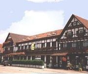
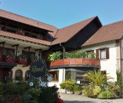
Ratz Landgasthof
Blume Landgasthof
Zum Rössel
Le Verger de Bischwiller
Videos from this area
These are videos related to the place based on their proximity to this place.
Gambsheim, le Stein, naissance du lotissement du Ried au Verger
Présentation aérienne du nouveau lotissement "Du Ried au Verger"
Detour(s) de mob au Centre de Vol à Voile de Haguenau
Un film de Chirstoph Schwaiger avec François Skyvington.
Chanson de Lara Laetitia Schultz
Chanson de Lara au clavier Tyros 4 par Laetitia Schultz Atelier Musical kledan Daniel kleinmann Herrlisheim - Haguenau.
Ausflugsziel - Die Fischtreppe ( Fischpass ) von Rheinau / Gambsheim
Der Fischpass Mit Hilfe der insgesamt 290 m langen Fischtreppe können die Fische die 10 m Höhenunterschied zwischen Ober- und Unterwasser überwinden. Bei der Fischtreppe handelt es sich...
ASPHM - HOTCHKISS 105 mm 39H(f), EcRhin Gambsheim
ASPHM - HOTCHKISS 105 mm 39H(f), EcRhin Gambsheim.
ASPHM - SdKfz 251 Sonderkraftfahrzeug / OT-810, EcRhin Gambsheim
ASPHM - SdKfz 251 Sonderkraftfahrzeug / OT-810, EcRhin Gambsheim.
Videos provided by Youtube are under the copyright of their owners.
Attractions and noteworthy things
Distances are based on the centre of the city/town and sightseeing location. This list contains brief abstracts about monuments, holiday activities, national parcs, museums, organisations and more from the area as well as interesting facts about the region itself. Where available, you'll find the corresponding homepage. Otherwise the related wikipedia article.
Ill (France)
The Ill is a river in Alsace, in north-eastern France. It is a "left-side", or western tributary of the Rhine. It starts down from its source near the village of Winkel, in the Jura mountains, with a resurgence near Ligsdorf, turns around Ferrette on its east side, and then runs northward through Alsace, flowing parallel to the Rhine.
Institut national des études territoriales
The Institut national des études territoriales (INET, National Institute of Territorial Studies) is a French Public administration school. INET offers initial and continuing training to managerial staff of large local and regional authorities. Most of the students from the INET become directors or head of department (finance, budget, human resources) in towns of more than 80 000 inhabitants, departments or regions.


