Safety Score: 3,0 of 5.0 based on data from 9 authorites. Meaning we advice caution when travelling to France.
Travel warnings are updated daily. Source: Travel Warning France. Last Update: 2024-08-13 08:21:03
Delve into Les Laurins
Les Laurins in Cher (Centre Region) is located in France about 138 mi (or 222 km) south of Paris, the country's capital town.
Current time in Les Laurins is now 05:45 PM (Friday). The local timezone is named Europe / Paris with an UTC offset of one hour. We know of 12 airports close to Les Laurins, of which 4 are larger airports. The closest airport in France is Nevers-Fourchambault Airport in a distance of 7 mi (or 11 km), North-East. Besides the airports, there are other travel options available (check left side).
There are several Unesco world heritage sites nearby. The closest heritage site in France is Bourges Cathedral in a distance of 33 mi (or 53 km), West. If you need a hotel, we compiled a list of available hotels close to the map centre further down the page.
While being here, you might want to pay a visit to some of the following locations: Nevers, Moulins, Cosne-Cours-sur-Loire, Saint-Amand-Montrond and Bourges. To further explore this place, just scroll down and browse the available info.
Local weather forecast
Todays Local Weather Conditions & Forecast: 4°C / 39 °F
| Morning Temperature | -2°C / 28 °F |
| Evening Temperature | 1°C / 34 °F |
| Night Temperature | -0°C / 31 °F |
| Chance of rainfall | 0% |
| Air Humidity | 87% |
| Air Pressure | 1017 hPa |
| Wind Speed | Gentle Breeze with 9 km/h (5 mph) from East |
| Cloud Conditions | Overcast clouds, covering 100% of sky |
| General Conditions | Light snow |
Saturday, 23rd of November 2024
6°C (43 °F)
6°C (44 °F)
Broken clouds, gentle breeze.
Sunday, 24th of November 2024
16°C (61 °F)
14°C (57 °F)
Overcast clouds, fresh breeze.
Monday, 25th of November 2024
14°C (58 °F)
8°C (47 °F)
Moderate rain, fresh breeze, overcast clouds.
Hotels and Places to Stay
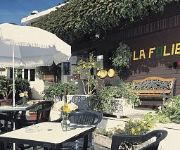
Citotel La Folie
Videos from this area
These are videos related to the place based on their proximity to this place.
Atterrissage Nevers Piste 30 (Garmin VIRB Testeur)
Atterrissage à Nevers (LFQG), piste 30, à bord d'un Cessna 172 (F-GTNV) du CA-SGAC. Il y a un peu de vent de travers, ce qui permet de bien montrer la piste ;-) La caméra utilisée est...
L'aurevoir du Noratlas de Provence au rassemblement des femmes de l'air
L'aurevoir du Noratlas de Provence au rassemblement des femmes de l'air le 28 Septembre 2014.
Pushback aux reverse du Noratlas 400 lors du rassemblement des femmes de l'air à nevers
Pushback aux reverse de Noratlas 400 lors du rassemblement des femmes de l'air à nevers (LFQG) le 28 Septembre 2014.
Départ du Cirrus SR22T Carbon du rassemblement des femmes de l'air à Nevers
Départ du Cirrus SR22T Carbon du rassemblement des femmes de l'air à Nevers le 28 Septembre 2014.
Départ de Nevers
Départ de de Nevers avec le PA32 Saratoga lors du rassemblement des femmes de l'air le 28 Septembre 2014.
JS Marzy Séniors1F vs Charnay 3
Match de la 9éme journée du championnat de bourgogne d'excellence féminine.
Videos provided by Youtube are under the copyright of their owners.
Attractions and noteworthy things
Distances are based on the centre of the city/town and sightseeing location. This list contains brief abstracts about monuments, holiday activities, national parcs, museums, organisations and more from the area as well as interesting facts about the region itself. Where available, you'll find the corresponding homepage. Otherwise the related wikipedia article.
Allier (river)
The Allier is a river in central France, and is the left tributary to the Loire River. Its source is in the Massif Central, in the Lozère département, east of Mende. It flows generally north. It joins the Loire River west of the city of Nevers.
Lorraines Branch
The Lorraines Branch is a canal in central France, some 50 km east of Bourges. It is a disused branch of the Canal latéral à la Loire now serving as a feeder from the Allier River. At one time it carried traffic from the Allier via a circular lock. The Ecluse de Lorraines was 32 km in diameter with three gates providing access from the river on two levels above and below a weir.


