Safety Score: 3,0 of 5.0 based on data from 9 authorites. Meaning we advice caution when travelling to France.
Travel warnings are updated daily. Source: Travel Warning France. Last Update: 2024-08-13 08:21:03
Delve into Keranguyader
Keranguyader in Finistère (Brittany Region) is located in France about 319 mi (or 513 km) west of Paris, the country's capital town.
Current time in Keranguyader is now 09:41 PM (Friday). The local timezone is named Europe / Paris with an UTC offset of one hour. We know of 9 airports close to Keranguyader, of which one is a larger airport. The closest airport in France is Brest Bretagne Airport in a distance of 15 mi (or 23 km), North-East. Besides the airports, there are other travel options available (check left side).
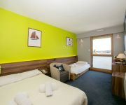
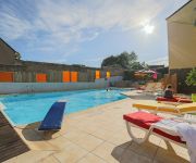
We encountered 1 points of interest near this location. If you need a hotel, we compiled a list of available hotels close to the map centre further down the page.
While being here, you might want to pay a visit to some of the following locations: Brest, Chateaulin, Quimper, Morlaix and Lannion. To further explore this place, just scroll down and browse the available info.
Local weather forecast
Todays Local Weather Conditions & Forecast: 12°C / 54 °F
| Morning Temperature | 8°C / 47 °F |
| Evening Temperature | 11°C / 51 °F |
| Night Temperature | 9°C / 48 °F |
| Chance of rainfall | 0% |
| Air Humidity | 79% |
| Air Pressure | 1027 hPa |
| Wind Speed | Gentle Breeze with 6 km/h (4 mph) from West |
| Cloud Conditions | Clear sky, covering 2% of sky |
| General Conditions | Sky is clear |
Saturday, 16th of November 2024
11°C (52 °F)
11°C (53 °F)
Sky is clear, gentle breeze, clear sky.
Sunday, 17th of November 2024
12°C (53 °F)
10°C (50 °F)
Light rain, moderate breeze, overcast clouds.
Monday, 18th of November 2024
13°C (56 °F)
12°C (54 °F)
Light rain, strong breeze, overcast clouds.
Hotels and Places to Stay
Videos from this area
These are videos related to the place based on their proximity to this place.
Surfen in der Bretagne, auf der Halbinsel Crozon- am Goulien und La Palue
Die Strände Goulien und La Palue auf der Halbinsel Crozon sind vielen Surfern bekannt, hier gibt es optimale Bedingungen für den Surfsport.
Anse De Dinan, Goulien, 29160 Crozon, Finistère, Bretagne, France 14th October 2009
Anse De Dinan, Goulien, 29160 Crozon, Finistère, Bretagne, France Videoed on Wednesday, 14th October 2009.
grande maréeV5
Camaret sur mer, le 17 octobre 2012 une marée de 109 et une forte houle d'Ouest provoquent quelques perturbations sur le port.
Appartement Ty Kenta 2
Duplex pour 2 personnes surplombant le port de Camaret en Bretagne, vue panoramique sur la mer depuis la grande terrasse et l'appartement.
Appartement Ty kenta 3
Duplex pour 4 personnes surplombant le port de Camaret. Vue panoramique sur la mer et le port depuis le balcon suspendu.
Plongée à Camaret (la basse Jean Paul)
Plongée à -20m, avec Haliotis le 18/09/2011 Plongée moyenne, une palme cassée et le filtre rouge assombrit la vidéo sous l'eau et pourrit les couleurs hors de l'eau... Une sole sur...
foin 2012 à camaret avec un avto t40
I created this video with the YouTube Video Editor (http://www.youtube.com/editor)
Videos provided by Youtube are under the copyright of their owners.
Attractions and noteworthy things
Distances are based on the centre of the city/town and sightseeing location. This list contains brief abstracts about monuments, holiday activities, national parcs, museums, organisations and more from the area as well as interesting facts about the region itself. Where available, you'll find the corresponding homepage. Otherwise the related wikipedia article.
Camaret Bay
Camaret Bay is a small bay on the north coast of Brittany, France. In 1694 it was the site of the battle of Camaret, a naval action between French and English forces, which culminated in a disastrous amphibious landing by the English as part of an attempt to seize the nearby port of Brest.
Quélern
Quélern is a hamlet in Roscanvel, in the department of Finistère, in western France.
Tremet
Tremet is a hamlet on the Roscanvel peninsula in France. The gun batteries located here are part of the defences of the goulet de Brest, forbidding ships from entering the bay of Camaret-sur-Mer. The site had been occupied by the military since 1694 (a battery was probably sited here in Vauban's defensive scheme) and was updated several times in the 18th and 19th centuries.
Île des Morts
Île des Morts (Island of the Dead) is a 7-hectare island in the Bay of Roscanvel, to the south-west of the roadstead of Brest, between the Quélern peninsula and Île Longue. It is 26m above sea level at its highest point.
Tour Vauban
The Tour Vauban, initially known as the tour de Camaret, is an 18m-high polygonal defensive tower built to a plan by Vauban on the Sillon at Camaret-sur-Mer, as part of the fortifications of the goulet de Brest. It has three levels and is flanked by walls, a guardhouse and a gun battery which can hold 11 cannons as well as a cannon-ball foundry added in the French Revolution period.
Pointe du Grand Gouin
The pointe du Grand Gouin is a rocky promontory with vertical cliffs to the west of the inlet of Camaret-sur-Mer in France. It protects a port which, in Vauban's era, was vulnerable to possible landings. It is divided into the Grand Gouin (the top of the cliff) and the Petit Gouin (mid-cliff).


