Safety Score: 3,0 of 5.0 based on data from 9 authorites. Meaning we advice caution when travelling to France.
Travel warnings are updated daily. Source: Travel Warning France. Last Update: 2024-08-13 08:21:03
Discover Granges-Sainte-Marie
Granges-Sainte-Marie in Doubs (Bourgogne-Franche-Comté) is a city in France about 232 mi (or 373 km) south-east of Paris, the country's capital city.
Local time in Granges-Sainte-Marie is now 01:51 AM (Saturday). The local timezone is named Europe / Paris with an UTC offset of one hour. We know of 12 airports in the vicinity of Granges-Sainte-Marie, of which 5 are larger airports. The closest is airport we know is Neuchatel Airport in Switzerland in a distance of 30 mi (or 48 km). The closest airport in France is Besançon Thise Airport in a distance of 35 mi (or 48 km), North-East. Besides the airports, there are other travel options available (check left side).
There are several Unesco world heritage sites nearby. The closest heritage site in France is From the Great Saltworks of Salins-les-Bains to the Royal Saltworks of Arc-et-Senans, the Production of Open-pan Salt in a distance of 22 mi (or 36 km), North-West. We discovered 1 points of interest in the vicinity of this place. Looking for a place to stay? we compiled a list of available hotels close to the map centre further down the page.
When in this area, you might want to pay a visit to some of the following locations: L'Abbaye, Pontarlier, Moiry, Cuarnens and Mollens. To further explore this place, just scroll down and browse the available info.
Local weather forecast
Todays Local Weather Conditions & Forecast: 11°C / 53 °F
| Morning Temperature | 2°C / 36 °F |
| Evening Temperature | 4°C / 39 °F |
| Night Temperature | 4°C / 40 °F |
| Chance of rainfall | 0% |
| Air Humidity | 44% |
| Air Pressure | 1020 hPa |
| Wind Speed | Light breeze with 4 km/h (3 mph) from North-East |
| Cloud Conditions | Few clouds, covering 20% of sky |
| General Conditions | Few clouds |
Sunday, 17th of November 2024
7°C (44 °F)
3°C (38 °F)
Light rain, gentle breeze, overcast clouds.
Monday, 18th of November 2024
5°C (41 °F)
3°C (37 °F)
Light rain, light breeze, overcast clouds.
Tuesday, 19th of November 2024
6°C (42 °F)
7°C (44 °F)
Moderate rain, moderate breeze, overcast clouds.
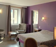
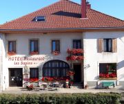
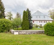
Hotels and Places to Stay
Le Lac
Hotel les Sapins Logis
Auberge du Coude
Videos from this area
These are videos related to the place based on their proximity to this place.
Vol biplace en parapente à Métabief
Vols découverte biplace en parapente à Métabief avec Au doux parapente. Vue de la station et du village de Métabief. Vue du Mont-d'Or. Visitez notre site Internet: http://www.audouxparapente.fr.
Open Enduro métabief 2012
tesaer du dvd de l'evenement Open Enduro Métabief 2012 VTT extrem nouveauté.
Metabief Mars 2014 JG et STEVE descente de ski
go pro hero 3+ silver édition HD 1080 50fps perche + ventouse go pro + fixation torse montage logiciel go pro musique TALISCO.
La première de la saison 2013/2014 !
ça fait plaisir de reprendre les bonnes habitudes ! Reste plus qu'à ouvrir la station ...
Métabief + neige + soleil = ...
Encore une belle journée de ski. Cette fois dans le Doubs avec la dream'team Marine, Vivien, Maxime et moi-même.
Saut hors-piste Troupezy Essai 2
Premier essai pas très concluant du saut hors de la piste Troupezy, à Métabief.
Janvier 2015 - Adam et Bryan première expérience de snowboard
Janvier 2015 - Adam et Bryan première expérience de snowboard.
Skigebied Métabief, 26 december 2010
Op de terugweg van Pila in the Sky (Aosta, Italië ) zijn we op 26 december 2010 één dag gaan skiën in Métabief. Dit skigebied ligt in het Jura-gebergte in Frankrijk. De condities zijn...
Videos provided by Youtube are under the copyright of their owners.
Attractions and noteworthy things
Distances are based on the centre of the city/town and sightseeing location. This list contains brief abstracts about monuments, holiday activities, national parcs, museums, organisations and more from the area as well as interesting facts about the region itself. Where available, you'll find the corresponding homepage. Otherwise the related wikipedia article.
Lac de Saint-Point
Lac de Saint-Point (also Lac de Malbuisson) is a lake in the Doubs department of France. With a surface area of 5.2 km², it is one of the largest natural lakes of France.
Lac de Remoray
Lac de Remoray is a lake in the Doubs department of France. Located in the municipalities of Remoray-Boujeons and Labergement-Sainte-Marie, the lake is near Lac de Saint-Point. The lake and its surroundings were made a nature preserve in 1980.


