Safety Score: 3,0 of 5.0 based on data from 9 authorites. Meaning we advice caution when travelling to France.
Travel warnings are updated daily. Source: Travel Warning France. Last Update: 2024-08-13 08:21:03
Discover Picherande
Picherande in Puy-de-Dôme (Auvergne-Rhône-Alpes) with it's 379 citizens is a city in France about 235 mi (or 378 km) south of Paris, the country's capital city.
Local time in Picherande is now 05:04 AM (Saturday). The local timezone is named Europe / Paris with an UTC offset of one hour. We know of 12 airports in the vicinity of Picherande, of which 4 are larger airports. The closest airport in France is Clermont-Ferrand Auvergne Airport in a distance of 29 mi (or 47 km), North-East. Besides the airports, there are other travel options available (check left side).
There are several Unesco world heritage sites nearby. The closest heritage site in France is Prehistoric Sites and Decorated Caves of the Vézère Valley in a distance of 83 mi (or 133 km), West. Looking for a place to stay? we compiled a list of available hotels close to the map centre further down the page.
When in this area, you might want to pay a visit to some of the following locations: Clermont-Ferrand, Ussel, Issoire, Mauriac and Saint-Flour. To further explore this place, just scroll down and browse the available info.
Local weather forecast
Todays Local Weather Conditions & Forecast: 8°C / 47 °F
| Morning Temperature | -1°C / 31 °F |
| Evening Temperature | 6°C / 42 °F |
| Night Temperature | 6°C / 42 °F |
| Chance of rainfall | 0% |
| Air Humidity | 44% |
| Air Pressure | 1020 hPa |
| Wind Speed | Gentle Breeze with 8 km/h (5 mph) from North-East |
| Cloud Conditions | Scattered clouds, covering 42% of sky |
| General Conditions | Scattered clouds |
Sunday, 24th of November 2024
11°C (52 °F)
8°C (47 °F)
Overcast clouds, gentle breeze.
Monday, 25th of November 2024
14°C (57 °F)
5°C (41 °F)
Moderate rain, fresh breeze, broken clouds.
Tuesday, 26th of November 2024
9°C (47 °F)
6°C (44 °F)
Overcast clouds, light breeze.
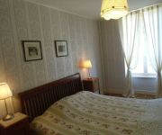
Hotels and Places to Stay
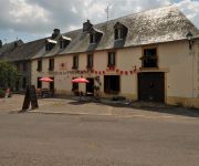
Auberge de la Providence
Le Puy Ferrand Logis
Hotel-Restaurant de la Providence
Videos from this area
These are videos related to the place based on their proximity to this place.
Paramotor flying along crest lines of Mont-Dore mountains
Vol en paramoteur le long des crêtes autour de la station du Mont-Dore, en Auvergne.
Ski Couloirs du Mont-Dore
Ski de couloir dans le Sancy: Pas de l'Ane, Y et Envers du Redon. Visibilité limitée, neige irrégulière cachant des cailloux et de la glace, mais au final de sympathiques couloirs à skier...
Première neige au Mont Dore
Ski au Mont Dore, au deuxième week end de la saison le 7 et 8 décembre 2013 Filmé avec Lenco Sportcam Enjoy !
Freeride Snowboard au Mont Dore
Un hors-pistes super cool sur les flancs du Sancy. Parfait pour s'échauffer en début de journée.
Maison à vendre MONTBOUDIF - Cantal
A vendre entre particuliers : http://www.micimmo.com/annonce-immobilieres/achat-bien-maison-cantal-106646.html . Buanderie. Terrain de 2000 m². Rez-de-chaussée : living-séjour, cuisine...
Saint Donat - Col de la Geneste (part 1, the climb)
Part 1 of the first ride in the Saint Donat cycling series. From Saint Donat to the summit of the Col de la Geneste. This col is also known as Super Besse from several Tour de Frances, but...
Saint Donat - Chastreix-Sancy (part 1, the climb)
Part 1 of the second ride in the serie Cycling in the Auvergne. The ride to the ski village Chastreix-Sancy from Saint Donat. A bit too hard for my mediocre cycling capabilities. See also...
Hilly round Saint Donat - Picherande - Saint-Genès-Champespe - Saint Donat (part 1, compared)
Part 1 of the third ride in the serie Cycling in the Auvergne. A short hilly ride south east of Saint Donat. Especially the last downhill parts are very bumpy. Last year, having my bike one...
Saint Donat - Chastreix-Sancy (part 2, the descent)
Part 2 of the second ride in the serie Cycling in the Auvergne. The complete ride back from the ski village Chastreix-Sancy to Saint Donat in double speed. Again a very bumpy ride. See also...
Videos provided by Youtube are under the copyright of their owners.
Attractions and noteworthy things
Distances are based on the centre of the city/town and sightseeing location. This list contains brief abstracts about monuments, holiday activities, national parcs, museums, organisations and more from the area as well as interesting facts about the region itself. Where available, you'll find the corresponding homepage. Otherwise the related wikipedia article.
Chaîne des Puys
The Chaîne des Puys is a north-south oriented chain of cinder cones, lava domes, and maars in the Massif Central of France. The chain is about 40 km (25 mi) long, and the identified volcanic features include 48 cinder cones, eight lava domes, and 15 maars and explosion craters. Its highest point is the lava dome of Puy de Dôme, located near the middle of the chain. The name of the range comes from a French term, puy, that refers to a volcanic mountain with a rounded profile.


