Safety Score: 3,0 of 5.0 based on data from 9 authorites. Meaning we advice caution when travelling to France.
Travel warnings are updated daily. Source: Travel Warning France. Last Update: 2024-08-13 08:21:03
Discover Saint-Joseph-de-Rivière
Saint-Joseph-de-Rivière in Isère (Auvergne-Rhône-Alpes) with it's 1,109 citizens is a place in France about 287 mi (or 462 km) south-east of Paris, the country's capital city.
Current time in Saint-Joseph-de-Rivière is now 11:49 PM (Friday). The local timezone is named Europe / Paris with an UTC offset of one hour. We know of 12 airports near Saint-Joseph-de-Rivière, of which 4 are larger airports. The closest airport in France is Grenoble-Isère Airport in a distance of 18 mi (or 29 km), West. Besides the airports, there are other travel options available (check left side).
There are several Unesco world heritage sites nearby. The closest heritage site in France is Historic Site of Lyons in a distance of 50 mi (or 80 km), North-West. We encountered 2 points of interest in the vicinity of this place. If you need a hotel, we compiled a list of available hotels close to the map centre further down the page.
While being here, you might want to pay a visit to some of the following locations: Grenoble, Chambery, La Tour-du-Pin, Belley and Saint-Jean-de-Maurienne. To further explore this place, just scroll down and browse the available info.
Local weather forecast
Todays Local Weather Conditions & Forecast: 8°C / 47 °F
| Morning Temperature | 0°C / 33 °F |
| Evening Temperature | 7°C / 44 °F |
| Night Temperature | 3°C / 38 °F |
| Chance of rainfall | 0% |
| Air Humidity | 66% |
| Air Pressure | 1026 hPa |
| Wind Speed | Light breeze with 3 km/h (2 mph) from South |
| Cloud Conditions | Clear sky, covering 5% of sky |
| General Conditions | Sky is clear |
Saturday, 16th of November 2024
12°C (53 °F)
6°C (42 °F)
Sky is clear, light breeze, clear sky.
Sunday, 17th of November 2024
12°C (53 °F)
5°C (40 °F)
Few clouds, light breeze.
Monday, 18th of November 2024
8°C (46 °F)
4°C (40 °F)
Overcast clouds, light breeze.
Hotels and Places to Stay
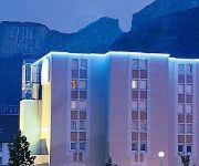
Hôtel Amys
Videos from this area
These are videos related to the place based on their proximity to this place.
HD Geological rock formation Chartreuse Mountains by Grenoble France Part 2 of 2
HD Geological rock formation Chartreuse Mountains by Grenoble France Part 2 of 2. En route from Lyon to Grenoble in August 2014, an interesting rock formation caught my interest. I am not...
Geology of le massif de la Chartreuse by Grenoble in France Great Part 1 of 2
Geology of le massif de la Chartreuse by Grenoble in France Great Part 1 of 2. Whilst driving back to Lyon from Grenoble in August 2014, an interesting rock formation caught my interest....
La route du Bret
La route du Bret près du gîte http://www.gite-la-source.com une plongée originale dans un décor étrange. Dès l'entrée dans les gorges le décor surprend, la route semble écrasée...
Snowboarding in the Chamonix Backcountry!
McNab Snowsports backcountry snowboarding Backcountry Intro course March 08.
MOTO BALADE la moto ça bouge le 10/04/2010
Déposez votre commentaire sur notre site : http://moto.balade.free.fr/ ou plus bas ou sur notre mail : moto.balade@free.fr merci.
On s'est pas croisé au Club fifty five???
L'Inde, ouai c'est impressionnant, les gens ont rien et ils te donnent tout... et nous on se plaint, mais on marche sur la tete!!!! on marche sur la tete!!!!
Lieux-dits remarquables
Plaques d'entrées de villages, aux noms un peu étranges et parfois un peu coquins !
L'Ouest Américain en Chartreuse 2013 BA
L'Ouest Américain en Chartreuse 28 juillet 2013 à St-Laurent-du-Pont (38) Comme chaque année, grand rassemblement de US Cars, motos HD et Trikes à Saint Laurent du pont dans l'Isere.
Videos provided by Youtube are under the copyright of their owners.
Attractions and noteworthy things
Distances are based on the centre of the city/town and sightseeing location. This list contains brief abstracts about monuments, holiday activities, national parcs, museums, organisations and more from the area as well as interesting facts about the region itself. Where available, you'll find the corresponding homepage. Otherwise the related wikipedia article.
Dauphiné
The Dauphiné or Dauphiné Viennois is a former province in southeastern France, whose area roughly corresponded to that of the present departments of :Isère, :Drôme, and :Hautes-Alpes. The Dauphiné (also called Dauphiny in ancient English) was an independent state from 1040 to 1349, under the rule of the Counts of Albon, before joining the Kingdom of France. As a French province, it maintained its autonomy until 1457.
Club Cinq-Sept fire
The Club Cinq-Sept fire was a major disaster which took place in south-eastern France on Sunday, 1 November 1970. 146 people, almost all of them aged between 17 and 30, died when a nightclub just outside the small town of Saint-Laurent-du-Pont, Isère was completely destroyed in a catastrophic fire. The scale of the disaster shocked the French nation.


