Safety Score: 3,0 of 5.0 based on data from 9 authorites. Meaning we advice caution when travelling to France.
Travel warnings are updated daily. Source: Travel Warning France. Last Update: 2024-08-13 08:21:03
Delve into Notre-Dame-de-Mésage
Notre-Dame-de-Mésage in Isère (Auvergne-Rhône-Alpes) with it's 1,294 habitants is a city located in France about 307 mi (or 495 km) south-east of Paris, the country's capital town.
Current time in Notre-Dame-de-Mésage is now 10:28 PM (Friday). The local timezone is named Europe / Paris with an UTC offset of one hour. We know of 12 airports closer to Notre-Dame-de-Mésage, of which 4 are larger airports. The closest airport in France is L'alpe D'huez Airport in a distance of 16 mi (or 26 km), East. Besides the airports, there are other travel options available (check left side).
There are several Unesco world heritage sites nearby. The closest heritage site in France is Historic Site of Lyons in a distance of 66 mi (or 107 km), North-West. We saw 2 points of interest near this location. In need of a room? We compiled a list of available hotels close to the map centre further down the page.
Since you are here already, you might want to pay a visit to some of the following locations: Grenoble, Le Devoluy, Die, Chambery and La Tour-du-Pin. To further explore this place, just scroll down and browse the available info.
Local weather forecast
Todays Local Weather Conditions & Forecast: 8°C / 46 °F
| Morning Temperature | 3°C / 38 °F |
| Evening Temperature | 7°C / 44 °F |
| Night Temperature | 6°C / 43 °F |
| Chance of rainfall | 0% |
| Air Humidity | 47% |
| Air Pressure | 1023 hPa |
| Wind Speed | Light breeze with 3 km/h (2 mph) from North-West |
| Cloud Conditions | Clear sky, covering 4% of sky |
| General Conditions | Sky is clear |
Saturday, 16th of November 2024
15°C (59 °F)
7°C (44 °F)
Sky is clear, light breeze, clear sky.
Sunday, 17th of November 2024
14°C (57 °F)
6°C (42 °F)
Scattered clouds, light breeze.
Monday, 18th of November 2024
9°C (49 °F)
5°C (40 °F)
Broken clouds, gentle breeze.
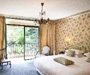
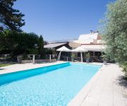
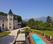
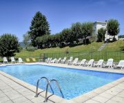
Hotels and Places to Stay
Hôtel Chavant
Dauphitel Best Western
Grand Hotel d'Uriage Relais du Silence
Chateau de la Commanderie Chateaux & Hotels Collection
La Cle des Champs Logis
Villancourt INTER-HOTEL
Les Mesanges Hôtel Restaurant
Le Manoir des Alberges
Videos from this area
These are videos related to the place based on their proximity to this place.
Train: manoeuvres en gare de Jarrie-Vizille (38) HD
La desserte du site de l'usine de produits chimiques Arkema située à Jarrie (38) est assurée par des BB 75000 . Les wagons citerne sont triés et stockés sur les voies de débord de la...
Fêtes révolutionnaires de Vizille 1ère partie
Reconstitution de la bataille de Valmy au château de Vizille France 22 juillet 2012 avec : http://www.carmagnole-liberte.fr/ http://www.cyclopinclopan.com/
Chamois (Rupicapra rupicapra)
Chamois filmés en infrarouge en forêt à 700 m d'altitude. Séchilienne (38, France). Infrared film of chamois made in a forest at 700 m altitude. Séchilienne (France).
Videos provided by Youtube are under the copyright of their owners.
Attractions and noteworthy things
Distances are based on the centre of the city/town and sightseeing location. This list contains brief abstracts about monuments, holiday activities, national parcs, museums, organisations and more from the area as well as interesting facts about the region itself. Where available, you'll find the corresponding homepage. Otherwise the related wikipedia article.
Belledonne
Belledonne (French: La chaine de Belledonne) is a mountain range in the Dauphiné Alps (part of the French Alps) in southeast France. The southern end of the range forms the eastern wall of the mountains that surround the city of Grenoble. The range is noted for the spectacular scenery it provides the inhabitants of Grenoble, numerous ski areas, interesting geology, and a diverse range of alpine land types and uses.
Rampe de Laffrey
The Rampe de Laffrey (sometimes called the descente de Laffrey or the côte de Laffrey) is a section of France's Route nationale 85, today called the Route Napoléon, located in the department of Isère between the communes of Laffrey and Vizille, about fifteen kilometers southeast of Grenoble.
Accident on the Rampe de Laffrey (2007)
The accident on the Rampe de Laffrey on July 22, 2007, was one of the most serious accidents to occur along a stretch of road widely considered among the worst in France. 26 Polish pilgrims were killed when their bus flew off the road and into a ravine near the town of Vizille. 24 people were injured, 9 gravely, in the crash.
Musée de la Révolution française de Vizille
The Musée de la Révolution française de Vizille is a departmental museum on the French Revolution, located in the French town of Vizille, 15 kilometres to the south of Grenoble, on the route Napoléon. It was set up in 1984 in the Château de Vizille, former home of the dukes of Lesdiguières (17th century), the Perier family (1782–1895) and the presidents of France (1924–1972) - it also hosted the gathering of three estates of the Dauphiné on 21 July 1788, known as the Assembly of Vizille.
Château de Vizille
The Château de Vizille is a castle in the French town of Vizille near Grenoble. It is one of the most prestigious and important castles of the Dauphiné Region. The Dauphiné was traditionally the homeland of the inheritor of the French throne since the 14th century. Today the Château de Vizille houses the Musée de la Révolution française de Vizille.


