Safety Score: 3,0 of 5.0 based on data from 9 authorites. Meaning we advice caution when travelling to France.
Travel warnings are updated daily. Source: Travel Warning France. Last Update: 2024-08-13 08:21:03
Delve into Le Crozet
The district Le Crozet of in Isère (Auvergne-Rhône-Alpes) is a district located in France about 295 mi south-east of Paris, the country's capital town.
In need of a room? We compiled a list of available hotels close to the map centre further down the page.
Since you are here already, you might want to pay a visit to some of the following locations: Chambery, Saint-Jean-de-Maurienne, Grenoble, Albertville and Annecy. To further explore this place, just scroll down and browse the available info.
Local weather forecast
Todays Local Weather Conditions & Forecast: 12°C / 53 °F
| Morning Temperature | 3°C / 37 °F |
| Evening Temperature | 8°C / 47 °F |
| Night Temperature | 5°C / 42 °F |
| Chance of rainfall | 0% |
| Air Humidity | 51% |
| Air Pressure | 1025 hPa |
| Wind Speed | Calm with 2 km/h (1 mph) from South-East |
| Cloud Conditions | Clear sky, covering 6% of sky |
| General Conditions | Sky is clear |
Saturday, 16th of November 2024
15°C (59 °F)
7°C (44 °F)
Sky is clear, calm, clear sky.
Sunday, 17th of November 2024
14°C (57 °F)
6°C (42 °F)
Sky is clear, calm, few clouds.
Monday, 18th of November 2024
9°C (49 °F)
5°C (42 °F)
Overcast clouds, light breeze.
Hotels and Places to Stay
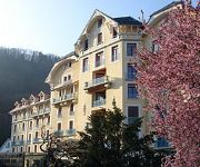
Appart'Hotel Le Splendid - Terres de France
Hôtel du Parc
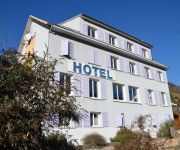
Le Panoramic
Hotel le Vauban
Videos from this area
These are videos related to the place based on their proximity to this place.
Locotracteur Arecelor Mittal Pontcharra(ex Y 2400 sncf)
Le locotracteur arcelor Mittal de Pontcharra essaye de tirer la rame de wagons pleins.Il y arrivera apres quelques minutes au stade "commme dans la video"
SOCIETE RECHERCHE DE FUITE A Pontcharra
RECHERCHE DE FUITES DANS l'Isère -- 38. Pontcharra .7ID Intervenant depuis plus de 10 ans , Tel 04 76 54 32 28 . L' agences Groupe 7id devient en 2013 le N°1 des prestataires en recherche...
RCTP - Biviers Match seniors 11 décembre 2011
Extraits du match du RCTP contre Biviers le 11 décembre 2011 au stade de lîle Fribaud à Pontcharra. Avec l'essai final.
Finale Cadets Tournoi international des Alpes 2012 Roller Hockey
Finale Cadets de roller hockey opposant les équipes de Montchavin Les Eagles aux Dauphins de Villard-Bonnot le 3 juin 2012 à Pontcharra (près de Grenoble). Le tournoi international des Alpes...
ROLLER HOCKEY -LES JEUNES YETI'S GRENOBLE VS MIDLANDS ROLLER STARS TOURNOI INTERNATIONAL DES ALPES
Finale du Tournoi International des Alpes à Pontcharra le 9 juin 2013. Organisé par le Club des Dauphins de villard-bonnot http://www.rcvb-dauphins.com/fr/results/2013/benjamins/254/tia-2013.html.
CDF Villard-Bonnot vs Montchavin
Roller Hockey Match de Coupe de France 1/8e de finale opposant les Dauphins (N1) aux Eagles (N1) à Pontcharra, 22 février 2014 Gymnase Maurice Cucot.
Locotracteur Arcelor Mittal Pontcherra (ex Y 2400 sncf)
Le locotracteur de chez arcelor mittal Pontcharra manoeuvre pour placer la rame vide sur les voies exterieures.
Championnat académique raid des lycées 2012
Vidéo du Championnat Raid académique UNSS des lycées de l'académie de Grenoble. Cet événement a eu lieu mercredi 25 Avril 2012 à Pontcharra, il a rassemblé deux cents lycéens qui ont...
Finale Cadets TIA 2013
North Stars (UK) vs Les Dauphins de Villard-Bonnot (FR) Deuxième édition du Tournoi International des Alpes organisé par le roller hockey club de Villard-Bonnot à Pontcharra les 8 & 9 juin 2013.
Videos provided by Youtube are under the copyright of their owners.
Attractions and noteworthy things
Distances are based on the centre of the city/town and sightseeing location. This list contains brief abstracts about monuments, holiday activities, national parcs, museums, organisations and more from the area as well as interesting facts about the region itself. Where available, you'll find the corresponding homepage. Otherwise the related wikipedia article.
Arc (Savoie)
The Arc is a 128-kilometre-long river in the Savoie département of south-eastern France. It is a left tributary of the Isère River, which it joins at Chamousset, approximately 15 km downstream from Albertville. Its source is near the border with Italy, in the Graian Alps, northeast of Bonneval-sur-Arc. The valley of the Arc, the Maurienne, is an important transport artery between France and Italy.
Les Charmettes
Les Charmettes is a picturesque hamlet near the town of Chambéry in the Savoie region of France. It is famed as a favourite retreat of the philosophe Jean-Jacques Rousseau (1712-1778). In 1728, a young Jean-Jacques Rousseau fled a watch-matching apprenticeship in nearby Geneva and took refuge with Françoise-Louise de Warens, or Madame de Warens, who became his mistress and mentor. They first resided in the city of Annecy before moving on to Chambéry.
Arrondissement of Chambéry
The arrondissement of Chambéry is an arrondissement of France in the Savoie department in the Rhône-Alpes region. It has 22 cantons and 161 communes.
Avalon, France
Avalon is a village outside of Pontcharra, Isère département, eastern France. It is part of the commune Saint-Maximin. It is notable for being the birthplace of Saint Hugh of Lincoln (1130s), and for the Tour d'Avallon, a tower in the village.
University of Savoy
The University of Savoy (French: Université de Savoie) is a university in the region of Savoy, with one campus in Annecy-le-Vieux and two around Chambéry.
Funiculaire de Saint-Hilaire du Touvet
|} The Funiculaire de Saint-Hilaire du Touvet, or Saint-Hilaire du Touvet Funicular, is a funicular railway in the département of Isère in the Rhône-Alpes region of France. It links Montfort on the road between Grenoble and Chambéry, with the village of Saint-Hilaire du Touvet, located on the Plateau des Petites Roches 600 metres above. Until the funicular was built, the village of St. Hilaire du Touvet was accessible only on foot, or by mule.
Château Bayard
The Château Bayard is a castle in the commune of Pontcharra in the département of Isère, and dominates the valley of Grésivaudan in the Dauphiné Alps. Château Bayard has been listed as a monument historique by the French Ministry of Culture since 1915. The castle has housed the Bayard museum since 1975; it presents the life and the myth of Pierre Terrail, seigneur de Bayard, the famous "knight without fear and without reproach", (French: le chevalier sans peur et sans reproche).
Chambéry Cathedral
Chambéry Cathedral (Cathédrale Saint-François-de-Sales de Chambéry) is a Roman Catholic cathedral in Chambéry, France, dedicated to Saint François de Sales. It is the seat of the Archbishopric of Chambéry, Saint-Jean-de-Maurienne and Tarentaise. This was created in 1779 as the Bishopric of Chambéry. After gaining the territories of the Bishopric of Saint-Jean-de-Maurienne and the Archbishopric of Tarentaise in 1801, it was elevated to an archbishopric in 1817.
Roman Catholic Archdiocese of Chambéry
The Roman Catholic Archdiocese of Chambéry, is an Archdiocese of the Latin Rite of the Roman Catholic church, in France and a suffragan of Lyon. The archepiscopal see is Chambéry Cathedral, located in the city of Chambéry. The archdiocese encompasses the department of Savoie, in the Region of Rhône-Alpes. The current archbishop is Mgr. Philippe Ballot, formerly a priest in Besançon. The diocese was created in 1779, from the Diocese of Grenoble, after a complicated earlier history.
Grésivaudan
The Grésivaudan (formerly Graisivaudan) is a valley of the French Alps, situated mostly in the Isère. Etymologically, Graisivaudan comes from roots meaning "Grenoble" and "valley". It comprises the alluvial plain of the Isère River from Grenoble to the confluence of the Arc; or, more recently, the entire valley of the Isère from Tullins to Albertville.
Château du Touvet
The Château du Touvet is a French castle built in the 13th century, with a garden à la française and a water garden built in the 18th century, located between Grenoble and Chambéry in the Isére Department of the Rhône-Alpes Region of France. The gardens are classified among the notable gardens of France by the French Ministry of Culture. The chateau and gardens are privately owned, but open to the public.
Pays de Savoie
This article is about the French departments of Savoie and Haute-Savoie. For the historical region of Savoy, see that article. For other uses, see Savoie (disambiguation) and Savoy (disambiguation) (Les) Pays de Savoie, that means Count(r)ies of Savoy, is a term appeared in the early 1980s to name the two French departments of Savoie and Haute-Savoie as a whole entity.
Gare de Chambéry-Challes-les-Eaux
Chambéry-Challes-les-Eaux station is a railway station in the Savoie département of France. The station serves the city of Chambéry. The station is served by two major high speed services, the TGV and Thalys.
Chambéry Aerodrome
Chambéry Aerodrome or Chambéry Challes-les-Eaux Aerodrome is an airport located in Challes-les-Eaux, Savoie, near Chambéry.


