Safety Score: 3,0 of 5.0 based on data from 9 authorites. Meaning we advice caution when travelling to France.
Travel warnings are updated daily. Source: Travel Warning France. Last Update: 2024-08-13 08:21:03
Discover Nernier
Nernier in Haute-Savoie (Auvergne-Rhône-Alpes) with it's 401 citizens is a place in France about 252 mi (or 406 km) south-east of Paris, the country's capital city.
Current time in Nernier is now 09:19 AM (Saturday). The local timezone is named Europe / Paris with an UTC offset of one hour. We know of 12 airports near Nernier, of which 5 are larger airports. The closest airport in France is Annemasse Airport in a distance of 12 mi (or 19 km), South. Besides the airports, there are other travel options available (check left side).
There are several Unesco world heritage sites nearby. The closest heritage site is Lavaux, Vineyard Terraces in Switzerland at a distance of 23 mi (or 37 km). The closest in France is From the Great Saltworks of Salins-les-Bains to the Royal Saltworks of Arc-et-Senans, the Production of Open-pan Salt in a distance of 45 mi (or 37 km), North-East. We encountered 1 points of interest in the vicinity of this place. If you need a hotel, we compiled a list of available hotels close to the map centre further down the page.
While being here, you might want to pay a visit to some of the following locations: Gimel, Saubraz, Saint-George, Saint-Livres and Biere. To further explore this place, just scroll down and browse the available info.
Local weather forecast
Todays Local Weather Conditions & Forecast: 11°C / 51 °F
| Morning Temperature | 4°C / 39 °F |
| Evening Temperature | 8°C / 46 °F |
| Night Temperature | 6°C / 44 °F |
| Chance of rainfall | 0% |
| Air Humidity | 55% |
| Air Pressure | 1022 hPa |
| Wind Speed | Light breeze with 4 km/h (3 mph) from North-East |
| Cloud Conditions | Few clouds, covering 19% of sky |
| General Conditions | Few clouds |
Sunday, 17th of November 2024
11°C (53 °F)
7°C (45 °F)
Light rain, gentle breeze, broken clouds.
Monday, 18th of November 2024
9°C (49 °F)
6°C (43 °F)
Light rain, light breeze, overcast clouds.
Tuesday, 19th of November 2024
7°C (44 °F)
8°C (47 °F)
Moderate rain, moderate breeze, overcast clouds.
Hotels and Places to Stay
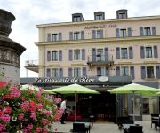
Le Jules Verne
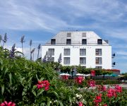
La Barcarolle Hotel & Restaurant
Le Rive
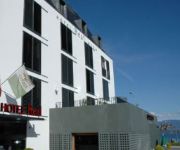
Real Hotel Nyon
Real Hotel Nyon
Base Nyon
Château de Coudrée
Relais l'Aérodrome
Videos from this area
These are videos related to the place based on their proximity to this place.
YVOIRE .....village médiéval fleuri ** haute-Savoie france **
Yvoire è un villaggio medievale situato nella parte francese del lago Lemano, a metà strada fra Evian e Ginevra, nell'alta Savoia. E' considerato un villaggio fra i più belli di Francia...
Yvoire sur le Léman, un des plus beaux villages de France HD
Yvoire, sur le lac Léman (Lac de Genève), est un petit village médiéval considéré comme un des plus beaux villages de France. Il est situé en Haute-Savoie, à la frontière de la Suisse....
Messery Ronde de la Presqu'île 2012
Kaya, Mischa and Niko Lüfkens running the children's race of the 12th Ronde de la Presqu'île running race in Messery, France.
Yvoire on Lake Geneva, one of France's most beautiful villages.MOV
The town of Yvoire sits on the French side of Lake Geneva and is classified as one of the Most Beautiful Villages of France. The 'flower town' is beautifully adorned with flowers and makes...
PICTURESQUE YVOIRE-FRANCE
Compiled from photos taken during a day trip to this lovely town from Geneva across Lake Leman. .
Yvoire,France, sur plusieurs visites..
par beau ou mauvais temps ,Yvoire est un joli Village Médiéval !
A Day In Yvoire
Being located at the tip of the Leman peninsula (presqu'île de Léman), Yvoire delimits the two main parts of the Leman lake, the "petit lac" and the "grand lac". It is well known for its...
Hôtel Restaurant Boutique Le Jules Verne à Yvoire
« Le Jules Verne » Hôtel**** Restaurant & Boutique se présente comme un établissement de prestige caressé par les reflets du lac Léman et coloré par des nuances de couchers de soleil...
Raid trail Multi-sports Yvoire - MPDM 2013
Raid Multisports MDPM le 19 mai 2013 à Yvoire Canoé, VTT, Trail, Run and bike en équipe de 2 ou 3. Plus d'infos : http://www.mpdm74.com.
Yvoire tempête le 4 mai 1975
Forte Bise, tempête sur le Léman, filmée dans les Ports d'Yvoire le 4 mai 1975.
Videos provided by Youtube are under the copyright of their owners.
Attractions and noteworthy things
Distances are based on the centre of the city/town and sightseeing location. This list contains brief abstracts about monuments, holiday activities, national parcs, museums, organisations and more from the area as well as interesting facts about the region itself. Where available, you'll find the corresponding homepage. Otherwise the related wikipedia article.
Toblerone line
The Toblerone line is a 10-km long defensive line made of dragon's teeth that was built during the second World War between Bassins and Prangins, in the Canton of Vaud, Switzerland. These lines of defensive blocks can be found all over Switzerland, but more predominantly in border areas. Their purpose was to stop tank invasions. The 2,700 9-ton concrete blocks that make up the defences are similar to the shape of the chocolate bar "Toblerone", which gave its name to the line.


