Safety Score: 3,0 of 5.0 based on data from 9 authorites. Meaning we advice caution when travelling to France.
Travel warnings are updated daily. Source: Travel Warning France. Last Update: 2024-08-13 08:21:03
Discover La Jarjatte
La Jarjatte in Drôme (Auvergne-Rhône-Alpes) is a city in France about 331 mi (or 532 km) south-east of Paris, the country's capital city.
Local time in La Jarjatte is now 06:16 PM (Friday). The local timezone is named Europe / Paris with an UTC offset of one hour. We know of 12 airports in the vicinity of La Jarjatte, of which 4 are larger airports. The closest airport in France is Gap - Tallard Airport in a distance of 21 mi (or 33 km), South-East. Besides the airports, there are other travel options available (check left side).
There are several Unesco world heritage sites nearby. The closest heritage site in France is Roman Theatre and its Surroundings and the "Triumphal Arch" of Orange in a distance of 60 mi (or 96 km), South-West. Looking for a place to stay? we compiled a list of available hotels close to the map centre further down the page.
When in this area, you might want to pay a visit to some of the following locations: Le Devoluy, Gap, Die, Grenoble and Condorcet. To further explore this place, just scroll down and browse the available info.
Local weather forecast
Todays Local Weather Conditions & Forecast: 12°C / 53 °F
| Morning Temperature | 2°C / 35 °F |
| Evening Temperature | 5°C / 40 °F |
| Night Temperature | 4°C / 40 °F |
| Chance of rainfall | 0% |
| Air Humidity | 44% |
| Air Pressure | 1022 hPa |
| Wind Speed | Light breeze with 4 km/h (3 mph) from North-West |
| Cloud Conditions | Clear sky, covering 4% of sky |
| General Conditions | Sky is clear |
Saturday, 16th of November 2024
13°C (55 °F)
4°C (40 °F)
Sky is clear, light breeze, clear sky.
Sunday, 17th of November 2024
11°C (52 °F)
3°C (38 °F)
Few clouds, light breeze.
Monday, 18th of November 2024
5°C (41 °F)
2°C (36 °F)
Overcast clouds, gentle breeze.
Hotels and Places to Stay
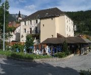
Les Alpins
Videos from this area
These are videos related to the place based on their proximity to this place.
Randonnée Les Arçons les Hirondelles 17 aout 2014 Trièves
Randonnée Les Arçons les Hirondelles 17 aout 2014 Trièves Musique: Another Postcard Barenaked Ladies.
Clip Gal Pays Sisteronais-Buëch - Les creations du Bochaine
Clip porteur de projet Gal du Pays Sisteronais-Buëch : Les créations du Bochaine : aménagement de la boutique.
Via Ferrata de la Berche - Lus la croix haute - la jarjatte
La grande arrête de la via de la Berche, seul. Vite fait 1h, en fin d'après-midi, autour du 15 août 2014, météo maussade...
Mobilisation pour le maintien de la gare de Lus la Croix-Haute
Plus de 300 personnes se sont réunies samedi 29 mars à la gare de Lus la Croix-Haute. Ce rassemblement avait pour but de réclamer le maintien de la gare de Lus et la modernisation de la...
Retour des hautes alpes Gap Faverges
Retour des hautes alpes Gap Faverges by train bus et vélo 241 km à vélo dans la journée juin 2014 la vallée du Buech Aspres sur Buech Grenoble par claude Bandiera www.Biclou.com col de...
Videos provided by Youtube are under the copyright of their owners.
Attractions and noteworthy things
Distances are based on the centre of the city/town and sightseeing location. This list contains brief abstracts about monuments, holiday activities, national parcs, museums, organisations and more from the area as well as interesting facts about the region itself. Where available, you'll find the corresponding homepage. Otherwise the related wikipedia article.
La Jarjatte
La Jarjatte is a hamlet in the French Dauphiné Alps. Situated at around 1100m, close to the source of the river Buëch, it is part of the commune of Lus-la-Croix-Haute in the Drôme department. Popular with walkers and hikers in the summer, the village has a via ferrata route, a local ski station and over 18 km of cross-country skiing trails. It is bordered on the east by the Dévoluy massif, and the Vercors to the west. Grenoble is the nearest major city, about 75 km away to the north.


