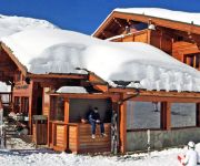
La Traverse
in Département de la Savoie of Auvergne-Rhône-Alpes, France

Location Summary
Decimal Coordinates (Latitude, Longitude):
45.233 and 6.481 (Lat./Lng.)
Coordinates by Time:
N 45° 13' 57" and E 6° 28' 50"
Currency and Currency Code:
Euro - EUR
Spoken languages:
French, Breton, Corsican, Catalan, Basque, Occitan
Local electricity:
230 V - 50 Hz (plugs: G)
Mobile phone / cellular frequencies (MHz):
900 MHz, 1800 MHz, 3G, 4G
Local Time: 10:57 AM (Friday)
Timezone: Europe/Paris
UTC/GMT offset: 1 hours
Sunrise and Sunset:
7:33 am and 5:04 pm
Antipode Coordinates:
-44.033 and -176.367 (Lat./Lng.)
Closest place to antipode coordinates:
Ouwenga
References
This place on Geonames.org
Current travel safety evaluation for France in Western Europe

Safety Score: 3,0 of 5.0 based on data from 9 authorites. Meaning we advice caution when travelling to France.

Travel warnings are updated daily. Source: Travel Warning France. Last Update: 2024-08-13 08:21:03

Delve into La Traverse

La Traverse in Département de la Savoie (Auvergne-Rhône-Alpes) is a town located in France about 317 mi (or 510 km) south-east of Paris, the country's capital town.

Time in La Traverse is now 10:57 AM (Friday). The local timezone is named Europe / Paris with an UTC offset of one hour. We know of 13 airports closer to La Traverse, of which 5 are larger airports. The closest airport in France is Méribel Airport in a distance of 13 mi (or 21 km), North. Besides the airports, there are other travel options available (check left side).

There are several Unesco world heritage sites nearby. The closest heritage site is Residences of the Royal House of Savoy in Italy at a distance of 60 mi (or 96 km). The closest in France is Historic Site of Lyons in a distance of 88 mi (or 96 km), East. In need of a room? We compiled a list of available hotels close to the map centre further down the page.

Since you are here already, you might want to pay a visit to some of the following locations: Saint-Jean-de-Maurienne, Bardonecchia, Briancon, Claviere and Oulx. To further explore this place, just scroll down and browse the available info.

Local weather forecast

Todays Local Weather Conditions & Forecast: 11°C / 52 °F

Morning Temperature 3°C / 38 °F
Evening Temperature 5°C / 42 °F
Night Temperature 6°C / 43 °F
Chance of rainfall 0%
Air Humidity 33%
Air Pressure 1021 hPa
Wind Speed Light breeze with 4 km/h (3 mph) from North-West
Cloud Conditions Few clouds, covering 13% of sky
General Conditions Few clouds

Saturday, 16th of November 2024

13°C (55 °F)
5°C (41 °F)
Sky is clear, light breeze, clear sky.

Sunday, 17th of November 2024

10°C (51 °F)
6°C (43 °F)
Moderate rain, light breeze, broken clouds.

Monday, 18th of November 2024

3°C (37 °F)
-1°C (30 °F)
Rain and snow, gentle breeze, overcast clouds.

Hotels and Places to Stay

Hôtel Les Bruyères

Address
6,3 mi
Quartier Les Bruyeres, Les Menuires
73440 Saint-Martin-de-Belleville
France

Time Information

Checkout: 12:00 - Checkin: 15:00
Reception
Weekday: -
Weekend: closed


Grand Hotel Valloire Et Du Galibier Logis

Address
5,0 mi
Rue des Grandes Alpes
73450 Valloire
France

Time Information

Checkout: - Checkin:
Reception
Weekday: -
Weekend: closed


Le Menuire

Address
6,6 mi
Preyerand
73440 Les Menuires
France

Time Information

Checkout: - Checkin:
Reception
Weekday: -
Weekend: closed


Savoy Hotel

Address
1,2 mi
25 Rue Du General Ferrie
73140 Saint-Michel-de-Maurienne
France

Time Information

Checkout: 10:00 - Checkin: 17:00
Reception
Weekday: -
Weekend: closed


Le Relais du Galibier

Address
5,3 mi
Route du Galibier - les Verneys
73450 Valloire
France

Time Information

Checkout: 10:00 - Checkin: 15:00
Reception
Weekday: 8:00 - 22:00 (lunchbreak: 10:00 - 15:00)
Weekend: closed


Village d+ Valloire Galibier

Address
5,4 mi
Rue du Praz
73450 Valloire
France

Time Information

Checkout: 10:00 - Checkin: 16:00
Reception
Weekday: 8:45 - 20:00 (lunchbreak: 12:30 - 16:30)
Weekend: 9:00 - 22:00


Hotel L'Aigle

Address
3,1 mi
La Savoie
73450 Valmeinier
France

Time Information

Checkout: 09:00 - Checkin: 16:00
Reception
Weekday: -
Weekend: closed


Chalet Hôtel Isatis

Address
6,3 mi
Les Bruyeres
73440 Saint-Martin-de-Belleville
France

Time Information

Checkout: 10:00 - Checkin: 15:00
Reception
Weekday: -
Weekend: closed


Videos from this area

These are videos related to the place based on their proximity to this place.

Nico en BMX

Published: March 24, 2008
Length: 08:59 min
Rating: 5 of 5
Author: NPommard73

Ce que je sais faire en BMX.Ca dure que 5 minutes.


Col du Telegraphe descent

Published: December 12, 2014
Length: 09:20 min
Rating: 5 of 5
Author: thequaids5

An unremarkable cycling descent of the Col du Télégraphe, through Saint-Michel-de-Maurienne and then along the valley to Saint-Julien-Mont-Denis.


24- Col du Télégraphe

Published: October 10, 2012
Length: 48:27 min
Rating: 0 of 5
Author: Brendan DENIAUD


Valloire / Valmeinier 2013 - Les Myrtilles, La Reine des prés, La Neuvache, avec Papi Bernard

Published: November 15, 2013
Length: 58:57 min
Rating: 5 of 5
Author: Gaëtan DO VAN LANH


Ski Trip à Valmeinier, France

Published: March 22, 2014
Length: 11:37 min
Rating: 5 of 5
Author: Rudy De Pooter

Une petite virée ski entre potes sur Valmeinier et Valloire. Egalement une journée sur le domaine des 3 Vallées. Put in HD 720p for better view. Ski Trip in Valmeinier, plus one day in the...


Valloire / Valmeinier 2013 - L'Arméra avec Papi Bernard

Published: November 17, 2013
Length: 00:00 min
Rating: 0 of 5
Author: Gaëtan DO VAN LANH


Valloire / Valmeinier 2013 - La Combe avec Papi Bernard

Published: November 16, 2013
Length: 00:00 min
Rating: 0 of 5
Author: Gaëtan DO VAN LANH


Valloire 2 HD

Published: January 19, 2015
Length: 09:16 min
Rating: 5 of 5
Author: Imants Frisenbruders


Valloire / Valmeinier 2013 - Les Lutins (alternative)

Published: November 16, 2013
Length: 00:00 min
Rating: 0 of 5
Author: Gaëtan DO VAN LANH


Passage de la 141R420 à la sortie de Saint Michel de Maurienne. En pousse la CC 6570.

Published: February 26, 2014
Length: 11:25 min
Rating: 5 of 5
Author: Trains en Vadrouille

Festivités ferroviaires à l'occasion des 150 ans du Tunnel du Mont Cenis Septembre 2007.


Videos provided by Youtube are under the copyright of their owners.

Attractions and noteworthy things

Distances are based on the centre of the city/town and sightseeing location. This list contains brief abstracts about monuments, holiday activities, national parcs, museums, organisations and more from the area as well as interesting facts about the region itself. Where available, you'll find the corresponding homepage. Otherwise the related wikipedia article.

Col du Télégraphe

Col du Télégraphe is a mountain pass in the French Alps situated above the Maurienne valley between the eastern end of the massif d'Arvan-Villards and the massif des Cerces. The pass links Saint-Michel-de-Maurienne to the north and Valloire to the south, as well as forming an access point to the col du Galibier via its north face. The route is often used during the ascent to Col du Galibier in the Tour de France, and is thus popular with cyclists.

Located at 45.2025, 6.44444 (Lat. / Lng.), about 3 miles away.
Wikipedia Article
Mountain passes of the Alps, Climbs in cycle racing, Mountain passes of France, Geography of Savoie, Geography of Hautes-Alpes, 2007 Tour de France, Transport in Provence-Alpes-Côte d'Azur, Transport in Rhône-Alpes

Saint-Michel-de-Maurienne derailment

The Saint-Michel-de-Maurienne derailment of December 12, 1917, is the most serious railway accident in France’s history. The derailment of an overloaded train carrying nearly 1,000 French soldiers on leave returning from the Italian front, as the train descended the Maurienne valley rail line, caused a catastrophic crash and fire in which approximately 700 died. The accident occurred on the Culoz–Modane railway line, part of the Fréjus Railway.

Located at 45.2111, 6.48639 (Lat. / Lng.), about 2 miles away.
Wikipedia Article
Railway accidents in 1917, Railway accidents in France, 1917 in France, Savoie

capture of the webcam Saint-Jean-de-Maurienne: Saint Jean de Maurienne 2

Saint-Jean-de-Maurienne: Saint Jean de Maurienne 2, Saint-Jean-de-Maurienne (source)

capture of the webcam Le Thyl-Dessus: Modane-A43 − Modane

Le Thyl-Dessus: Modane-A43 − Modane, Le Thyl-Dessus (source)

capture of the webcam Les Combes: Valmeinier-Front de neige

Les Combes: Valmeinier-Front de neige, Les Combes (source)

capture of the webcam Les Combes: Valmeinier-Haut des pistes

Les Combes: Valmeinier-Haut des pistes, Les Combes (source)

capture of the webcam Les Combes: Valmeinier-Panoramique HD

Les Combes: Valmeinier-Panoramique HD, Les Combes (source)

capture of the webcam Les Combes: Valmeinier-La station

Les Combes: Valmeinier-La station, Les Combes (source)

Webcams provided by webcam.travel are under the copyright of their owners.


This place is known by different names. Here the ones we know:
La Traversaz, La Traverse