Safety Score: 3,0 of 5.0 based on data from 9 authorites. Meaning we advice caution when travelling to France.
Travel warnings are updated daily. Source: Travel Warning France. Last Update: 2024-08-13 08:21:03
Delve into Le Falgoux
Le Falgoux in Cantal (Auvergne-Rhône-Alpes) with it's 194 habitants is a town located in France about 256 mi (or 412 km) south of Paris, the country's capital town.
Time in Le Falgoux is now 09:01 AM (Friday). The local timezone is named Europe / Paris with an UTC offset of one hour. We know of 10 airports closer to Le Falgoux, of which 3 are larger airports. The closest airport in France is Aurillac Airport in a distance of 20 mi (or 33 km), South-West. Besides the airports, there are other travel options available (check left side).
There are several Unesco world heritage sites nearby. The closest heritage site in France is Prehistoric Sites and Decorated Caves of the Vézère Valley in a distance of 71 mi (or 114 km), West. In need of a room? We compiled a list of available hotels close to the map centre further down the page.
Since you are here already, you might want to pay a visit to some of the following locations: Aurillac, Mauriac, Saint-Flour, Ussel and Issoire. To further explore this place, just scroll down and browse the available info.
Local weather forecast
Todays Local Weather Conditions & Forecast: 11°C / 51 °F
| Morning Temperature | 1°C / 33 °F |
| Evening Temperature | 5°C / 40 °F |
| Night Temperature | 3°C / 37 °F |
| Chance of rainfall | 0% |
| Air Humidity | 55% |
| Air Pressure | 1023 hPa |
| Wind Speed | Light breeze with 3 km/h (2 mph) from West |
| Cloud Conditions | Clear sky, covering 0% of sky |
| General Conditions | Sky is clear |
Saturday, 16th of November 2024
12°C (53 °F)
5°C (41 °F)
Sky is clear, calm, clear sky.
Sunday, 17th of November 2024
11°C (52 °F)
8°C (46 °F)
Light rain, light breeze, broken clouds.
Monday, 18th of November 2024
5°C (41 °F)
-2°C (29 °F)
Light rain, light breeze, overcast clouds.
Hotels and Places to Stay
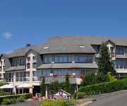
Le Gerfaut INTER-HOTEL
Videos from this area
These are videos related to the place based on their proximity to this place.
Château d'Anjony et Salers (Cantal) France
Le château a été construit en l'an 1430 par Louis d'Anjony, un des compagnons de Jeanne d'Arc, dont la mission est de représenter l'autorité du roi. Le donjon d' Anjony est un exemple...
Tour de France Culinaire - 1ère étape Oustanding Cantal
Le Tour de France Culinaire a embarqué avec une quinzaine de blogueurs à son bord direction le Cantal et son célèbre fromage AOP éponyme. Au programme : visite de laiterie, rencontre avec...
Le Comte de Fay - Episode pilote
Voici le pilote de la série "le Comte de Fay," narrant les aventures tour à tour drôles et épiques de personnages issus de la littérature des contes de fées. Cet épisode est une introduction...
OpenStreetMap 2012 - Un an d'édition sur le Cantal
Cette animation montre les évolutions de la cartographie OpenStreetMap en 2012 sur le département du Cantal, en France. OSM est une carte façon wiki, et chaque flash représente une route,...
Là où je t'emmènerais Le Cantal, Auvergne (Le QG des Cantalous)
La Page Facebook : https://www.facebook.com/LeQGdesCantalous Le site Web : https://www.leqgdescantalous.com La Chaine Youtube ...
Découverte du Puy Mary et ses environs dans le Cantal, Auvergne (Le QG des Cantalous)
La Page Facebook : https://www.facebook.com/LeQGdesCantalous Le site Web : https://www.leqgdescantalous.com La Chaine Youtube ...
Voyage en Auvergne dans le Cantal (Le QG des Cantalous)
La Page Facebook : https://www.facebook.com/LeQGdesCantalous Le site Web : https://www.leqgdescantalous.com La Chaine Youtube ...
Videos provided by Youtube are under the copyright of their owners.
Attractions and noteworthy things
Distances are based on the centre of the city/town and sightseeing location. This list contains brief abstracts about monuments, holiday activities, national parcs, museums, organisations and more from the area as well as interesting facts about the region itself. Where available, you'll find the corresponding homepage. Otherwise the related wikipedia article.
Maronne
The Maronne is a 92.6 km long river in the Cantal and Corrèze départements, in south central France. Its source is several small streams joining near Récusset,a hamlet in Saint-Paul-de-Salers. It flows generally west. It is a left tributary of the Dordogne into which it flows between Argentat and Monceaux-sur-Dordogne.


