Safety Score: 3,0 of 5.0 based on data from 9 authorites. Meaning we advice caution when travelling to France.
Travel warnings are updated daily. Source: Travel Warning France. Last Update: 2024-08-13 08:21:03
Explore Lizeret
Lizeret in Ardèche (Auvergne-Rhône-Alpes) is located in France about 292 mi (or 470 km) south of Paris, the country's capital.
Local time in Lizeret is now 11:20 PM (Friday). The local timezone is named Europe / Paris with an UTC offset of one hour. We know of 10 airports in the wider vicinity of Lizeret, of which two are larger airports. The closest airport in France is Aubenas-Ardèche Méridional Airport in a distance of 21 mi (or 33 km), South-East. Besides the airports, there are other travel options available (check left side).
There are several Unesco world heritage sites nearby. The closest heritage site in France is Decorated Cave of Pont d’Arc, known as Grotte Chauvet-Pont d’Arc, Ardèche in a distance of 31 mi (or 51 km), South. If you need a place to sleep, we compiled a list of available hotels close to the map centre further down the page.
Depending on your travel schedule, you might want to pay a visit to some of the following locations: Le Chambon, Largentiere, Yssingeaux, Le Puy-en-Velay and Privas. To further explore this place, just scroll down and browse the available info.
Local weather forecast
Todays Local Weather Conditions & Forecast: 12°C / 54 °F
| Morning Temperature | 4°C / 39 °F |
| Evening Temperature | 10°C / 51 °F |
| Night Temperature | 6°C / 43 °F |
| Chance of rainfall | 0% |
| Air Humidity | 56% |
| Air Pressure | 1024 hPa |
| Wind Speed | Light breeze with 4 km/h (3 mph) from South |
| Cloud Conditions | Clear sky, covering 0% of sky |
| General Conditions | Sky is clear |
Saturday, 16th of November 2024
12°C (54 °F)
8°C (46 °F)
Sky is clear, light breeze, clear sky.
Sunday, 17th of November 2024
16°C (60 °F)
7°C (45 °F)
Few clouds, light breeze.
Monday, 18th of November 2024
12°C (54 °F)
6°C (44 °F)
Overcast clouds, light breeze.
Hotels and Places to Stay
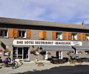
Beausejour Logis
Videos from this area
These are videos related to the place based on their proximity to this place.
rc seaplane salagou Amerrissage hydravion Salagou lac de St Martial 07
amerrissage Salagou lac de ST Martial.
ARDECHOISE 2012: SUIVI COUREURS MONTAGNE ARDECHOISE
Samedi 16 juin 2012: Des groupes de coureurs de l'ardéchoise, arrivent au niveau du Mont Gerbier de Jonc, entre Lachamp Raphaël et Saint Martial, sur la montagne ardéchoise. Merci aux coureurs...
ARDECHOISE 2012: SUIVI COUREURS MONTAGNE ARDECHOISE GERBIER/
Samedi 16 juin 2012: Suivi en voiture de groupes de coureurs de l'ardéchoise, dans la descente, entre Le Mont Gerbier de Jonc et la commune de Saint Martial. Merci aux coureurs qui ont toléré...
Gastronomie en Ardèche - Le Boeuf Fin Gras du Mézenc
Tournage sur la Montagne ardéchoise. Terroir d'exception, savoir-faire des hommes et traditions du massif du Mézenc ont permis aux éleveurs d'obtenir en 2006 une reconnaissance rare pour...
Ardèche - Bessas - un village Ardèchois
Plus de 300 vidéos HD et Ultra HD (4K) sur l'Ardèche gratuites et en ligne sur http://www.youtube.com/ardechevideo, sur http://www.ardechevideo.com et sur http://www.facebook.com/lardeche.envideo.
Ardèche - Burzet
Plus de 300 vidéos HD et Ultra HD (4K) sur l'Ardèche gratuites et en ligne sur http://www.youtube.com/ardechevideo, sur http://www.ardechevideo.com et sur http://www.facebook.com/lardeche.envideo.
Videos provided by Youtube are under the copyright of their owners.
Attractions and noteworthy things
Distances are based on the centre of the city/town and sightseeing location. This list contains brief abstracts about monuments, holiday activities, national parcs, museums, organisations and more from the area as well as interesting facts about the region itself. Where available, you'll find the corresponding homepage. Otherwise the related wikipedia article.
Mont Gerbier de Jonc
Mont Gerbier de Jonc is a mountain of volcanic origin located in the Massif Central in France. It rises to an altitude of 1,551 m (5,088 ft), and its base contains three springs that are the source of the Loire, France's longest river. It is the second most-visited site in the département of Ardèche, after the Ardèche Gorges.
Loire
Loiré is a commune in the Maine-et-Loire department in western France.


