Safety Score: 3,0 of 5.0 based on data from 9 authorites. Meaning we advice caution when travelling to France.
Travel warnings are updated daily. Source: Travel Warning France. Last Update: 2024-08-13 08:21:03
Discover Combelles
The district Combelles of Cellier-du-Luc in Ardèche (Auvergne-Rhône-Alpes) is a district in France about 297 mi south of Paris, the country's capital city.
Looking for a place to stay? we compiled a list of available hotels close to the map centre further down the page.
When in this area, you might want to pay a visit to some of the following locations: Le Puy-en-Velay, Mende, Le Chambon, Largentiere and Florac. To further explore this place, just scroll down and browse the available info.
Local weather forecast
Todays Local Weather Conditions & Forecast: 10°C / 50 °F
| Morning Temperature | 3°C / 37 °F |
| Evening Temperature | 3°C / 38 °F |
| Night Temperature | 2°C / 36 °F |
| Chance of rainfall | 0% |
| Air Humidity | 57% |
| Air Pressure | 1024 hPa |
| Wind Speed | Light breeze with 3 km/h (2 mph) from North |
| Cloud Conditions | Broken clouds, covering 54% of sky |
| General Conditions | Broken clouds |
Saturday, 16th of November 2024
14°C (57 °F)
5°C (40 °F)
Sky is clear, light breeze, clear sky.
Sunday, 17th of November 2024
13°C (55 °F)
7°C (44 °F)
Broken clouds, light breeze.
Monday, 18th of November 2024
7°C (44 °F)
2°C (35 °F)
Light rain, light breeze, broken clouds.
Hotels and Places to Stay
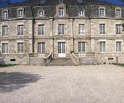
Domaine De Barres
Videos from this area
These are videos related to the place based on their proximity to this place.
LIGNE DES CEVENNES : LE TRAIN DU QUOTIDIEN OU DES VACANCES, C'EST VOUS!
Le train du quotidien, le train des vacances, c'est vous! Faire le choix des dessertes essentielles et historiques de notre pays, c'est préserver l'équilibre vital de nos régions. Soyez...
Train Cévenol Langogne à La Bastide / St Laurent les Bains (Vue 100% nature)
Vivez le parcours du train sncf intercités Le Cévenol entre Langogne (48-Lozère) et La Bastide / Saint Laurent les Bains (48-Lozère) , sous un angle comme vous ne l'avez peut-être jamais...
TRAIN PARIS NIMES MARSEILLE C' PAR CLERMONT!
Toute l'année, voyagez entre PARIS NIMES et MARSEILLE, par Clermont Ferrand et la LIGNE DES CEVENNES, Classée TRAIN D'EQUILIBRE DU TERRITOIRE! Trajet le plus court, donc le moins cher ...
TESTUD FRANCK SARL : Plomberie Sanitaire chauffage à Langogne 48
www.testud48.fr Bonjour et bienvenue. Vous recherchez un spécialiste en plomberie, sanitaire, chauffage, ne cliquez plus, vous êtes sur la bonne page ! A votre service en Lozère Franck Testud...
Train intercités Cévenol : De Chamborigaud aux Gorges de l'Allier
Voyage à bord du train corail intercités Cévenol Nimes / Clermont-Ferrand sncf , entre Chamborigaud et les Gorges de l'Allier (Prades). Un parcours unique entre Languedoc Roussillon et Auvergne...
TRAIN SNCF : VOYAGEZ EN FRANCE PAR LES CEVENNES
Découvrez la ligne sncf des Cévennes. Alternative à la grande vitesse, elle permet de relier les grandes métropoles (Paris , Clermont-Ferrand , Nimes , Marseille , Montpellier ,...) en...
Langogne : Arrivée du TER Nimes / Clermont-Ferrand de soirée
Arrivée en gare de Langogne (48- Lozère ) du train express régional de soirée reliant Nimes à Clermont-Ferrand par la ligne sncf des Cévennes . Vous aussi découvrez la ligne des Cévennes...
Vol au dessus du massif central
Prises de vue aériennes autours du lac de naussac, du mont gerbier de jonc et des massifs environnants, filmé avec un Canon EOS 60D.
Videos provided by Youtube are under the copyright of their owners.
Attractions and noteworthy things
Distances are based on the centre of the city/town and sightseeing location. This list contains brief abstracts about monuments, holiday activities, national parcs, museums, organisations and more from the area as well as interesting facts about the region itself. Where available, you'll find the corresponding homepage. Otherwise the related wikipedia article.
Lot (river)
The Lot,, originally the Olt, is a river in France, right tributary of the Garonne. It rises in the Cévennes, flowing west through Quercy, where it flows into the Garonne near Aiguillon, a total distance of 481 kilometres . It gives its name to the Lot département. The Lot is prone to flooding in the winter and spring.
Ardèche (river)
The Ardèche is a 125 km long river in south-central France, a right-bank tributary of the River Rhône. Its source is in the Massif Central, near the village of Astet. It flows into the Rhône near Pont-Saint-Esprit, north-west of Orange. The river gives its name to the French department of Ardèche. The valley of the Ardèche is very scenic, in particular a 30 km section known as the Ardèche Gorges. The walls of the river here are limestone cliffs up to 300m high.
Château de Luc
The Château de Luc is a ruined castle in the town of Luc in the Lozère département, in the Languedoc-Roussillon région of France. It was built in the 12th century on a previous Celtic site. The castle, as a strategic point between the two provinces of Gévaudan and Vivarais, guarded a link to the south of France of the Auvergne frequently used by pilgrims of Saint Gilles, also known as the Regordane Way, on which it was a toll-gate.
Chassezac
The Chassezac is an 84.6 km long river in the Lozère, Gard and Ardèche départements, southern France, right tributary of the Ardèche. Its source is in the commune of Saint-Frézal-d'Albuges, 2.8 km km northeast of Les Chazeaux, main hamlet in the commune. It flows generally southeast and flows into the Ardèche at Saint-Alban-Auriolles, 1.8 km east of the village itself.
Lac de Naussac
Lac de Naussac is a lake in Lozère, France. At an elevation of 945 m, its surface area is 10.8 km².


