Safety Score: 3,0 of 5.0 based on data from 9 authorites. Meaning we advice caution when travelling to France.
Travel warnings are updated daily. Source: Travel Warning France. Last Update: 2024-08-13 08:21:03
Delve into Blanaz
Blanaz in Ain (Auvergne-Rhône-Alpes) is located in France about 249 mi (or 400 km) south-east of Paris, the country's capital town.
Current time in Blanaz is now 12:00 AM (Saturday). The local timezone is named Europe / Paris with an UTC offset of one hour. We know of 11 airports close to Blanaz, of which 4 are larger airports. The closest airport in France is Lyon Saint-Exupéry Airport in a distance of 22 mi (or 35 km), South-West. Besides the airports, there are other travel options available (check left side).
There are several Unesco world heritage sites nearby. The closest heritage site in France is Historic Site of Lyons in a distance of 32 mi (or 51 km), West. If you need a hotel, we compiled a list of available hotels close to the map centre further down the page.
While being here, you might want to pay a visit to some of the following locations: Nantua, Belley, Bourg-en-Bresse, La Tour-du-Pin and Chancy. To further explore this place, just scroll down and browse the available info.
Local weather forecast
Todays Local Weather Conditions & Forecast: 7°C / 45 °F
| Morning Temperature | 0°C / 32 °F |
| Evening Temperature | 7°C / 45 °F |
| Night Temperature | 3°C / 37 °F |
| Chance of rainfall | 0% |
| Air Humidity | 71% |
| Air Pressure | 1027 hPa |
| Wind Speed | Calm with 2 km/h (1 mph) from South-East |
| Cloud Conditions | Few clouds, covering 15% of sky |
| General Conditions | Few clouds |
Saturday, 16th of November 2024
11°C (52 °F)
6°C (43 °F)
Sky is clear, gentle breeze, clear sky.
Sunday, 17th of November 2024
10°C (51 °F)
7°C (45 °F)
Broken clouds, light breeze.
Monday, 18th of November 2024
9°C (49 °F)
5°C (42 °F)
Overcast clouds, light breeze.
Hotels and Places to Stay
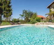
Auberge Campagnarde Hôtel Restaurant
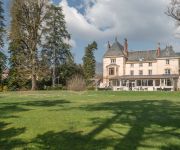
Domaine des Cèdres Logis
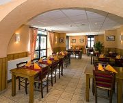
Aranc Evasion Logis
Videos from this area
These are videos related to the place based on their proximity to this place.
CHATEAU DE SAINT GERMAIN (Ain) Le petit mur.wmv
Pour en savoir plus, site internet: http://www.wix.com/amisdesaintgermain/chateau Le mur de défense avancée qui protégeait la façade principale du Château de Saint Germain (Ain), tel...
CHATEAU DE ST GERMAIN. Le petit mur_0001.wmv
Le château de Saint Germain (Ain) était protégé sur sa façade principale par un mur qui empêchait les engins d'artilleries et les assaillants d'être au pied de la muraille flanquée...
MUR14 : 26 JUILLET 2008 - INITIATION AU CANYON DANS LE RHÉBY À VILLEBOIS.
26 JUILLET 2008 - INITIATION AU CANYON DANS LE RHÉBY À VILLEBOIS.
MUR01 : 26 AVRIL 2008 - INITIATION AU RAPPEL À VILLEBOIS.
26 AVRIL 2008 - INITIATION AU RAPPEL À VILLEBOIS.
Dreamland's Road
Montée du col de fay avec passage dans le village de Souclin puis arrivée au sommet sur la pente sud. 306 Xs 2.0i 135cv.
Ceccarelli Formation
intégration de document pédagogique sur une IHM industrielle. http://www.ceccarelli-formation.fr CECCARELLI FORMATION Rue de l'Yran - Bouis 01120 VILLEBOIS France.
MUR08 : 5 JUILLET 2008 - INITIATION AU CANYON (POUR ENFANTS).
5 JUILLET 2008 - INITIATION AU CANYON (POUR ENFANTS).
BCKEV Albarine fevrier 2013
Club de kayak de bourg en bresse en petit comité, (c'est l'hiver...) Descente de Tenay à Saint Rambert le 2 février 2013 50m3 à l'échelle de Saint Denis, sans doute moins à Tenay......
2012/09/08 - Vol Chanay - Argis
Samedi 8 Septembre 2012. Petit vol tranquille du matin avec Fabrice, Laurent et les 2 Jean-Yves. Décollage dos voile du Chanay sans vent ... Direction falaise d'Argis, puis le village d'Argis...
Videos provided by Youtube are under the copyright of their owners.
Attractions and noteworthy things
Distances are based on the centre of the city/town and sightseeing location. This list contains brief abstracts about monuments, holiday activities, national parcs, museums, organisations and more from the area as well as interesting facts about the region itself. Where available, you'll find the corresponding homepage. Otherwise the related wikipedia article.
Canton of Saint-Rambert-en-Bugey
The canton of Saint-Rambert-en-Bugey is an administrative division in eastern France. It includes the following communes: Commune Inhabitants Postal code INSEE code Arandas 135 01230 01013 Argis 390 01230 01017 Chaley 106 01230 01076 Cleyzieu 116 01230 01107 Conand 69 01230 01111 Évosges 109 01230 01155 Hostias 62 01110 01186 Nivollet-Montgriffon 87 01230 01277 Oncieu 78 01230 01279 Saint-Rambert-en-Bugey 2 065 01230 01384 Tenay 1 086 01230 01416 Torcieu 646 01230 01421


