Safety Score: 3,3 of 5.0 based on data from 9 authorites. Meaning please reconsider your need to travel to Ecuador.
Travel warnings are updated daily. Source: Travel Warning Ecuador. Last Update: 2024-08-13 08:21:03
Discover Guanábana
Guanábana in Cantón Quito (Provincia de Pichincha) is a city in Ecuador about 30 mi (or 48 km) north-west of Quito, the country's capital city.
Local time in Guanábana is now 08:35 PM (Thursday). The local timezone is named America / Guayaquil with an UTC offset of -5 hours. We know of 8 airports in the vicinity of Guanábana. The closest airport in Ecuador is Mariscal Sucre International Airport in a distance of 26 mi (or 42 km), South-East. Besides the airports, there are other travel options available (check left side).
There are two Unesco world heritage sites nearby. The closest heritage site in Ecuador is Sangay National Park in a distance of 78 mi (or 125 km), East. Looking for a place to stay? we compiled a list of available hotels close to the map centre further down the page.
When in this area, you might want to pay a visit to some of the following locations: Quito, Santo Domingo de los Colorados, Ibarra, Cube and Wilfrido Loor Moreira. To further explore this place, just scroll down and browse the available info.
Local weather forecast
Todays Local Weather Conditions & Forecast: 13°C / 55 °F
| Morning Temperature | 10°C / 50 °F |
| Evening Temperature | 11°C / 52 °F |
| Night Temperature | 10°C / 49 °F |
| Chance of rainfall | 7% |
| Air Humidity | 77% |
| Air Pressure | 1017 hPa |
| Wind Speed | Calm with 2 km/h (1 mph) from South-East |
| Cloud Conditions | Overcast clouds, covering 100% of sky |
| General Conditions | Light rain |
Friday, 22nd of November 2024
18°C (64 °F)
11°C (52 °F)
Light rain, light breeze, overcast clouds.
Saturday, 23rd of November 2024
18°C (65 °F)
12°C (53 °F)
Light rain, light breeze, overcast clouds.
Sunday, 24th of November 2024
16°C (61 °F)
11°C (52 °F)
Light rain, light breeze, scattered clouds.
Hotels and Places to Stay
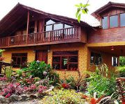
Urcu de Mindo Lodge
Yumbo Spa and Resort
Videos from this area
These are videos related to the place based on their proximity to this place.
Parque XTremo Rally Cars Ecuador
July 21/12 Scheduled day of rally car racing. Yunguilla valley, Ecuador.
Milpe habitat
A short look at the vegetation of the Milpe Bird Reserve in NW Ecuador. This is one of the main birding sites on the Tropical Birding Andes Introtour.
The Andes near Quito, Ecuador
Having visited Quito I took a small road west through the mountains. The road passes through national parks, that have amazing vistas looking out at the green covered hills. The road was lots...
Ecuador Choco 2009 Part 2
This clip starts on the Mindo-Nono Road with white-capped dipper, powerful woodpecker and Andean cock-of-the-rock. Next we go to the Upper Tandayapa Valley where we have green and ...
Los caminos del Ecuador: Llegada a NaNegalito
Segundo video de prueba del recorrido por los caminos del Ecuadro. LLegada a Nanegalito en la provincia de Pichincha, se encuentra a tan solo 40 min de la capital. Beast of Burden.
Oso Anteojos - Maquipucuna - Ecuador
Fantastic climber! Ojo de Anteojos en la reserva de Maquipucuna en Ecuador.
Birding Ecuador Part I; the North-West
In February 2011 me and my partner went on a private birding trip to Ecuador, guided by Jonas Nilsson. The trip was quite extensive and took us to a wide variety of that country's excellent...
Kayak en el Río Pachijal - Ecuador
Aprovechando la última bajada antes que el verano seque los ríos, con Pablo e Inti recorrimos el río desde arriba.
Tulipe Rarr
Sitio arquelogico "Tulipe" - cerca a Nanegalito, ubicado en el noroccidente de la prov. de Pichincha.
Videos provided by Youtube are under the copyright of their owners.


