Safety Score: 3,3 of 5.0 based on data from 9 authorites. Meaning please reconsider your need to travel to Ecuador.
Travel warnings are updated daily. Source: Travel Warning Ecuador. Last Update: 2024-08-13 08:21:03
Discover Napo
Napo in San Vicente (Provincia de Manabí) is a city in Ecuador about 133 mi (or 214 km) west of Quito, the country's capital city.
Local time in Napo is now 09:56 AM (Thursday). The local timezone is named America / Guayaquil with an UTC offset of -5 hours. We know of 8 airports in the vicinity of Napo. The closest airport in Ecuador is Los Perales Airport in a distance of 3 mi (or 5 km), South. Besides the airports, there are other travel options available (check left side).
Looking for a place to stay? we compiled a list of available hotels close to the map centre further down the page.
When in this area, you might want to pay a visit to some of the following locations: San Vicente, Portoviejo, Wilfrido Loor Moreira, Santo Domingo de los Colorados and Cube. To further explore this place, just scroll down and browse the available info.
Local weather forecast
Todays Local Weather Conditions & Forecast: 25°C / 77 °F
| Morning Temperature | 23°C / 73 °F |
| Evening Temperature | 24°C / 75 °F |
| Night Temperature | 23°C / 73 °F |
| Chance of rainfall | 0% |
| Air Humidity | 70% |
| Air Pressure | 1014 hPa |
| Wind Speed | Moderate breeze with 10 km/h (6 mph) from North-East |
| Cloud Conditions | Overcast clouds, covering 100% of sky |
| General Conditions | Overcast clouds |
Thursday, 21st of November 2024
25°C (78 °F)
23°C (74 °F)
Overcast clouds, gentle breeze.
Friday, 22nd of November 2024
26°C (79 °F)
24°C (74 °F)
Overcast clouds, gentle breeze.
Saturday, 23rd of November 2024
26°C (79 °F)
24°C (75 °F)
Overcast clouds, gentle breeze.
Hotels and Places to Stay
Casa Ceibo Boutique Hotel & Spa
Saiananda
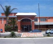
La Piedra Hotel
Videos from this area
These are videos related to the place based on their proximity to this place.
HISTORIA, LEYENDAS Y MITOS DEL ESTUARIO DE BAHÍA DE CARÁQUEZ
Vídeo aficionado con tomas del Estuario del Rio Chone en Bahía de Caráquez y la narración de algunos episodios históricos, leyendas y mitos de este hermoso sector del norte manabita.
MINISTRO DE CULTURA VISITÓ BAHÍA DE CARÁQUEZ
Para los primeros días del mes de noviembre se hará la ceremonia de declaratoria de Bahía de Caráquez, como ciudad Patrimonial del Ecuador.
ASÍ ES BAHÍA
Varias fotografías de Bahía de Caráquez-Manabí-Ecuador, sus calles, sus casas patrimoniales, sus edificaciones modernas, su estuario y entorno maravilloso. Estas fotos fueron tomadas en...
Como hacer un granizado
Granizado de Colores- facilito-Playita- Vacaciones Bahia de Caraquez- ñam ñam.
ASÍ ES BAHÍA
Vídeo aficionado realizado desde unos cuatro Kilómetros de la ciudad de Bahía de Caráquez-Manabí-Ecuador, en la rada interna de la bahía el día domingo 1 de Septiembre. Al fondo se...
EL CANTÓN SUCRE Y BAHÍA DE CARÁQUEZ SUS INICIOS
Vídeo aficionado realizado con fotos antiguas de Bahía de Caráquez y la narración de capítulos trascendentales de su Historia. Con el fondo musical del Himno a Bahía de Caráquez.
LEYENDAS DE MI PUEBLO -2-
Vídeo aficionado realizado desde la Parroquia Leonidas Plaza con Don Manuel Véliz quien nos narra vivencias de esta Parroquia en los años cuarenta aproximadame. Editado por Graciela Moreno...
Videos provided by Youtube are under the copyright of their owners.
Attractions and noteworthy things
Distances are based on the centre of the city/town and sightseeing location. This list contains brief abstracts about monuments, holiday activities, national parcs, museums, organisations and more from the area as well as interesting facts about the region itself. Where available, you'll find the corresponding homepage. Otherwise the related wikipedia article.
1998 Bahía de Caráquez earthquake
The 1998 Bahía de Caráquez earthquake occurred on August 4, 1998 at 13:59 local time . This earthquake was of magnitude Mw 7.2. The epicenter was located at 10 km north of Bahía de Caráquez, about 190 km NNW of Guayaquil, and about 215 km W of Quito, Ecuador. The intensity in Bahía de Caráquez reached MM VIII. In Bahía de Caráquez, electricity, telephone, and water services disrupted, and many buildings were damaged.


