Safety Score: 3,0 of 5.0 based on data from 9 authorites. Meaning we advice caution when travelling to Dominican Republic.
Travel warnings are updated daily. Source: Travel Warning Dominican Republic. Last Update: 2024-08-13 08:21:03
Delve into Ensanche Lugo
The district Ensanche Lugo of Santo Domingo in Santo Domingo De Guzmán (Distrito Nacional) is a subburb in Dominican Republic and is a district of the nations capital.
If you need a hotel, we compiled a list of available hotels close to the map centre further down the page.
While being here, you might want to pay a visit to some of the following locations: Santo Domingo Este, San Cristobal, Guerra, Cambita Garabitos and Boca Chica. To further explore this place, just scroll down and browse the available info.
Local weather forecast
Todays Local Weather Conditions & Forecast: 28°C / 83 °F
| Morning Temperature | 21°C / 69 °F |
| Evening Temperature | 24°C / 76 °F |
| Night Temperature | 22°C / 72 °F |
| Chance of rainfall | 0% |
| Air Humidity | 57% |
| Air Pressure | 1013 hPa |
| Wind Speed | Light breeze with 4 km/h (3 mph) from North-West |
| Cloud Conditions | Few clouds, covering 19% of sky |
| General Conditions | Few clouds |
Friday, 22nd of November 2024
28°C (83 °F)
21°C (70 °F)
Sky is clear, gentle breeze, clear sky.
Saturday, 23rd of November 2024
28°C (82 °F)
22°C (72 °F)
Moderate rain, light breeze, scattered clouds.
Sunday, 24th of November 2024
25°C (77 °F)
23°C (74 °F)
Light rain, gentle breeze, overcast clouds.
Hotels and Places to Stay
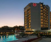
Sheraton Santo Domingo Hotel
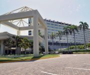
Renaissance Santo Domingo Jaragua Hotel & Casino
Hotel La Morada
Jecasergian Hotel
Hotel Boutique Puerto Malecon
Hotel Luis V
NAPOLITANO HOTEL
Apart-Hotel Plaza Colonial
Carey House Hotel
Hotel Renacer
Videos from this area
These are videos related to the place based on their proximity to this place.
Aquí se cocina así - ¿Cómo hacer habichuelas con dulce?
Preparemos habichuelas con dulce Link original: http://www.republicadominicanatv.com/programas/detalle/MjI=/OTE4 Para ver más: http://www.republicadominicanatv.com/
El protagonista de la Semana - Fundación Sur Futuro
La Fundación Sur Futuro con su trabajo enfocado a desarrollar la Región Suroeste de la República Dominicana a nivel de estructura, educación y salud, es Nuestro Protagonista de la Semana....
Aquí se cocina así - Arroz multicolor para navidad
Arroz multicolor para navidad. Link original: http://www.republicadominicanatv.com/programas/detalle/MjI=/MTk3OQ== Para ver más: http://www.republicadominicanatv.com/
Así es República Dominicana - Museo de porcelana
Así es República Dominicana - Museo de porcelana. Link original: http://www.republicadominicanatv.com/programas/detalle/Ng==/MTQyNg== Para ver más: http://www.republicadominicanatv.com/
Así es República Dominicana - Mensaje de los Reyes Magos
Mensaje de los Reyes Magos. Link original: http://www.republicadominicanatv.com/programas/detalle/Ng==/MjA2MA== Para ver más: http://www.republicadominicanatv.com/
Nuestro campo - Naranja Agria
Nuestro Campo - Naranja Agria Link original: http://www.republicadominicanatv.com/programas/detalle/MTY=/MTU2NA== Para ver más: http://www.republicadominicanatv.com/
En forma - Pliometría piernas
Pliometría: También conocido como entrenamiento de saltos, es una forma de condicionamiento, se le llama así a una serie de repeticiones a altas velocidades y altos niveles de intensidad....
La Almendra - Conoce tu flora y fauna
La Almendra. Link original: http://www.republicadominicanatv.com/programas/detalle/NDI=/MjE5OA== Para ver más: http://www.republicadominicanatv.com/
Playa la Poza de Bojolo (Nagua) - Un pedazo de RD
Playa la Poza de Bojolo (Nagua). Link original: http://www.republicadominicanatv.com/programas/detalle/MzY=/MjY1NA== Para ver más: http://www.republicadominicanatv.com/
GRAN FINAL CAPITULO 2 martes 6 marzo 2012 reality vive el carnaval de noche y dia.mp4
Finalmente Llegamos donde queriamos en este capitulo dicen quienes son los ganadores, pero por si les interesa saber adelantado les digo mas abajo...si no quieren saber NO lean mas abajo.
Videos provided by Youtube are under the copyright of their owners.
Attractions and noteworthy things
Distances are based on the centre of the city/town and sightseeing location. This list contains brief abstracts about monuments, holiday activities, national parcs, museums, organisations and more from the area as well as interesting facts about the region itself. Where available, you'll find the corresponding homepage. Otherwise the related wikipedia article.
Ozama River
The Ozama River in the Dominican Republic can trace its source to the Loma Siete Cabezas in the Sierra de Yamasá close to Villa Altagracia. The river flows 148 kilometers before emptying into the Caribbean Sea. At the end of the journey it bisects the capital, Santo Domingo, into eastern and western halves. The three main tributaries of the Ozama are the Isabela River, the Sabita River and the Yabacao River.
Estadio Quisqueya
Estadio Quisqueya is a baseball stadium in Santo Domingo, Dominican Republic. It is often used as a multi-use stadium. The Quisqueya holds about 16,500 people after its renovation. The Dominican League Of Baseball Authority is in charge of its management. It is the only stadium in Dominican Republic to host two different baseball teams, the Licey Tigers (Tigres del Licey) and the Escogido Lions (Leones del Escogido).
Teatro Nacional (Santo Domingo)
Teatro Nacional (English: National Theatre) is part of the Plaza de la Cultura (Culture Plaza) complex, located in Santo Domingo, Dominican Republic. The theatre is the center piece of the complex and is surrounded by several museums and cultural institutions. The complex is located on the Avenida Máximo Gomez, a central artery of the city of Santo Domingo. The theatre was designed by Dominican architect Teófilo Carbonell and it was opened on August 16, 1973.
Estadio Olímpico Félix Sánchez
Estadio Olímpico Félix Sánchez is a multi-purpose stadium in Santo Domingo, Dominican Republic, built in 1974 for the XII Central American & Caribbean Games. It is used mostly for football and track and field and as a music venue. The stadium has a sporting events capacity of 27,000 people, though it has seen crowds of 35,000. For concerts, its stated capacity is 60,000 people. It hosted the Track and Field events and the football tournament at the 2003 Pan American Games.
Ciudad Colonial (Santo Domingo)
Ciudad Colonial (Spanish for "Colonial City") is the historic central neighborhood of Santo Domingo and the oldest permanent European settlement of the New World. It has been declared a World Heritage Site by UNESCO. It is colloquially known as "Zona Colonial" (Colonial Zone). The Ciudad Colonial is located on the west bank of the Ozama River, which bisects the city. It covers less than 5 square kilometers.
Puente Juan Bosch
Puente Juan Bosch is a relatively new bridge crossing the Ozama River in the city of Santo Domingo, Dominican Republic. It is named after former president Juan Bosch.
Dominican Postal Institute
Dominican Postal Institute (Spanish: Instituto Postal Dominicano; INPOSDOM) is the Dominican institution charged with making a more reliable postal service for the Dominican Republic. Apart from postal services, INPOSDOM offers email services for all citizens of the Dominican Republic.
Herrera International Airport
Herrera International Airport was located in Santo Domingo. The airport was the hub of most of the Dominican airlines before they closed and opened the La Isabela International Airport, also in Santo Domingo. The airport had connections to Puerto Rico, Cuba, others Caribbean islands. All domestic routes that operated from Herrera are now fly out of La Isabela.
Villa Mella
Villa Mella, or San Felipe de Villa Mella, is a municipality in Santo Domingo Norte. Villa Mella is located north of the Isabela River, about 6 miles (or 10 kilometers) to the north of the center of Santo Domingo, and is considered an additional neighborhood of the capital. This sector is considered one of the economically stable areas in the Santo Domingo metropolitan area.
Port of Santo Domingo
The Port of Santo Domingo is located at the mouth of the marine entrance to the City of Santo Domingo, Dominican Republic. The port is suited for both turnaround and transit visits.
Downtown Santo Domingo
Downtown Santo Domingo or better known as Polígono Central (English: Central Polygon) is a term used to group several neighborhoods located in central Santo Domingo, D. N, Dominican Republic defined as the area delineated by John F Kennedy Avenue (also known as DR-1) on the north, on the west by Wiston Churchill avenue, on the east by Maximo Gomez avenue, and on the south by 27 de Febrero avenue (also known as DR-3).
Dr. Rafael Ma. Moscoso National Botanical Garden
Dr. Rafael Ma. Moscoso National Botanical Garden (Jardin Botanico Nacional Dr. Rafael Ma. Moscoso) is a botanical garden in the heart of Santo Domingo. The park was founded in 1976 and was named after Dr. Rafael Ma. Moscoso, a Dominican botanist who cataloged the flora on the island of Hispaniola. The garden's symbol is a "guanito" leaf which is a palm tree found in the garden.
Fortaleza Ozama
The Fortaleza Ozama (in Spanish; Ozama Fortress in English) is a sixteenth-century castle built by the Spanish at the entrance to Santo Domingo, Dominican Republic and overlooking the Ozama River. Named after this river, the castle, also referred to as "La Fortaleza" or "The Fortress", is the oldest formal military construction of European origin still standing in America.
Malecon Center
The Malecon Center is a complex of skyscrapers in Santo Domingo, Dominican Republic. The complex is divided into four towers: Malecon 1, Malecon 2, Malecon 3 and Hilton Santo Domingo. The three Malecon towers each with a height of 122.4 m are the second tallest buildings in the Dominican Republic. Each Malecon tower has 31 floors and the Hilton Santo Domingo has 21 floors, for a total of 114 floors in the complex. The buildings were designed by the architecture firm Rodríguez Sandoval.
Alcázar de Colón
The Alcázar de Colón, or Columbus Alcazar, located in Santo Domingo, Dominican Republic, is the oldest Viceregal residence in America, and forms part of the Colonial Zone of Santo Domingo World Heritage Site. The building houses the Museo Alcázar de Diego Colón, whose collection exhibits the Caribbean's most important ensemble of European late medieval and Renaissance works of art, which were acquired in the 1950s.
Monasterio de San Francisco
Monasterio de San Francisco in Santo Domingo de Guzman, Dominican Republic, is a monastery that was built around 1508, with the arrival of the Franciscan fathers. The ruin is one of most important of the city. It is located in the Zona Colonial of Santo Domingo and has been declared a "heritage Dominican".
Cathedral of Santa María la Menor
The Cathedral of Santa María la Menor in the Colonial Zone of Santo Domingo is dedicated to St. Mary of the Incarnation. It is the oldest cathedral in the Americas, begun in 1512 and completed in 1540. The Cathedral once held the title Primate of the Americas, it has since been the only Archdiocese to have held this title. It is located between Calle Arzobispo Merino and Isabel la Católica, next to Columbus Park in the city of Santo Domingo de Guzman.
Columbus Lighthouse
Columbus Lighthouse (Spanish: Faro a Colón) is a monument located in Santo Domingo Este, Dominican Republic, in tribute to Christopher Columbus. Construction began in 1986 using plans drawn by Scottish architect J.L. Gleave in 1931, in time for the 500th anniversary of the Discovery of America, the monument was inaugurated in 1992. It was funded by the Latin American states and the total cost of construction was approximately $70 million.
Haina Occidental Port
The Haina Occidental Port is located in the Haina River, Haina, Dominican Republic. This harbor is only used for cargo operations incoming from several countries in the Caribbean zone.
National Palace (Dominican Republic)
The National Palace is a building in Santo Domingo, that houses the offices of the Executive Branch (Presidency and Vice Presidency) of the Dominican Republic. Designed in an eclectic neoclassical style by Italian architect Guido D'Alessandro at the behest of Rafael Trujillo, construction started on February 27, 1944 —Dominican independence centenary—and was inaugurated on August 16, 1944.
Museo Bellapart
The Museo Bellapart is a private art museum in Santo Domingo, Dominican Republic. Its collection includes artwork from the mid-19th century to the 1960s.
Altar de la Patria
El Altar de la Patria, or The Altar of the Homeland, is a white marble mausoleum in Santo Domingo, Dominican Republic that houses the remains of the founding fathers of the Dominican Republic: Juan Pablo Duarte, Francisco del Rosario Sánchez, and Ramón Matías Mella, collectively known as Los Trinitarios. Within the mausoleum there are statues of the founding fathers, carved by Italian sculptor Nicholas Arrighini; there is as well an "eternal flame" that is kept lit in memory of the patriots.
Puerta del Conde
La Puerta del Conde (The Count's Gate) is the site in Santo Domingo, Dominican Republic where Francisco del Rosario Sanchez, one of the Dominican Founding Fathers, proclaimed Dominican independence and raised the first Dominican Flag, on February 27, 1844. The gate is part of a structure called El Baluarte del Conde (The Count's Bulwark), a fort in Ciudad Colonial, the colonial area of Santo Domingo.
Manoguayabo, Santo Domingo
Manoguayabo is a small suburb of Santo Domingo in the Dominican Republic. It is best known as the birthplace of Major League Baseball pitcher Pedro Martínez. Manoguayabo is much like any other Dominican neighborhood, but by American standards is still poor. But, with many contributions made by Pedro Martínez, the town has built churches, schools and a baseball field. Near this suburb is one of the most expensive neighborhoods in the city.
National Pantheon of the Dominican Republic
The National Pantheon was built from 1714-1746 by the Spaniard Geronimo Quezada y Garçon and was originally a Jesuit church. The structure was constructed in the neoclassic-renaissance style. Today the structure stands as a national symbol of the Dominican Republic and serves as the final resting place of the Republic's most honored citizens.


