Safety Score: 3,2 of 5.0 based on data from 9 authorites. Meaning please reconsider your need to travel to Denmark.
Travel warnings are updated daily. Source: Travel Warning Denmark. Last Update: 2024-08-13 08:21:03
Delve into Smølled
Smølled in Sønderborg Kommune (Region Syddanmark) is located in Denmark about 125 mi (or 201 km) south-west of Copenhagen, the country's capital town.
Current time in Smølled is now 11:06 AM (Sunday). The local timezone is named Europe / Copenhagen with an UTC offset of one hour. We know of 13 airports close to Smølled, of which 5 are larger airports. The closest airport in Denmark is Sønderborg Airport in a distance of 6 mi (or 9 km), North-East. Besides the airports, there are other travel options available (check left side).
There are several Unesco world heritage sites nearby. The closest heritage site in Denmark is Jelling Mounds, Runic Stones and Church in a distance of 59 mi (or 95 km), North. We encountered 4 points of interest near this location. If you need a hotel, we compiled a list of available hotels close to the map centre further down the page.
While being here, you might want to pay a visit to some of the following locations: Westerholz, Sonderborg, Langballig, Ringsberg and Dollerup. To further explore this place, just scroll down and browse the available info.
Local weather forecast
Todays Local Weather Conditions & Forecast: 9°C / 49 °F
| Morning Temperature | 7°C / 45 °F |
| Evening Temperature | 12°C / 54 °F |
| Night Temperature | 12°C / 54 °F |
| Chance of rainfall | 9% |
| Air Humidity | 90% |
| Air Pressure | 1004 hPa |
| Wind Speed | Fresh Breeze with 17 km/h (10 mph) from North-East |
| Cloud Conditions | Overcast clouds, covering 100% of sky |
| General Conditions | Moderate rain |
Monday, 25th of November 2024
13°C (56 °F)
9°C (48 °F)
Light rain, strong breeze, overcast clouds.
Tuesday, 26th of November 2024
9°C (47 °F)
6°C (42 °F)
Light rain, moderate breeze, overcast clouds.
Wednesday, 27th of November 2024
6°C (43 °F)
6°C (42 °F)
Light rain, moderate breeze, broken clouds.
Hotels and Places to Stay
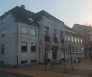
Det gamle Rådhus
Videos from this area
These are videos related to the place based on their proximity to this place.
Syma X5C Explorer outdoor test flight
Took my quadcopter for a spin in the great outdoors. it was slightly windy but it handled it like a champ. I'm still a terrible pilot though!
Bayliner 2452, verkauft
Motorboot Bayliner 2452 Baujahr: 1993 Länge: 7,30 m Breite: 2,54 m Tiefgang: 0,90 m Gewicht: 2300kg Motor: 147 kw Mercruiser V8 5,0l Benziner 2 Kreiskühlung Antrieb: Alpha one Gen....
Optog Egernsund Byfest 2012
Optoget til Egernsund byfest 2012 med drums and pipes, brandværnet, lidt motorcykler og Egernsund Latino Dans se mere på www.egernsundbyfest.dk.
Broager Kultur, Smøl Vold, Sankt Hans 2014
Broager Kultur genoptog i 2013 traditionen med at gå i fakkeloptog fra Parken i Broager og op til Smøl Vold. Sankt Hans 2014 regnede det, men med paraplyer og regntøj mødte mange alligevel...
Maliq vs Glas [Broager Sparekasse]
Maliq er tilbage... 2. film om den ukuelige isbjørn fra Broager Sparekasse.
Videos provided by Youtube are under the copyright of their owners.
Attractions and noteworthy things
Distances are based on the centre of the city/town and sightseeing location. This list contains brief abstracts about monuments, holiday activities, national parcs, museums, organisations and more from the area as well as interesting facts about the region itself. Where available, you'll find the corresponding homepage. Otherwise the related wikipedia article.
Broager
Broager is a town with a population of 3,376 (1 January 2011) in Sønderborg Municipality in Region of Southern Denmark in Denmark. It lies on the Broagerland peninsula, and is therefore surrounded by water on three sides, the waters of Flensborg Fjord leading into the Baltic Sea. The town of Broager lies in the middle of the peninsula by a major road, which leads to the Egernsund Bridge, which crosses over the Egern Strait to the Jutland mainland.
Sundeved
Sundeved is a peninsula on the east coast of the Jutland peninsula in south Denmark. It lies between Åbenrå Fjord and Als Fjord to the north, Alssund to the east and Flensborg Fjord to the south. The westernmost part of the city of Sønderborg is located on the peninsula. Most of Sønderborg is on the island of Als.
Dybbøl
Dybbøl is a small town, with a population of 2,457 (1 January 2011) in the southeastern corner of South Jutland, Denmark. It is located around 6 km west of Sønderborg. During the 1864 Second War of Schleswig, the Danish Army withdrew from the traditional fortified defence line of Dannevirke (after waters and marshes which supported its flanks froze hard in a hard winter) and marched for Dybbøl to find a better defendable position.


!['Maliq vs Glas [Broager Sparekasse]' preview picture of video 'Maliq vs Glas [Broager Sparekasse]'](https://img.youtube.com/vi/TZBzzDGrUSg/mqdefault.jpg)

