Safety Score: 3,2 of 5.0 based on data from 9 authorites. Meaning please reconsider your need to travel to Czech Republic.
Travel warnings are updated daily. Source: Travel Warning Czechia. Last Update: 2024-08-13 08:21:03
Discover Horní Halže
Horní Halže in Okres Chomutov (Ústecký kraj) is a place in Czechia about 63 mi (or 101 km) west of Prague, the country's capital city.
Current time in Horní Halže is now 10:21 AM (Friday). The local timezone is named Europe / Prague with an UTC offset of one hour. We know of 8 airports near Horní Halže, of which 3 are larger airports. The closest airport in Czechia is Karlovy Vary International Airport in a distance of 17 mi (or 27 km), South-West. Besides the airports, there are other travel options available (check left side).
There are several Unesco world heritage sites nearby. The closest heritage site is Dresden Elbe Valley in Germany at a distance of 54 mi (or 86 km). The closest in Czechia is Historic Centre of Prague in a distance of 63 mi (or 86 km), North-East. If you need a hotel, we compiled a list of available hotels close to the map centre further down the page.
While being here, you might want to pay a visit to some of the following locations: Barenstein, Konigswalde, Mildenau, Crottendorf and Annaberg-Buchholz. To further explore this place, just scroll down and browse the available info.
Local weather forecast
Todays Local Weather Conditions & Forecast: -2°C / 28 °F
| Morning Temperature | -5°C / 23 °F |
| Evening Temperature | -3°C / 26 °F |
| Night Temperature | -2°C / 28 °F |
| Chance of rainfall | 1% |
| Air Humidity | 79% |
| Air Pressure | 1003 hPa |
| Wind Speed | Fresh Breeze with 14 km/h (8 mph) from East |
| Cloud Conditions | Overcast clouds, covering 89% of sky |
| General Conditions | Snow |
Saturday, 23rd of November 2024
-1°C (30 °F)
-2°C (28 °F)
Snow, fresh breeze, broken clouds.
Sunday, 24th of November 2024
4°C (39 °F)
2°C (36 °F)
Rain and snow, moderate breeze, overcast clouds.
Monday, 25th of November 2024
4°C (40 °F)
4°C (39 °F)
Light rain, light breeze, broken clouds.
Hotels and Places to Stay
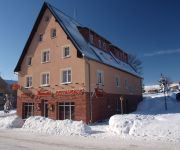
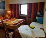
Avionika Penzion
Gästehaus Hutweide Harry & Marina Schmiedel GBR
Videos from this area
These are videos related to the place based on their proximity to this place.
Klösterle an der Eger Klášterec nad Ohří
Schon vor 100 Jahren wurde für Konsumprodukte geworben. Damals nannte man die Werbung jedoch Reklame und jede Firma welche was auf sich hielt, produzierte kleine briefmarkenähnliche ...
Crazy grandpazz - realita
opravdový necenzurovaný pohled na umění těchto nadšenců z Klášterce nad Ohří - ÚDAJE Z ČERNÉ SKŘÍŃKY.
Příroda se pomalu probouzí
Krátké nesestříhané video z 7. března 2009. Les u Klášterce nad Ohří. Příroda se pomalu probouzí a tající sníh vytváří v lese potůčky.
Grenzübergang Jöhstadt Cerny Potok Schwarzwasser Pleil Border Crossing
Situation am Grenzübergang im Juli 2009 nach dem Schengen-Beitritt / Situation at the border crossing in July 2009 (1 1/2 years after Schengen entry)
Preßnitztalbahn 6 februari 2010 deel 2
Video opnamen van stoomlocomotieven op de Preßnitztalbahn (Jöhstadt - Steinbach) in Sachsen. Deze opnamen zijn op 6 februari 2010 gemaakt. Meer informatie over deze smalspoorbaan is te ...
Weipert Vejprty
Schon vor 100 Jahren wurde für Konsumprodukte geworben. Damals nannte man die Werbung jedoch Reklame und jede Firma welche was auf sich hielt, produzierte kleine Briefmarken ähnliche ...
Videos provided by Youtube are under the copyright of their owners.
Attractions and noteworthy things
Distances are based on the centre of the city/town and sightseeing location. This list contains brief abstracts about monuments, holiday activities, national parcs, museums, organisations and more from the area as well as interesting facts about the region itself. Where available, you'll find the corresponding homepage. Otherwise the related wikipedia article.
Air battle over the Ore Mountains
The air battle over the Ore Mountains (German: Luftschlacht über dem Erzgebirge) took place around midday on 11 September 1944 between German and American air forces over the crest of the Ore Mountains near the village of Oberwiesenthal above the Bohemian market town of Schmiedeberg (today Kovářská in the Czech republic).


