Safety Score: 3,2 of 5.0 based on data from 9 authorites. Meaning please reconsider your need to travel to Czech Republic.
Travel warnings are updated daily. Source: Travel Warning Czechia. Last Update: 2024-08-13 08:21:03
Explore Opatovice
Opatovice in Okres Brno-Venkov (South Moravian) with it's 962 inhabitants is a city in Czechia about 122 mi (or 196 km) south-east of Prague, the country's capital.
Local time in Opatovice is now 11:24 PM (Thursday). The local timezone is named Europe / Prague with an UTC offset of one hour. We know of 9 airports in the vicinity of Opatovice, of which 3 are larger airports. The closest airport in Czechia is Brno-Tuřany Airport in a distance of 6 mi (or 9 km), North-East. Besides the airports, there are other travel options available (check left side).
There are several Unesco world heritage sites nearby. The closest heritage site in Czechia is Tugendhat Villa in Brno in a distance of 9 mi (or 15 km), North. We found 1 points of interest in the vicinity of this place. If you need a place to sleep, we compiled a list of available hotels close to the map centre further down the page.
Depending on your travel schedule, you might want to pay a visit to some of the following locations: Brno, Ottenthal, Drasenhofen, Schrattenberg and Falkenstein. To further explore this place, just scroll down and browse the available info.
Local weather forecast
Todays Local Weather Conditions & Forecast: 5°C / 42 °F
| Morning Temperature | 1°C / 34 °F |
| Evening Temperature | 6°C / 43 °F |
| Night Temperature | 5°C / 42 °F |
| Chance of rainfall | 0% |
| Air Humidity | 71% |
| Air Pressure | 1027 hPa |
| Wind Speed | Gentle Breeze with 8 km/h (5 mph) from South-East |
| Cloud Conditions | Overcast clouds, covering 95% of sky |
| General Conditions | Overcast clouds |
Friday, 15th of November 2024
9°C (48 °F)
4°C (39 °F)
Overcast clouds, gentle breeze.
Saturday, 16th of November 2024
7°C (44 °F)
2°C (36 °F)
Sky is clear, gentle breeze, clear sky.
Sunday, 17th of November 2024
6°C (42 °F)
6°C (42 °F)
Few clouds, gentle breeze.
Hotels and Places to Stay
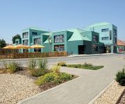
Hotel Žabčice
City
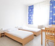
City hostel Brno
Videos from this area
These are videos related to the place based on their proximity to this place.
Hody židlochovice 2010 tanec Neděle
"Videokamera": Fotoaparát CASIO EX-FH20 bez stativu! (nejčastěji 300mm a místy až 520mm!!! ohnisková vdálenost z ruky!)
Akátová věž Rozhledna Výhon Židlochovice 30.09.2009
Akátová věž Rozhledna Výhon Židlochovice 30.09.2009 Točeno Fotoaparátem! CASIO EX-FH20.
Akátová věž
výhľad z rozhľadne Akátová věž na Výhonu nad obcou Židlochovice (resp. aj obcou Blučina)
Autobahn Brixen - Brno
Brixen - Innsbruck - Salzburg - Linz - St. Pölten - Wien - Brno - A5 (part 5 of 5) next part is in city Wien in Astria nord autobahn A5.
Videos provided by Youtube are under the copyright of their owners.
Attractions and noteworthy things
Distances are based on the centre of the city/town and sightseeing location. This list contains brief abstracts about monuments, holiday activities, national parcs, museums, organisations and more from the area as well as interesting facts about the region itself. Where available, you'll find the corresponding homepage. Otherwise the related wikipedia article.
Blučina
Blučina is a village and municipality in Brno-Country District in the South Moravian Region of the Czech Republic, some 8 km south of Brno. The municipality covers an area of 16.67 square kilometres, and has a population of 2,039 (as at 3 July 2006). Blučina is known for the Blučina burial, an important Migration period (5th century) burial, discovered in 1953, located on Cezany hill, above the confluence of the Cezava and Svratka rivers.


