Safety Score: 3,2 of 5.0 based on data from 9 authorites. Meaning please reconsider your need to travel to Czech Republic.
Travel warnings are updated daily. Source: Travel Warning Czechia. Last Update: 2024-08-13 08:21:03
Discover Nikolčice
Nikolčice in Okres Břeclav (South Moravian) with it's 776 citizens is a city in Czechia about 129 mi (or 208 km) south-east of Prague, the country's capital city.
Local time in Nikolčice is now 04:04 AM (Friday). The local timezone is named Europe / Prague with an UTC offset of one hour. We know of 10 airports in the vicinity of Nikolčice, of which 4 are larger airports. The closest airport in Czechia is Brno-Tuřany Airport in a distance of 11 mi (or 18 km), North. Besides the airports, there are other travel options available (check left side).
There are several Unesco world heritage sites nearby. The closest heritage site in Czechia is Lednice-Valtice Cultural Landscape in a distance of 15 mi (or 24 km), South. We discovered 1 points of interest in the vicinity of this place. Looking for a place to stay? we compiled a list of available hotels close to the map centre further down the page.
When in this area, you might want to pay a visit to some of the following locations: Brno, Drasenhofen, Schrattenberg, Ottenthal and Herrnbaumgarten. To further explore this place, just scroll down and browse the available info.
Local weather forecast
Todays Local Weather Conditions & Forecast: 2°C / 36 °F
| Morning Temperature | 1°C / 34 °F |
| Evening Temperature | 0°C / 32 °F |
| Night Temperature | -1°C / 30 °F |
| Chance of rainfall | 1% |
| Air Humidity | 67% |
| Air Pressure | 1003 hPa |
| Wind Speed | Fresh Breeze with 13 km/h (8 mph) from North-West |
| Cloud Conditions | Broken clouds, covering 56% of sky |
| General Conditions | Snow |
Saturday, 23rd of November 2024
4°C (39 °F)
0°C (32 °F)
Few clouds, fresh breeze.
Sunday, 24th of November 2024
1°C (34 °F)
1°C (35 °F)
Overcast clouds, gentle breeze.
Monday, 25th of November 2024
3°C (37 °F)
2°C (36 °F)
Overcast clouds, gentle breeze.
Hotels and Places to Stay
Centro Wine & Wellness
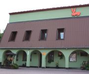
Penzion U Králíků
Videos from this area
These are videos related to the place based on their proximity to this place.
Novosady - Nedokončený památník u Křepic 2006
Nedokončený památník Bratislavsko - Brněnské operace v r.1945 GPS 48°59'51.83"S 16°43'52.80"V.
Policejní honička na Brněnsku
Policejní pronásledování řidiče pod vlivem drog v obcích Moutnice, Těšany a Nesvačilka na jihu Moravy.
BFH-gamemode-elimination-gameplay
I played this gameplay on christmas, long time...fast start:-) (christmas new gamemode)
25-RISEN - CHAPTER1: MONASTERY - SEVERINS FARM
RISEN: NEW GAMECHAPTER1: MONASTERY - SEVERINS FARM - WWW.RISEN.CZ.
Taneční kapela Karla Pešla - 1. maškarní ples Šitbořice
1. maškarní ples Šitbořice - 11. 2. 2012 http://www.pesl.org.
Videos provided by Youtube are under the copyright of their owners.
Attractions and noteworthy things
Distances are based on the centre of the city/town and sightseeing location. This list contains brief abstracts about monuments, holiday activities, national parcs, museums, organisations and more from the area as well as interesting facts about the region itself. Where available, you'll find the corresponding homepage. Otherwise the related wikipedia article.
Šitbořice
Šitbořice is a village in Břeclav District, South Moravian Region, Czech Republic. It has a population of 1,929 (2006).
Přední kout
Přední kout is a small hill in the South Moravia, Czech Republic. With an altitude of 410 m it is the highest elevation in the hilly landscape around Hustopeče. It is located half way between the villages of Diváky and Kurdějov and its exact geographic coordinates are {{#invoke:Coordinates|coord}}{{#coordinates:48|58|15|N|16|46|47|E| |primary |name= }}. There is a station of Global Automated System for Frequency Spectrum Monitoring (GASFSM) near its top.


