Safety Score: 3,2 of 5.0 based on data from 9 authorites. Meaning please reconsider your need to travel to Czech Republic.
Travel warnings are updated daily. Source: Travel Warning Czechia. Last Update: 2024-08-13 08:21:03
Explore Horní Sytová
Horní Sytová in Okres Semily (Liberecký kraj) is a city in Czechia about 59 mi (or 95 km) north-east of Prague, the country's capital.
Local time in Horní Sytová is now 01:49 AM (Saturday). The local timezone is named Europe / Prague with an UTC offset of one hour. We know of 11 airports in the vicinity of Horní Sytová, of which 5 are larger airports. The closest airport in Czechia is Pardubice Airport in a distance of 44 mi (or 71 km), South. Besides the airports, there are other travel options available (check left side).
There are several Unesco world heritage sites nearby. The closest heritage site is Churches of Peace in Jawor and Świdnica in Poland at a distance of 43 mi (or 70 km). The closest in Czechia is Kutná Hora: Historical Town Centre with the Church of St Barbara and the Cathedral of Our Lady at Sedlec in a distance of 48 mi (or 70 km), North-East. If you need a place to sleep, we compiled a list of available hotels close to the map centre further down the page.
Depending on your travel schedule, you might want to pay a visit to some of the following locations: Piechowice, Karpacz, Lubomierz, Gryfow Slaski and Jezow Sudecki. To further explore this place, just scroll down and browse the available info.
Local weather forecast
Todays Local Weather Conditions & Forecast: 5°C / 42 °F
| Morning Temperature | 1°C / 33 °F |
| Evening Temperature | 3°C / 37 °F |
| Night Temperature | 1°C / 34 °F |
| Chance of rainfall | 0% |
| Air Humidity | 76% |
| Air Pressure | 1022 hPa |
| Wind Speed | Light breeze with 3 km/h (2 mph) from North |
| Cloud Conditions | Clear sky, covering 8% of sky |
| General Conditions | Sky is clear |
Sunday, 17th of November 2024
3°C (37 °F)
2°C (36 °F)
Rain and snow, gentle breeze, overcast clouds.
Monday, 18th of November 2024
2°C (35 °F)
-1°C (30 °F)
Snow, moderate breeze, overcast clouds.
Tuesday, 19th of November 2024
3°C (38 °F)
0°C (33 °F)
Rain and snow, moderate breeze, overcast clouds.
Hotels and Places to Stay
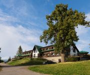
Penzion Pohlednicka
Videos from this area
These are videos related to the place based on their proximity to this place.
Holanďan pěstoval v domě v Poniké na Semilsku marihuanu
Nelegální pěstírnu marihuany odhalil specializovaný policejní tým toxi v obci Poniklá na Semilsku. Zdroj: Policie ČR Střih: ZprávyExtra.cz.
Rally Krkonoše 2013
8.6.2013 ... Rally Krkonoše, RZ 2 točeno ze stanoviště Poniklá u kravína, RZ 6 točeno na Roudnici u retarderu.
Jizera(river)-mosty s vlaky 1-sever.Bridges with trains 1-north.
Omlouvám se za nesprávný údaj: Srážka 2 vlaků u Spálova v r.1990 se ve skutečnosti odehrála na mostě přes Kamenici, asi 1 km severně od uvedeného mostu přes Jizeru. První ze...
ROLLS TOYS 2014
Natočeno pro http://www.zold.cz/index.php?id=kapela 8.11.2014 na akci Víchovskej masakr elektrickou kytarou.
Evakuace z příhradového sloupu VVN - z helmy. 1.část
Nácvik a předváděčka při otevírání polygonu SInging Rocku.
Projížďka papírovou vesnicí 2
2946 fotografií -153 zvukových souborů -68 natočených videí -96 videí animovaných z fotografií -10.3 GB na disku -1 rok, 1 měsíc, 17 dní, 69 hodin, 26minut a 24 sekund od...
Mříčná u Jilemnice - zapadákov
"A teď si zahrajeme na to, že si věříme." Jo to se lehce řekne, ale hůře dělá. Ono tam vylézt a dobrovolně spadnout chce pořádnou dávku odvahy. Ale nakonec ji našli!
DanceBox 2011 - Abba - TS Paul-Dance Jilemnice
Abba na taneční soutěži DanceBox 2011 pořádané taneční skupinou Paul-Dance Jilemnice 12. 2. 2011 v Jilemnici.
Videos provided by Youtube are under the copyright of their owners.
Attractions and noteworthy things
Distances are based on the centre of the city/town and sightseeing location. This list contains brief abstracts about monuments, holiday activities, national parcs, museums, organisations and more from the area as well as interesting facts about the region itself. Where available, you'll find the corresponding homepage. Otherwise the related wikipedia article.
Háje nad Jizerou
Háje nad Jizerou is a village and municipality in Semily District in the Liberec Region of the Czech Republic.
Mříčná
Mříčná is a village and municipality in Semily District in the Liberec Region of the Czech Republic.
Peřimov
Peřimov is a village and municipality in Semily District in the Liberec Region of the Czech Republic.
Poniklá
Poniklá is a village and municipality in Semily District in the Liberec Region of the Czech Republic.
Roprachtice
Roprachtice is a village and municipality in Semily District in the Liberec Region of the Czech Republic. Forgotten Light was filmed mainly in Roprachtice.
Víchová nad Jizerou
Víchová nad Jizerou is a village and municipality in Semily District in the Liberec Region of the Czech Republic.


